Moving to Arboles, Colorado
The current estimated population of Arboles, Colorado, is 280, with approximately 50% male and 50% female. The population has remained stable due to the town’s small size and rural nature.
City Facts
- Year Founded: Early 1900s
- County Affiliated: Archuleta County
- Land Area: 1.5 square miles
- Population Density: 187 people per square mile
- Area Code: 970
- Zip Codes: 81121
Geography and Location
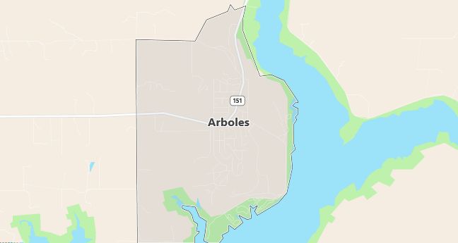
Arboles, Colorado, is a small rural community located in southwestern Colorado, within Archuleta County. The town is situated near Navajo Lake, a popular recreational area that spans the Colorado-New Mexico border. Arboles experiences a semi-arid climate, with hot summers and mild winters, which is typical of the high desert regions in the southwestern U.S. The landscape surrounding Arboles includes rolling hills, open plains, and access to the Navajo Reservoir, making the town a haven for outdoor activities such as fishing, boating, camping, and hiking. The town is located about 30 miles southwest of Pagosa Springs, known for its hot springs and tourism. Arboles’ rural location and proximity to Navajo Lake make it a quiet, scenic place to live, with access to natural beauty and outdoor recreation.
Demographics
Median resident age: 47.8 years
Median household income: $33,125
Median house value: $150,000
Population by Race
Races in Arboles:
- White Non-Hispanic (61.6%)
- Hispanic (25.0%)
- Other race (15.9%)
- Two or more races (14.7%)
- American Indian (11.6%)
(Total can be greater than 100% because Hispanics could be counted in other races)
Ancestries: German (30.6%), English (24.1%), Irish (17.2%), French (11.2%), Swiss (6.5%), Dutch (4.7%).
Elevation: 6220 feet
Land area: 5.3 square miles

Population by Education
For population 25 years and over in Arboles
- High school or higher: 84.5%
- Bachelor’s degree or higher: 24.1%
- Graduate or professional degree: 9.6%
- Unemployed: 0.8%
- Mean travel time to work: 29.6 minutes
For population 15 years and over in Arboles CDP
- Never married: 9.0%
- Now married: 78.1%
- Separated: 2.9%
- Widowed: 1.4%
- Divorced: 8.6%
0.9% Foreign born
Hospitals
Hospitals/medical centers near Arboles:
- MERCY MEDICAL CENTER OF DURANGO (about 36 miles; DURANGO, CO)
- LIFECOURSE CENTER FOR REHAB SERVICES (about 60 miles; FARMINGTON, NM)
- SAN JUAN REGIONAL MEDICAL CENTER INC (about 60 miles; FARMINGTON, NM)
Airports
Airports certified for carrier operations nearest to Arboles:
- DURANGO-LA PLATA COUNTY (about 25 miles; DURANGO, CO; Abbreviation: DRO)
- FOUR CORNERS REGIONAL (about 59 miles; FARMINGTON, NM; Abbreviation: FMN)
- TELLURIDE REGIONAL (about 72 miles; TELLURIDE, CO; Abbreviation: TEX)
Other public-use airports nearest to Arboles:
- NAVAJO STATE PARK (about 22 miles; NAVAJO DAM, NM; Abbreviation: 1V0)
- STEVENS FIELD (about 31 miles; PAGOSA SPRINGS, CO; Abbreviation: 2V1)
- ANIMAS AIR PARK (about 34 miles; DURANGO, CO; Abbreviation: 00C)
Colleges and Universities
Colleges/universities with over 2000 students nearest to Arboles:
- FORT LEWIS COLLEGE (about 36 miles; DURANGO, CO; Full-time enrollment: 4,051)
- SAN JUAN COLLEGE (about 53 miles; FARMINGTON, NM; Full-time enrollment: 2,837)
- ADAMS STATE COLLEGE (about 111 miles; ALAMOSA, CO; Full-time enrollment: 4,147)
- WESTERN STATE COLLEGE COLORADO (about 121 miles; GUNNISON, CO; Full-time enrollment: 2,199)
- UNIVERSITY OF PHOENIX-ALBUQUERQUE NM CAMPUS (about 142 miles; ALBUQUERQUE, NM; Full-time enrollment: 3,261)
- ALBUQUERQUE TECHNICAL VOCATIONAL INSTITUTE (about 145 miles; ALBUQUERQUE, NM; Full-time enrollment: 9,188)
- UNIVERSITY OF NEW MEXICO-MAIN CAMPUS (about 146 miles; ALBUQUERQUE, NM; Full-time enrollment: 18,780)
