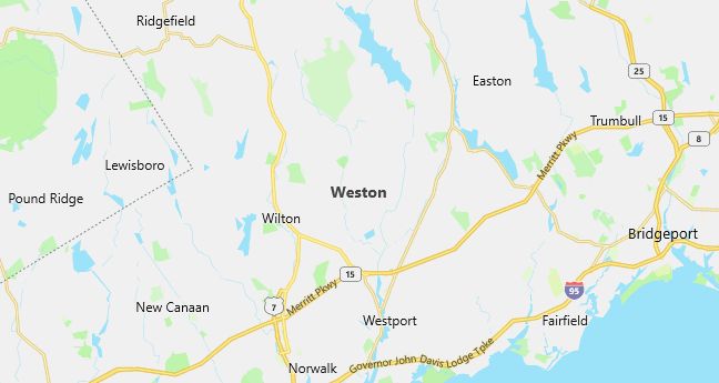
Moving to Weston, Connecticut
Population: 10,037. Estimated population in July 2024: 10,276 (+2.4% change)
Males: 4,930 (49.1%), Females: 5,107 (50.9%)
Fairfield County
Demographics
Median resident age: 39.7 years
Median household income: $146,697
Median house value: $633,900
Population by Race
Races in Weston:
- White Non-Hispanic (94.1%)
- Hispanic (2.1%)
- Two or more races (1.0%)
- Black (0.9%)
- Chinese (0.7%)
- Asian Indian (0.5%)
Ancestries: Irish (17.7%), Italian (13.9%), English (13.7%), German (13.4%), United States (7.0%), Russian (6.9%).
Elevation: 311 feet

Population by Education
For population 25 years and over in Weston
- High school or higher: 98.1%
- Bachelor’s degree or higher: 74.4%
- Graduate or professional degree: 33.7%
- Unemployed: 1.2%
- Mean travel time to work: 41.6 minutes
For population 15 years and over in Weston town
- Never married: 14.3%
- Now married: 76.7%
- Separated: 0.5%
- Widowed: 3.4%
- Divorced: 5.2%
8.2% Foreign born (4.5% Europe, 1.3% Asia, 1.0% Latin America).
Hospitals
Hospitals/medical centers near Weston:
- HALL-BROOKE HOSPITAL (about 5 miles; WESTPORT, CT)
- NORWALK HOSPITAL ASSOCIATION (about 7 miles; NORWALK, CT)
- STAMFORD HOSPITAL (about 8 miles; STAMFORD, CT)
Airports
Airports certified for carrier operations nearest to Weston:
- DANBURY MUNI (about 13 miles; DANBURY, CT; Abbreviation: DXR)
- IGOR I SIKORSKY MEMORIAL (about 19 miles; BRIDGEPORT, CT; Abbreviation: BDR)
- WESTCHESTER COUNTY (about 24 miles; WHITE PLAINS, NY; Abbreviation: HPN)
Other public-use airports nearest to Weston:
- WATERBURY-OXFORD (about 26 miles; OXFORD, CT; Abbreviation: OXC)
- CANDLELIGHT (about 26 miles; NEW MILFORD, CT; Abbreviation: 6Y2)
- CANDLELIGHT FARMS (about 26 miles; NEW MILFORD, CT; Abbreviation: 11N)
Amtrak stations near Weston:
- 14 miles: BRIDGEPORT (525 WATER ST.). Services: fully wheelchair accessible, enclosed waiting area, public restrooms, public payphones, snack bar, paid short-term parking, paid long-term parking, call for car rental service, taxi stand, intercity bus service, public transit connection.
- 16 miles: STAMFORD (WASHINGTON BLVD. & E. STATE ST.). Services: ticket office, fully wheelchair accessible, enclosed waiting area, public restrooms, public payphones, snack bar, ATM, paid short-term parking, paid long-term parking, call for car rental service, taxi stand, public transit connection.
Colleges and Universities
Colleges/universities with over 2000 students nearest to Weston:
- UNIVERSITY OF BRIDGEPORT (about 8 miles; Bridgeport, CT; Full-time enrollment: 2,162)
- NORWALK COMMUNITY COLLEGE (about 9 miles; NORWALK, CT; Full-time enrollment: 2,772)
- FAIRFIELD UNIVERSITY (about 9 miles; FAIRFIELD, CT; Full-time enrollment: 4,197)
- SACRED HEART UNIVERSITY (about 11 miles; FAIRFIELD, CT; Full-time enrollment: 4,120)
- WESTERN CONNECTICUT STATE UNIVERSITY (about 14 miles; DANBURY, CT; Full-time enrollment: 4,297)
- SUNY COLLEGE AT PURCHASE (about 26 miles; PURCHASE, NY; Full-time enrollment: 3,517)
- SUNY WESTCHESTER COMMMUNITY COLLEGE (about 29 miles; VALHALLA, NY; Full-time enrollment: 6,730)
Schools
Public high school in Weston:
- WESTON HIGH SCHOOL (Students: 651; Location: 115 SCHOOL RD.; Grades: 09 – 12)
Public primary/middle schools in Weston:
- HURLBUTT ELEMENTARY SCHOOL (Students: 949; Location: 9 SCHOOL RD.; Grades: PK – 04)
- WESTON MIDDLE SCHOOL (Students: 851; Location: 135 SCHOOL RD.; Grades: 05 – 08)
- HOMEBOUND (Location: 24 SCHOOL ROAD; Grades: PK – 12)
Libraries
Library in Weston:
- WESTON PUBLIC LIBRARY (Operating income: $303,147; Location: 56 NORFIELD RD.; 47,154 books; 1,595 audio materials; 2,812 video materials; 132 serial subscriptions)
