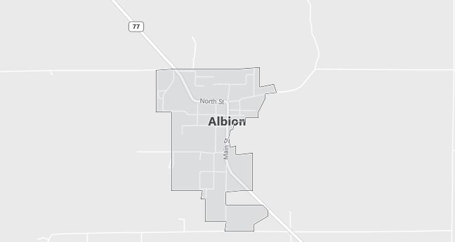
Moving to Albion, Idaho
The current estimated population of Albion is 290, with 51% male and 49% female. The population has remained stable, supported by its rural charm and proximity to recreational areas.
City Facts
- Year founded: 1871
- County: Cassia County
- Land area: 0.64 square miles
- Population density: 453 people per square mile
- Area code: 208
- Zip code: 83311
Geography and Location
Albion is located in southern Idaho, in Cassia County, nestled in the foothills of the Albion Mountains. The town is near the City of Rocks National Reserve, a popular destination for rock climbing, hiking, and camping. Albion is situated along State Highway 77, which provides access to nearby towns like Burley and Twin Falls. The surrounding landscape includes rolling hills, mountains, and agricultural land. Albion experiences a semi-arid climate, with hot summers and cold winters.
Demographics
Median resident age: 43.2 years
Median household income: $42,375
Median house value: $76,900
Population by Race
Races in Albion:
- White Non-Hispanic (97.3%)
- Hispanic (2.7%)
- Other race (0.8%)
Ancestries: English (24.0%), German (20.2%), United States (11.1%), Dutch (6.9%), Danish (6.1%), Irish (6.1%).
Elevation: 4730 feet
Land area: 0.4 square miles

Population by Education
For population 25 years and over in Albion
- High school or higher: 89.6%
- Bachelor’s degree or higher: 16.0%
- Graduate or professional degree: 4.3%
- Unemployed: 7.4%
- Mean travel time to work: 19.4 minutes
For population 15 years and over in Albion city
- Never married: 17.6%
- Now married: 68.2%
- Separated: 1.1%
- Widowed: 5.1%
- Divorced: 8.0%
0.0% Foreign born
Population change in the 1990s: -41 (-13.5%).
Hospitals
Hospitals/medical centers near Albion:
- CASSIA REGIONAL MEDICAL CENTER (about 17 miles; BURLEY, ID)
- MINIDOKA MEMORIAL HOSPITAL (about 19 miles; RUPERT, ID)
- HARMS MEMORIAL HOSPITAL (about 52 miles; AMERICAN FALLS, ID)
Airports
Airports certified for carrier operations nearest to Albion:
- JOSLIN FIELD – MAGIC VALLEY RGNL (about 63 miles; TWIN FALLS, ID; Abbreviation: TWF)
- POCATELLO REGIONAL (about 77 miles; POCATELLO, ID; Abbreviation: PIH)
- FRIEDMAN MEMORIAL (about 90 miles; HAILEY, ID; Abbreviation: SUN)
Other public-use airports nearest to Albion:
- BURLEY MUNI (about 16 miles; BURLEY, ID; Abbreviation: BYI)
- OAKLEY MUNI (about 24 miles; OAKLEY, ID; Abbreviation: 1U6)
- HAZELTON MUNI (about 40 miles; HAZELTON, ID; Abbreviation: U94)
Colleges and Universities
Colleges/universities with over 2000 students nearest to Albion:
- COLLEGE OF SOUTHERN IDAHO (about 63 miles; TWIN FALLS, ID; Full-time enrollment: 3,433)
- IDAHO STATE UNIVERSITY (about 90 miles; POCATELLO, ID; Full-time enrollment: 10,057)
- UTAH STATE UNIVERSITY (about 128 miles; LOGAN, UT; Full-time enrollment: 16,384)
- WEBER STATE UNIVERSITY (about 141 miles; OGDEN, UT; Full-time enrollment: 12,112)
- RICKS COLLEGE (about 161 miles; REXBURG, ID; Full-time enrollment: 8,670)
- UNIVERSITY OF UTAH (about 166 miles; SALT LAKE CITY, UT; Full-time enrollment: 19,866)
- UNIVERSITY OF PHOENIX-UTAH CAMPUS (about 167 miles; SALT LAKE CITY, UT; Full-time enrollment: 2,021)
Public primary/middle school in Albion:
- ALBION ELEMENTARY SCHOOL (Students: 29; Location: 401 MARKET STREET; Grades: KG – 05)
