Moving to Amo, Indiana
The current estimated population of Amo, Indiana is 420, with 50.1% male and 49.9% female. Amo has maintained a stable population, reflecting its role as a small rural community in central Indiana.
City Facts
- Year founded: 1850
- County: Hendricks
- Land area: 0.6 square miles
- Population density: Approximately 700 people per square mile
- Area code: 317
- Zip code: 46103
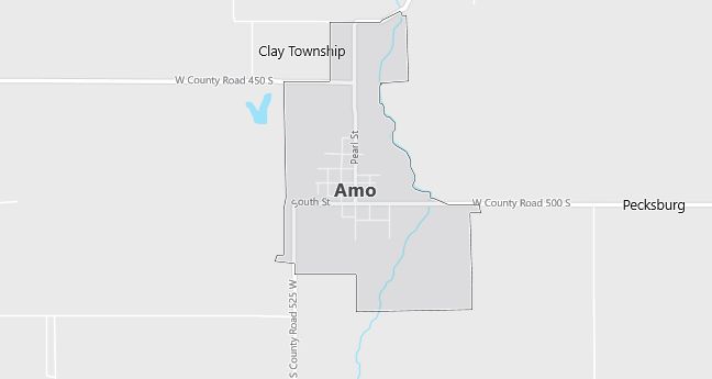
Geography and Location
Amo, Indiana, is located in Hendricks County, in central Indiana, about 30 miles west of Indianapolis. The town is surrounded by farmland, offering a quiet, rural lifestyle with easy access to the amenities of nearby cities like Indianapolis and Plainfield. Amo’s small size and close-knit community make it a peaceful place to live, with local parks and schools serving residents. The town’s history as a stop on the Vandalia Railroad is preserved in its historic buildings and local charm.
Demographics
Median resident age: 32.0 years
Median household income: $41,167
Median house value: $83,700
Population by Race
Races in Amo:
- White Non-Hispanic (99.5%)
Ancestries: United States (39.6%), German (14.3%), English (8.0%), Irish (6.0%), Dutch (1.7%), French Canadian (1.2%).
Elevation: 822 feet
Land area: 0.6 square miles
Population by Education
For population 25 years and over in Amo
- High school or higher: 83.7%
- Bachelor’s degree or higher: 11.9%
- Graduate or professional degree: 6.7%
- Unemployed: 5.4%
- Mean travel time to work: 34.1 minutes
For population 15 years and over in Amo town
- Never married: 20.6%
- Now married: 53.4%
- Separated: 2.4%
- Widowed: 9.8%
- Divorced: 13.9%
0.0% Foreign born
Population change in the 1990s: +32 (+8.4%).
Hospitals
Hospitals/medical centers near Amo:
- HENDRICKS COMMUNITY HOSPITAL (about 8 miles; DANVILLE, IN)
- ST FRANCIS HOSPITAL AND HEALTH CENTERS (about 18 miles; MOORESVILLE, IN)
- PUTNAM COUNTY HOSPITAL (about 19 miles; GREENCASTLE, IN)
Airports
Airports certified for carrier operations nearest to Amo:
- INDIANAPOLIS INTL (about 23 miles; INDIANAPOLIS, IN; Abbreviation: IND)
- MONROE COUNTY (about 39 miles; BLOOMINGTON, IN; Abbreviation: BMG)
- TERRE HAUTE INTERNATIONAL-HULMAN FIELD (about 51 miles; TERRE HAUTE, IN; Abbreviation: HUF)
Other public-use airports nearest to Amo:
- HENDRICKS COUNTY-GORDON GRAHAM FLD (about 11 miles; INDIANAPOLIS, IN; Abbreviation: 2R2)
- PAM’S PLACE (about 14 miles; EMINENCE, IN; Abbreviation: 78I)
- PUTNAM COUNTY (about 14 miles; GREENCASTLE, IN; Abbreviation: 4I7)
Colleges and Universities
Colleges/universities with over 2000 students nearest to Amo:
- DEPAUW UNIVERSITY (about 19 miles; GREENCASTLE, IN; Full-time enrollment: 2,197)
- IVY TECH STATE COLLEGE-CENTRAL INDIANA (about 32 miles; INDIANAPOLIS, IN; Full-time enrollment: 3,397)
- BUTLER UNIVERSITY (about 32 miles; INDIANAPOLIS, IN; Full-time enrollment: 3,721)
- INDIANA UNIVERSITY-PURDUE UNIVERSITY-INDIANAPOLIS (about 33 miles; INDIANAPOLIS, IN; Full-time enrollment: 19,818)
- UNIVERSITY OF INDIANAPOLIS (about 34 miles; INDIANAPOLIS, IN; Full-time enrollment: 2,784)
- INDIANA UNIVERSITY-BLOOMINGTON (about 37 miles; BLOOMINGTON, IN; Full-time enrollment: 33,835)
- PURDUE UNIVERSITY-MAIN CAMPUS (about 55 miles; WEST LAFAYETTE, IN; Full-time enrollment: 36,407)
Public primary/middle school in Amo:
- MILL CREEK WEST ELEMENTARY (Students: 348; Location: 4704 PEARL ST; Grades: KG – 06)