Moving to Albion, Indiana
The current estimated population of Albion is 2,350, with 49% male and 51% female. The population has remained stable, with the town serving as the county seat of Noble County.
City Facts
- Year founded: 1846
- County: Noble County
- Land area: 1.93 square miles
- Population density: 1,218 people per square mile
- Area code: 260
- Zip code: 46701
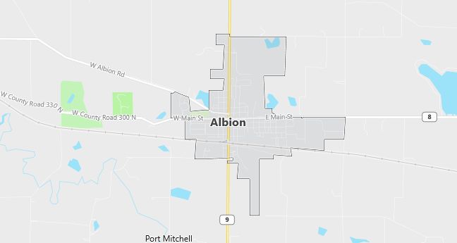
Geography and Location
Albion is located in northeastern Indiana, in Noble County. The town is situated near Chain O’Lakes State Park, a popular destination for boating, fishing, and hiking. Albion is located along State Route 9 and U.S. Route 33, providing access to larger towns like Fort Wayne and Kendallville. The surrounding area includes rolling hills, forests, and small lakes, typical of northern Indiana’s landscape. Albion experiences a humid continental climate, with cold winters and warm summers.
Demographics
Median resident age: 30.2 years
Median household income: $36,282
Median house value: $76,300
Population by Race
Races in Albion:
- White Non-Hispanic (97.0%)
- Hispanic (1.3%)
- Black (0.9%)
- Other race (0.9%)
- American Indian (0.6%)
Ancestries: German (28.2%), United States (13.1%), Irish (8.5%), English (7.3%), French (6.4%), Swedish (2.8%).
Land area: 1.4 square miles
Population by Education
For population 25 years and over in Albion
- High school or higher: 81.3%
- Bachelor’s degree or higher: 9.6%
- Graduate or professional degree: 1.9%
- Unemployed: 3.1%
- Mean travel time to work: 19.4 minutes
For population 15 years and over in Albion town
- Never married: 26.3%
- Now married: 49.8%
- Separated: 0.8%
- Widowed: 6.0%
- Divorced: 17.1%
0.6% Foreign born
Population change in the 1990s: +402 (+21.4%).
Hospitals
Hospitals/medical centers near Albion:
- PARKVIEW NOBLE HOSPITAL (about 12 miles; KENDALLVILLE, IN)
- PARKVIEW WHITLEY HOSPITAL (about 17 miles; COLUMBIA CITY, IN)
- LAGRANGE COMMUNITY HOSPITAL (about 18 miles; LAGRANGE, IN)
Airports
Airports certified for carrier operations nearest to Albion:
- FORT WAYNE INTERNATIONAL (about 34 miles; FORT WAYNE, IN; Abbreviation: FWA)
- ELKHART MUNI (about 46 miles; ELKHART, IN; Abbreviation: EKM)
- KALAMAZOO/BATTLE CREEK INTERNATIONAL (about 59 miles; KALAMAZOO, MI; Abbreviation: AZO)
Other public-use airports nearest to Albion:
- KENDALLVILLE MUNI (about 13 miles; KENDALLVILLE, IN; Abbreviation: C62)
- SMITH FIELD (about 27 miles; FORT WAYNE, IN; Abbreviation: SMD)
- GOSHEN MUNI (about 27 miles; GOSHEN, IN; Abbreviation: GSH)
Colleges and Universities
Colleges/universities with over 2000 students nearest to Albion:
- INDIANA UNIVERSITY-PURDUE UNIVERSITY-FORT WAYNE (about 30 miles; FT WAYNE, IN; Full-time enrollment: 7,385)
- UNIVERSITY OF NOTRE DAME (about 61 miles; NOTRE DAME, IN; Full-time enrollment: 10,633)
- WESTERN MICHIGAN UNIVERSITY (about 62 miles; KALAMAZOO, MI; Full-time enrollment: 23,132)
- INDIANA WESLEYAN UNIVERSITY (about 62 miles; MARION, IN; Full-time enrollment: 6,684)
- INDIANA UNIVERSITY-SOUTH BEND (about 62 miles; SOUTH BEND, IN; Full-time enrollment: 4,725)
- KALAMAZOO VALLEY COMMUNITY COLLEGE (about 64 miles; KALAMAZOO, MI; Full-time enrollment: 5,017)
- KELLOGG COMMUNITY COLLEGE (about 68 miles; BATTLE CREEK, MI; Full-time enrollment: 2,824)
Schools
Public high schools in Albion:
- CENTRAL NOBLE HIGH SCHOOL (Students: 444; Location: 302 COUGAR CT; Grades: 09 – 12)
- CHAIN O’LAKES (Location: 3516 E 75 S; Grades: 09 – 12)
Private high school in Albion:
- CORNERSTONE CHRISTIAN SCHOOL (Students: 50; Location: 4304 S OAK ST; Grades: KG – 12)
Public primary/middle schools in Albion:
- ALBION ELEMENTARY SCHOOL (Students: 417; Location: 202 COUGAR CT; Grades: KG – 05)
- CENTRAL NOBLE MIDDLE SCHOOL (Students: 349; Location: 401 E HIGHLAND; Grades: 06 – 08)
Libraries
Library in Albion:
- NOBLE COUNTY PL (Operating income: $663,136; Location: 813 E MAIN ST; 87,271 books; 1,463 audio materials; 3,865 video materials; 382 serial subscriptions)