Moving to Albany, Indiana
The current estimated population of Albany, Indiana is 2,140, with 48.5% male and 51.5% female. The town’s population has remained stable over the years, reflecting its role as a small, rural community in eastern Indiana.
City Facts
- Year founded: 1833
- County: Delaware
- Land area: 1.2 square miles
- Population density: Approximately 1,783 people per square mile
- Area code: 765
- Zip code: 47320
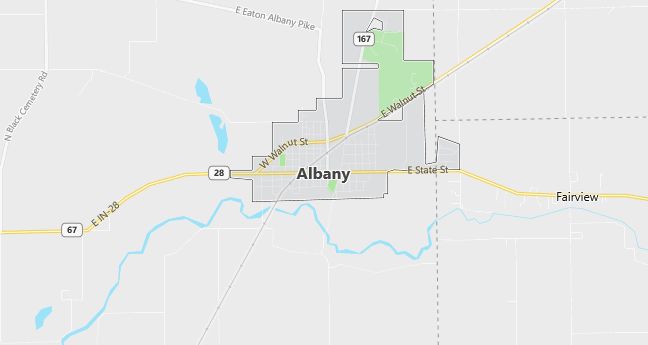
Geography and Location
Albany, Indiana is located in Delaware County, in eastern Indiana, about 15 miles northeast of Muncie. The town is situated along State Route 67, providing easy access to larger cities in the region. Albany is known for its agricultural roots, with surrounding farmland producing corn, soybeans, and livestock. The town’s small size and rural setting give it a close-knit, family-friendly atmosphere. Albany is also home to local parks, providing recreational opportunities for residents. Its proximity to Muncie offers additional amenities and services, including educational opportunities at Ball State University.
Demographics
Median resident age: 37.9 years
Median household income: $33,314
Median house value: $65,800
Population by Race
Races in Albany:
- White Non-Hispanic (98.4%)
- Two or more races (0.9%)
Ancestries: United States (19.8%), German (15.2%), English (11.7%), Irish (9.4%), Dutch (2.6%), French (1.8%).
Elevation: 954 feet
Land area: 1.7 square miles
Population by Education
For population 25 years and over in Albany
- High school or higher: 87.9%
- Bachelor’s degree or higher: 8.2%
- Graduate or professional degree: 3.8%
- Unemployed: 2.0%
- Mean travel time to work: 23.3 minutes
For population 15 years and over in Albany town
- Never married: 20.6%
- Now married: 60.3%
- Separated: 0.8%
- Widowed: 7.3%
- Divorced: 10.9%
0.6% Foreign born
Population change in the 1990s: -47 (-1.9%).
Hospitals
Hospitals/medical centers near Albany:
- BALL MEMORIAL HOSPITAL INC (about 12 miles; MUNCIE, IN)
- BLACKFORD COMMUNITY HOSPITAL (about 14 miles; HARTFORD CITY, IN)
- ST VINCENT RANDOLPH HOSPITAL INC (about 20 miles; WINCHESTER, IN)
Airports
Airports certified for carrier operations nearest to Albany:
- DELAWARE COUNTY – JOHNSON FIELD (about 12 miles; MUNCIE, IN; Abbreviation: MIE)
- ANDERSON MUNICIPAL-DARLINGTON FIELD (about 29 miles; ANDERSON, IN; Abbreviation: AID)
- FORT WAYNE INTERNATIONAL (about 46 miles; FORT WAYNE, IN; Abbreviation: FWA)
Other public-use airports nearest to Albany:
- REESE (about 12 miles; MUNCIE, IN; Abbreviation: 7I2)
- PORTLAND MUNI (about 21 miles; PORTLAND, IN; Abbreviation: PLD)
- RANDOLPH COUNTY (about 25 miles; WINCHESTER, IN; Abbreviation: I22)
Colleges and Universities
Colleges/universities with over 2000 students nearest to Albany:
- BALL STATE UNIVERSITY (about 14 miles; MUNCIE, IN; Full-time enrollment: 17,039)
- IVY TECH STATE COLLEGE-EAST CENTRAL (about 14 miles; MUNCIE, IN; Full-time enrollment: 2,013)
- ANDERSON UNIVERSITY (about 31 miles; ANDERSON, IN; Full-time enrollment: 2,116)
- INDIANA WESLEYAN UNIVERSITY (about 34 miles; MARION, IN; Full-time enrollment: 6,684)
- INDIANA UNIVERSITY-PURDUE UNIVERSITY-FORT WAYNE (about 56 miles; FT WAYNE, IN; Full-time enrollment: 7,385)
- MIAMI UNIVERSITY-OXFORD (about 65 miles; OXFORD, OH; Full-time enrollment: 15,704)
- BUTLER UNIVERSITY (about 73 miles; INDIANAPOLIS, IN; Full-time enrollment: 3,721)
Public primary/middle school in Albany:
- ALBANY ELEMENTARY SCHOOL (Students: 246; Location: 700 W STATE ST; Grades: KG – 05)