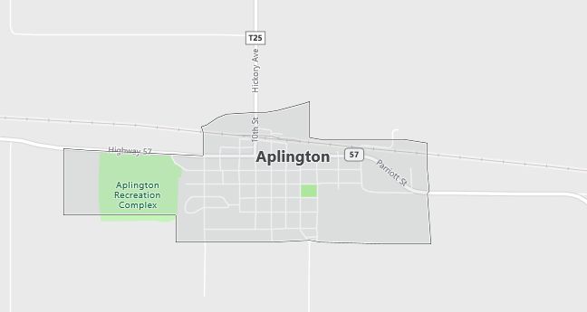
Aplington, Iowa Population, Hospitals, Airports, and Schools
The current estimated population of Aplington is 1,100, with 49% male and 51% female. The population has remained stable, supported by its strong agricultural base and small-town appeal.
City Facts
- Year founded: 1856
- County: Butler County
- Land area: 1.4 square miles
- Population density: 785 people per square mile
- Area code: 319
- Zip code: 50604
Geography and Location
Aplington is located in northeastern Iowa, within Butler County. The town is part of the larger Cedar Valley region and lies about 30 miles northwest of Waterloo. Aplington is surrounded by flat, fertile farmland, characteristic of Iowa’s agricultural heartland, with corn and soybeans being the primary crops. The town has a humid continental climate, with hot summers and cold, snowy winters. Aplington is located near U.S. Route 20, providing convenient access to neighboring towns and cities. The local economy is largely driven by agriculture, along with small businesses and services that support the rural community. Aplington has a close-knit, family-friendly atmosphere, with a strong emphasis on community events and local traditions. The town is also home to several parks, offering residents outdoor recreational opportunities. Despite its small size, Aplington maintains a vibrant community with a focus on quality of life and agricultural heritage.
Demographics
Median resident age: 44.7 years
Median household income: $32,440
Median house value: $65,200
Population by Race
Races in Aplington:
- White Non-Hispanic (99.3%)
Ancestries: German (57.9%), United States (8.3%), Dutch (6.8%), English (4.6%), Irish (4.6%), Norwegian (3.9%).
Elevation: 970 feet
Land area: 0.6 square miles

Population by Education
For population 25 years and over in Aplington
- High school or higher: 72.7%
- Bachelor’s degree or higher: 15.9%
- Graduate or professional degree: 3.8%
- Unemployed: 4.4%
- Mean travel time to work: 20.2 minutes
For population 15 years and over in Aplington city
- Never married: 12.6%
- Now married: 62.2%
- Separated: 1.3%
- Widowed: 16.6%
- Divorced: 7.3%
1.1% Foreign born
Population change in the 1990s: -80 (-7.1%).
Hospitals
Hospitals/medical centers near Aplington:
- GRUNDY COUNTY MEMORIAL HOSPITAL (about 17 miles; GRUNDY CENTER, IA)
- FRANKLIN GENERAL HOSPITAL (about 26 miles; HAMPTON, IA)
- ELLSWORTH MUNICIPAL HOSPITAL (about 27 miles; IOWA FALLS, IA)
Airports
Airports certified for carrier operations nearest to Aplington:
- WATERLOO MUNI (about 34 miles; WATERLOO, IA; Abbreviation: ALO)
- MASON CITY MUNI (about 50 miles; MASON CITY, IA; Abbreviation: MCW)
- DES MOINES INTL (about 90 miles; DES MOINES, IA; Abbreviation: DSM)
Other public-use airports nearest to Aplington:
- ACKLEY MUNI (about 11 miles; ACKLEY, IA; Abbreviation: 4C7)
- ALLISON MUNI (about 13 miles; ALLISON, IA; Abbreviation: K98)
- GRUNDY CENTER MUNI (about 17 miles; GRUNDY CENTER, IA; Abbreviation: 6K7)
Colleges and Universities
Colleges/universities with over 2000 students nearest to Aplington:
- HAWKEYE COMMUNITY COLLEGE (about 37 miles; WATERLOO, IA; Full-time enrollment: 3,292)
- UNIVERSITY OF NORTHERN IOWA (about 41 miles; CEDAR FALLS, IA; Full-time enrollment: 12,524)
- NORTH IOWA AREA COMMUNITY COLLEGE (about 45 miles; MASON CITY, IA; Full-time enrollment: 2,161)
- IOWA STATE UNIVERSITY (about 56 miles; AMES, IA; Full-time enrollment: 24,473)
- UPPER IOWA UNIVERSITY (about 77 miles; FAYETTE, IA; Full-time enrollment: 3,173)
- DES MOINES COMMUNITY COLLEGE (about 78 miles; ANKENY, IA; Full-time enrollment: 6,959)
- KIRKWOOD COMMUNITY COLLEGE (about 80 miles; CEDAR RAPIDS, IA; Full-time enrollment: 7,991)
Public primary/middle schools in Aplington:
- APLINGTON / PARKERSBURG MIDDLE SCHOOL (Students: 184; Location: 215 10TH ST; Grades: 06 – 08)
- APLINGTON ELEMENTARY SCHOOL (Students: 139; Location: 215 10TH ST; Grades: KG – 05)
Libraries
Library in Aplington:
- APLINGTON LEGION MEMORIAL LIBRARY (Operating income: $38,992; Location: PARROT STREET, PO BOX 38; 16,457 books; 308 audio materials; 240 video materials; 66 serial subscriptions)
