Moving to Altoona, Iowa
The current estimated population of Altoona is 19,000, with 48% male and 52% female. The population has grown rapidly, supported by its proximity to Des Moines and suburban development.
City Facts
- Year founded: 1868
- County: Polk County
- Land area: 9.7 square miles
- Population density: 1,958 people per square mile
- Area code: 515
- Zip code: 50009
Geography and Location
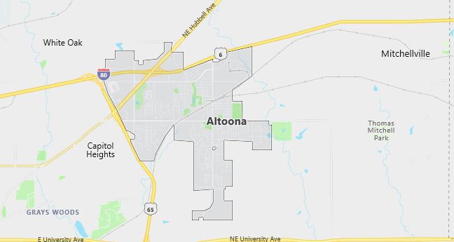
Altoona is located in central Iowa, in Polk County, and is part of the Des Moines metropolitan area. The town is home to Adventureland Amusement Park and Prairie Meadows Racetrack and Casino, both major attractions that draw visitors from across the region. Altoona is situated along Interstate 80, providing easy access to Des Moines and other major cities in Iowa. The town has a humid continental climate, with cold winters and warm summers.
Demographics
Median resident age: 32.2 years
Median household income: $50,162
Median house value: $115,600
Population by Race
Races in Altoona:
- White Non-Hispanic (95.2%)
- Hispanic (1.7%)
- Two or more races (1.2%)
- Black (0.9%)
- Other race (0.8%)
- American Indian (0.6%)
Ancestries: German (29.2%), Irish (13.3%), English (9.5%), United States (7.2%), Dutch (5.3%), Swedish (4.1%).
Land area: 7.1 square miles

Population by Education
For population 25 years and over in Altoona
- High school or higher: 93.1%
- Bachelor’s degree or higher: 23.8%
- Graduate or professional degree: 4.8%
- Unemployed: 2.7%
- Mean travel time to work: 20.4 minutes
For population 15 years and over in Altoona city
- Never married: 22.6%
- Now married: 60.9%
- Separated: 1.2%
- Widowed: 4.8%
- Divorced: 10.5%
1.8% Foreign born
Population change in the 1990s: +2,927 (+39.5%).
Hospitals
Hospitals/medical centers near Altoona:
- IOWA LUTHERAN HOSPITAL (about 10 miles; DES MOINES, IA)
- IOWA METHODIST MEDICAL CENTER (about 12 miles; DES MOINES, IA)
- BROADLAWNS MEDICAL CENTER (about 12 miles; DES MOINES, IA)
Airports
Airports certified for carrier operations nearest to Altoona:
- DES MOINES INTL (about 15 miles; DES MOINES, IA; Abbreviation: DSM)
- FORT DODGE REGIONAL (about 79 miles; FORT DODGE, IA; Abbreviation: FOD)
- OTTUMWA INDUSTRIAL (about 82 miles; OTTUMWA, IA; Abbreviation: OTM)
Other public-use airports nearest to Altoona:
- ANKENY REGIONAL (about 6 miles; ANKENY, IA; Abbreviation: IKV)
- MORNINGSTAR FIELD (about 12 miles; DES MOINES, IA; Abbreviation: Y76)
- AMES MUNI (about 25 miles; AMES, IA; Abbreviation: AMW)
Colleges and Universities
Colleges/universities with over 2000 students nearest to Altoona:
- DES MOINES COMMUNITY COLLEGE (about 11 miles; ANKENY, IA; Full-time enrollment: 6,959)
- DRAKE UNIVERSITY (about 15 miles; DES MOINES, IA; Full-time enrollment: 4,227)
- IOWA STATE UNIVERSITY (about 27 miles; AMES, IA; Full-time enrollment: 24,473)
- IOWA CENTRAL COMMUNITY COLLEGE (about 77 miles; FT DODGE, IA; Full-time enrollment: 2,807)
- GRACELAND UNIVERSITY-LAMONI (about 78 miles; LAMONI, IA; Full-time enrollment: 2,026)
- INDIAN HILLS COMMUNITY COLLEGE (about 85 miles; OTTUMWA, IA; Full-time enrollment: 2,744)
- HAWKEYE COMMUNITY COLLEGE (about 96 miles; WATERLOO, IA; Full-time enrollment: 3,292)
Schools
Public high school in Altoona:
- THE HARBOR-SOUTHEAST POLK ALTERNATIVE SCHOOL (Students: 69; Location: 1301 1ST AVE N; Grades: 09 – 12)
Public primary/middle schools in Altoona:
- CENTENNIAL ELEMENTARY SCHOOL (Students: 513; Location: 910 7TH AVE SE; Grades: KG – 06)
- WILLOWBROOK ELEMENTARY SCHOOL (Students: 493; Location: 300 17TH AVE SW; Grades: PK – 06)
- ALTOONA ELEMENTARY SCHOOL (Students: 394; Location: 301 6TH ST SW; Grades: KG – 06)
Libraries
Library in Altoona:
- ALTOONA PUBLIC LIBRARY (Operating income: $324,490; Location: 700 EIGHTH ST.SW; 33,965 books; 2,039 audio materials; 1,634 video materials; 127 serial subscriptions)
