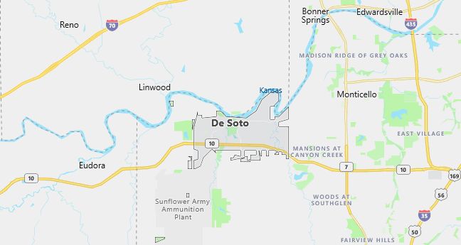
De Soto, Kansas Population, Hospitals, Airports, and Schools
Population: 4,561. Estimated population in July 2024: 5,170 (+13.4% change)
Males: 2,316 (50.8%), Females: 2,245 (49.2%)
Johnson County
Zip code: 66018
Demographics
Median resident age: 32.3 years
Median household income: $46,426
Median house value: $123,900
Population by Race
Races in De Soto:
- White Non-Hispanic (89.9%)
- Hispanic (6.9%)
- American Indian (2.0%)
- Two or more races (1.9%)
- Other race (1.7%)
(Total can be greater than 100% because Hispanics could be counted in other races)
Ancestries: German (22.7%), English (14.3%), Irish (13.3%), United States (10.7%), French (3.6%), Scotch-Irish (3.3%).
Elevation: 842 feet
Land area: 11.3 square miles

Population by Education
For population 25 years and over in De Soto
- High school or higher: 85.9%
- Bachelor’s degree or higher: 23.9%
- Graduate or professional degree: 8.3%
- Unemployed: 2.3%
- Mean travel time to work: 23.5 minutes
For population 15 years and over in De Soto city
- Never married: 20.0%
- Now married: 63.8%
- Separated: 1.0%
- Widowed: 4.0%
- Divorced: 11.2%
4.5% Foreign born (3.8% Latin America).
Population change in the 1990s: +2,196 (+92.9%).
Hospitals
Hospitals/medical centers near De Soto:
- OLATHE MEDICAL CENTER (about 10 miles; OLATHE, KS)
- MEADOWBROOK REHABILITATION HOSPITAL (about 11 miles; GARDNER, KS)
- OVERLAND PARK REGIONAL MEDICAL CENTER (about 16 miles; OVERLAND PARK, KS)
Airports
Airports certified for carrier operations nearest to De Soto:
- CHARLES B. WHEELER DOWNTOWN (about 29 miles; KANSAS CITY, MO; Abbreviation: MKC)
- KANSAS CITY INTL (about 29 miles; KANSAS CITY, MO; Abbreviation: MCI)
- FORBES FIELD (about 48 miles; TOPEKA, KS; Abbreviation: FOE)
Other public-use airports nearest to De Soto:
- CEDAR AIR PARK (about 7 miles; OLATHE, KS; Abbreviation: 51K)
- GARDNER MUNI (about 12 miles; GARDNER, KS; Abbreviation: K34)
- NEW CENTURY AIRCENTER (about 12 miles; OLATHE, KS; Abbreviation: IXD)
Amtrak station near De Soto:
- 19 miles: LAWRENCE (413 E. 7TH ST.). Services: partially wheelchair accessible, public payphones, vending machines, free short-term parking, free long-term parking, call for taxi service.
Colleges and Universities
Colleges/universities with over 2000 students nearest to De Soto:
- KANSAS CITY KANSAS COMMUNITY COLLEGE (about 18 miles; KANSAS CITY, KS; Full-time enrollment: 2,837)
- UNIVERSITY OF KANSAS MEDICAL CENTER (about 18 miles; KANSAS CITY, KS; Full-time enrollment: 2,168)
- JOHNSON COUNTY COMMUNITY COLLEGE (about 19 miles; OVERLAND PARK, KS; Full-time enrollment: 8,857)
- UNIVERSITY OF KANSAS MAIN CAMPUS (about 22 miles; LAWRENCE, KS; Full-time enrollment: 22,506)
- PARK UNIVERSITY (about 26 miles; PARKVILLE, MO; Full-time enrollment: 4,180)
- METROPOLITAN COMMUNITY COLLEGES (about 27 miles; KANSAS CITY, MO; Full-time enrollment: 2,259)
- DEVRY INSTITUTE OF TECHNOLOGY (about 27 miles; KANSAS CITY, MO; Full-time enrollment: 2,189)
Schools
Public high school in De Soto:
- DE SOTO HIGH SCHOOL (Students: 409; Location: 35000 W 91ST STREET; Grades: 09 – 12)
Public primary/middle schools in De Soto:
- STARSIDE ELEM (Students: 504; Location: 35400 W 91ST; Grades: KG – 05)
- LEXINGTON TRAILS MIDDLE SCHOOL (Students: 354; Location: 8800 PENNER AVENUE; Grades: 06 – 08)
