Moving to Albany, Kentucky
The current estimated population of Albany, Kentucky is 1,978, with 48.2% male and 51.8% female. Albany has experienced stable population trends, serving as the county seat of Clinton County and a hub for the surrounding rural areas.
City Facts
- Year founded: 1837
- County: Clinton
- Land area: 2.4 square miles
- Population density: Approximately 824 people per square mile
- Area code: 606
- Zip code: 42602
Geography and Location
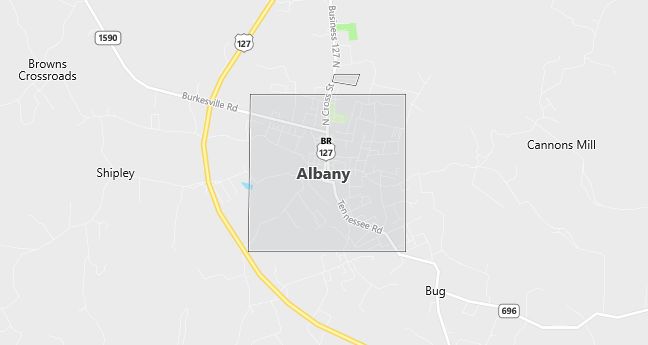
Albany, Kentucky is located in the southern part of the state, near the Tennessee border, in Clinton County. The town is situated in a region known for its scenic beauty, with rolling hills, forests, and access to two major lakes—Dale Hollow Lake to the south and Lake Cumberland to the northeast. These lakes provide opportunities for boating, fishing, and camping, making Albany a popular destination for outdoor enthusiasts. The town’s location along U.S. Highway 127 makes it accessible to other parts of Kentucky and Tennessee. Albany serves as a local center for commerce, government, and education for the surrounding rural community.
Demographics
Median resident age: 39.9 years
Median household income: $14,558
Median house value: $44,800
Population by Race
Races in Albany:
- White Non-Hispanic (96.1%)
- Hispanic (3.1%)
- Two or more races (0.7%)
- American Indian (0.7%)
Ancestries: United States (37.2%), English (5.9%), Scotch-Irish (3.0%), Irish (2.6%), German (2.3%), Italian (1.0%).
Elevation: 962 feet
Land area: 3.4 square miles

Population by Education
For population 25 years and over in Albany
- High school or higher: 52.9%
- Bachelor’s degree or higher: 6.9%
- Graduate or professional degree: 3.8%
- Unemployed: 6.9%
- Mean travel time to work: 16.2 minutes
For population 15 years and over in Albany city
- Never married: 22.6%
- Now married: 47.0%
- Separated: 2.1%
- Widowed: 13.3%
- Divorced: 15.0%
2.6% Foreign born (2.6% Latin America).
Population change in the 1990s: +97 (+4.6%).
Hospitals
Hospital/medical center in Albany:
- CLINTON CO HOSP INC (723 BURKESVILLE RD)
Other hospitals/medical centers near Albany:
- CUMBERLAND CO HOSP (about 19 miles; BURKESVILLE, KY)
- WAYNE CO HOSP INC (about 23 miles; MONTICELLO, KY)
- JAMESTOWN REGIONAL MEDICAL CENTER (about 24 miles; JAMESTOWN, TN)
Airports
Airports certified for carrier operations nearest to Albany:
- BOWLING GREEN-WARREN COUNTY RGNL (about 91 miles; BOWLING GREEN, KY; Abbreviation: BWG)
- BLUE GRASS (about 100 miles; LEXINGTON, KY; Abbreviation: LEX)
- MC GHEE TYSON (about 101 miles; KNOXVILLE, TN; Abbreviation: TYS)
Other public-use airports nearest to Albany:
- DALE HOLLOW RGNL (PETRO FIELD) (about 5 miles; ALBANY, KY; Abbreviation: 44I)
- RUSSELL COUNTY (about 22 miles; JAMESTOWN, KY; Abbreviation: K24)
- WAYNE COUNTY (about 23 miles; MONTICELLO, KY; Abbreviation: EKQ)
Colleges and Universities
Colleges/universities with over 2000 students nearest to Albany:
- TENNESSEE TECHNOLOGICAL UNIVERSITY (about 44 miles; COOKEVILLE, TN; Full-time enrollment: 7,204)
- ROANE STATE COMMUNITY COLLEGE (about 68 miles; HARRIMAN, TN; Full-time enrollment: 3,490)
- ELIZABETHTOWN COMMUNITY COLLEGE (about 86 miles; ELIZABETHTOWN, KY; Full-time enrollment: 2,217)
- EASTERN KENTUCKY UNIVERSITY (about 94 miles; RICHMOND, KY; Full-time enrollment: 11,214)
- VOLUNTEER STATE COMMUNITY COLLEGE (about 94 miles; GALLATIN, TN; Full-time enrollment: 4,215)
- WESTERN KENTUCKY UNIVERSITY (about 95 miles; BOWLING GREEN, KY; Full-time enrollment: 12,806)
- THE UNIVERSITY OF TENNESSEE (about 95 miles; KNOXVILLE, TN; Full-time enrollment: 23,333)
Schools
Public high school in Albany:
- CLINTON COUNTY HIGH SCHOOL (Students: 456; Location: N HWY 127; Grades: 09 – 12)
Public primary/middle schools in Albany:
- ALBANY ELEMENTARY SCHOOL (Students: 631; Location: 819 THIRD ST; Grades: PK – 04)
- CLINTON COUNTY MIDDLE SCHOOL (Students: 468; Location: RR 4 BOX 90; Grades: 05 – 08)
Libraries
Library in Albany:
- CLINTON COUNTY PUBLIC LIBRARY (Operating income: $90,307; Location: 205 BURKESVILLE ROAD; 28,893 books; 396 audio materials; 452 video materials; 48 serial subscriptions)
