Moving to Ashfield, Massachusetts
The current estimated population of Ashfield, Massachusetts, is 1,737, with approximately 49% male and 51% female. The population has remained stable, reflecting the town’s rural charm and small size.
City Facts
- Year Founded: 1765
- County Affiliated: Franklin County
- Land Area: 40.3 square miles
- Population Density: 43 people per square mile
- Area Code: 413
- Zip Codes: 01330
Geography and Location
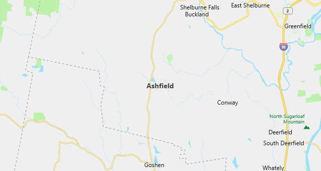
Ashfield, Massachusetts, is located in the northwestern part of the state, within Franklin County. It is part of the Pioneer Valley region, known for its rural landscapes and rich agricultural history. Ashfield experiences a humid continental climate, with cold winters and warm summers, typical of New England. The town’s geography includes forests, rolling hills, and small farms, with the Ashfield Lake offering scenic views and recreational opportunities such as swimming and fishing. Ashfield’s economy is largely based on agriculture, small businesses, and tourism, with visitors drawn to the town’s historic buildings, local festivals, and outdoor activities. Ashfield is located about 30 miles northwest of Springfield and is accessible via State Route 112. The town’s rural charm, strong sense of community, and natural beauty make it an appealing place to live for those seeking a peaceful lifestyle in the heart of New England.
Demographics
Median resident age: 41.8 years
Median household income: $52,875
Median house value: $129,200
Population by Race
Races in Ashfield:
- White Non-Hispanic (97.0%)
- Two or more races (1.6%)
- American Indian (0.9%)
- Black (0.6%)
Ancestries: English (22.7%), Irish (18.8%), German (14.8%), French (8.7%), Italian (7.3%), Polish (6.9%).
Elevation: 1244 feet

Population by Education
For population 25 years and over in Ashfield
- High school or higher: 94.5%
- Bachelor’s degree or higher: 46.5%
- Graduate or professional degree: 22.2%
- Unemployed: 3.2%
- Mean travel time to work: 32.0 minutes
For population 15 years and over in Ashfield town
- Never married: 22.6%
- Now married: 57.8%
- Separated: 1.9%
- Widowed: 5.4%
- Divorced: 12.4%
2.9% Foreign born (1.2% Europe, 0.7% North America, 0.6% Latin America, 0.4% Asia).
Hospitals
Hospitals/medical centers near Ashfield:
- FRANKLIN MEDICAL CENTER (about 15 miles; GREENFIELD, MA)
- COOLEY DICKINSON HOSPITAL INC,THE (about 18 miles; NORTHAMPTON, MA)
- UNIVERSITY HEALTH SERVICES (about 23 miles; AMHERST, MA)
Airports
Airports certified for carrier operations nearest to Ashfield:
- BARNES MUNI (about 27 miles; WESTFIELD/SPRINGFIELD, MA; Abbreviation: BAF)
- WESTOVER ARB/METROPOLITAN (about 30 miles; SPRINGFIELD/CHICOPEE, MA; Abbreviation: CEF)
- BRADLEY INTL (about 42 miles; WINDSOR LOCKS, CT; Abbreviation: BDL)
Other public-use airports nearest to Ashfield:
- TURNERS FALLS (about 20 miles; MONTAGUE, MA; Abbreviation: 0B5)
- NORTHAMPTON (about 20 miles; NORTHAMPTON, MA; Abbreviation: 7B2)
- MOUNT SNOW (about 28 miles; WEST DOVER, VT; Abbreviation: 4V8)
Colleges and Universities
Colleges/universities with over 2000 students nearest to Ashfield:
- UNIVERSITY OF MASSACHUSETTS-AMHERST (about 16 miles; AMHERST, MA; Full-time enrollment: 21,468)
- SMITH COLLEGE (about 18 miles; NORTHAMPTON, MA; Full-time enrollment: 3,053)
- WESTFIELD STATE COLLEGE (about 25 miles; WESTFIELD, MA; Full-time enrollment: 4,058)
- MOUNT HOLYOKE COLLEGE (about 25 miles; SOUTH HADLEY, MA; Full-time enrollment: 2,029)
- HOLYOKE COMMUNITY COLLEGE (about 26 miles; HOLYOKE, MA; Full-time enrollment: 3,747)
- WILLIAMS COLLEGE (about 33 miles; WILLIAMSTOWN, MA; Full-time enrollment: 2,047)
- SPRINGFIELD COLLEGE (about 33 miles; SPRINGFIELD, MA; Full-time enrollment: 4,176)
Public primary/middle school in Ashfield:
- SANDERSON ACADEMY (Students: 177; Location: 808 CAPE STREET; Grades: KG – 06)
Libraries
Library in Ashfield:
- BELDING MEMORIAL LIBRARY (Operating income: $34,224; Location: 244 MAIN ST.; 14,519 books; 35 audio materials; 200 video materials; 19 serial subscriptions)
