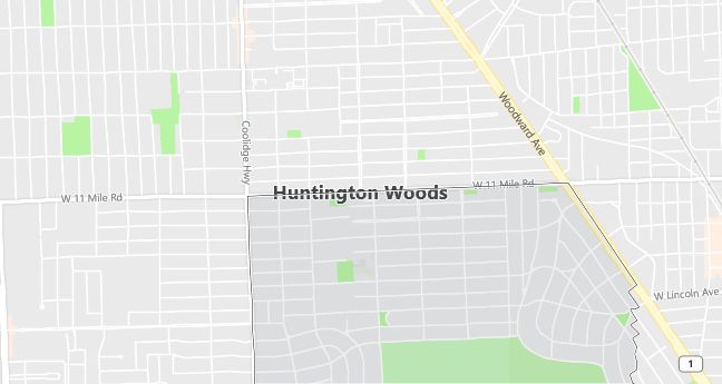
Moving to Huntington Woods, Michigan
Population: 6,151. Estimated population in July 2024: 5,928 (-3.6% change)
Males: 3,001 (48.8%), Females: 3,150 (51.2%)
Oakland County
Zip code: 48070
Demographics
Median resident age: 40.6 years
Median household income: $87,086
Median house value: $245,400
Population by Race
Races in Huntington Woods:
- White Non-Hispanic (96.3%)
- Hispanic (0.9%)
- Black (0.7%)
- Two or more races (0.6%)
Ancestries: German (16.7%), Russian (12.4%), Polish (11.9%), English (11.3%), Irish (9.3%), United States (6.1%).
Elevation: 660 feet
Land area: 1.5 square miles

Population by Education
For population 25 years and over in Huntington Woods
- High school or higher: 96.8%
- Bachelor’s degree or higher: 72.5%
- Graduate or professional degree: 40.4%
- Unemployed: 1.6%
- Mean travel time to work: 21.2 minutes
For population 15 years and over in Huntington Woods city
- Never married: 17.8%
- Now married: 68.8%
- Separated: 0.2%
- Widowed: 5.8%
- Divorced: 7.4%
8.0% Foreign born (3.8% Europe, 2.9% Asia, 1.0% North America).
Population change in the 1990s: -292 (-4.5%).
Hospitals
Hospitals/medical centers near Huntington Woods:
- WILLIAM BEAUMONT HOSPITAL (about 3 miles; ROYAL OAK, MI)
- HENRY FORD – KINGSWOOD HOSPITAL (about 3 miles; FERNDALE, MI)
- GREAT LAKES REGIONAL REHAB HOSPITAL (about 5 miles; SOUTHFIELD, MI)
Airports
Airports certified for carrier operations nearest to Huntington Woods:
- DETROIT CITY (about 13 miles; DETROIT, MI; Abbreviation: DET)
- OAKLAND COUNTY INTERNATIONAL (about 21 miles; PONTIAC, MI; Abbreviation: PTK)
- DETROIT METROPOLITAN WAYNE COUNTY (about 24 miles; DETROIT, MI; Abbreviation: DTW)
Other public-use airports nearest to Huntington Woods:
- OAKLAND/TROY (about 4 miles; TROY, MI; Abbreviation: 7D2)
- COBO HALL (about 15 miles; DETROIT, MI; Abbreviation: 84G)
- BERZ-MACOMB (about 19 miles; DETROIT, MI; Abbreviation: UIZ)
Amtrak stations near Huntington Woods:
- 2 miles: ROYAL OAK (201 S. SHERMAN DR.). Services: enclosed waiting area, public payphones, vending machines, paid short-term parking, taxi stand, intercity bus service, public transit connection.
- 5 miles: BIRMINGHAM (449 S. ETON ST.). Services: public payphones, free short-term parking, free long-term parking, call for taxi service, public transit connection.
- 11 miles: DETROIT (11 W. BALTIMORE AVE.). Services: ticket office, partially wheelchair accessible, enclosed waiting area, public restrooms, public payphones, free short-term parking, call for car rental service, taxi stand, public transit connection.
Colleges and Universities
Colleges/universities with over 2000 students nearest to Huntington Woods:
- MARYGROVE COLLEGE (about 5 miles; DETROIT, MI; Full-time enrollment: 5,301)
- UNIVERSITY OF DETROIT MERCY (about 5 miles; DETROIT, MI; Full-time enrollment: 4,119)
- LAWRENCE TECHNOLOGICAL UNIVERSITY (about 5 miles; SOUTHFIELD, MI; Full-time enrollment: 2,479)
- UNIVERSITY OF PHOENIX-DETROIT CAMPUS (about 9 miles; TROY, MI; Full-time enrollment: 2,090)
- OAKLAND COMMUNITY COLLEGE-BLOOMFIELD HILLS CAMPUS (about 9 miles; BLOOMFIELD HILLS, MI; Full-time enrollment: 11,634)
- WAYNE STATE UNIVERSITY (about 10 miles; DETROIT, MI; Full-time enrollment: 20,389)
- DAVENPORT UNIVERSITY-EASTERN REGION-DEARBORN (about 11 miles; DEARBORN, MI; Full-time enrollment: 2,247)
Public primary/middle school in Huntington Woods:
- BURTON ELEMENTARY SCHOOL (Students: 501; Location: 26315 SCOTIA ROAD; Grades: KG – 05)
Libraries
Library in Huntington Woods:
- HUNTINGTON WOODS PUBLIC LIBRARY (Operating income: $376,568; Location: 26415 SCOTIA ROAD; 45,695 books; 2,492 audio materials; 46 video materials; 163 serial subscriptions)
