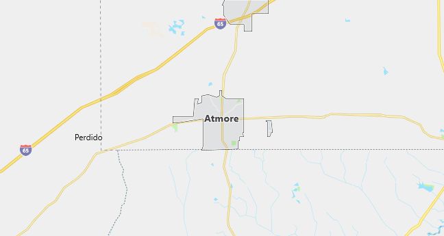
Moving to Atmore, Alabama
The current estimated population of Atmore, Alabama, is 8,100, with 48% male and 52% female. The population has seen slight growth in recent years, supported by the town’s expanding economy, including its role as a center for gaming and tourism.
City Facts
- Year Founded: 1866
- County Affiliation: Escambia County
- Land Area: 21.9 square miles
- Population Density: 370 people per square mile
- Area Code: 251
- Zip Codes: 36502, 36503
Geography and Location
Atmore, Alabama, is a small city located in Escambia County, in the southern part of the state. The city is situated near the border with Florida, about 50 miles northeast of Mobile, Alabama, and 45 miles north of Pensacola, Florida. Atmore’s location along U.S. Highway 31 and Interstate 65 makes it an important regional transportation hub.
The geography of Atmore is defined by its flat, rural landscape, typical of the Gulf Coastal Plain. The surrounding area is primarily agricultural, with fields of cotton, peanuts, and corn, as well as timber production. The city is close to the Escambia River, which provides opportunities for fishing, boating, and other outdoor activities.
Atmore experiences a humid subtropical climate, with long, hot summers and mild winters, making it suitable for year-round outdoor activities. The city has also become known for its casino industry, with the Wind Creek Casino and Hotel serving as a major employer and tourist attraction. This has contributed to the city’s economic growth in recent years, alongside its traditional agricultural base.
Demographics
Median resident age: 37.4 years
Median household income: $22,867
Median house value: $62,900
Population by Race
Races in Atmore:
- White Non-Hispanic (49.2%)
- Black (46.3%)
- American Indian (2.9%)
- Two or more races (0.9%)
- Hispanic (0.7%)
Ancestries: United States (11.3%), Irish (5.6%), English (5.0%), German (3.8%), Scotch-Irish (2.1%), Dutch (1.2%).
Elevation: 283 feet
Land area: 8.3 square miles

Population by Education
For population 25 years and over in Atmore
- High school or higher: 68.1%
- Bachelor’s degree or higher: 12.1%
- Graduate or professional degree: 4.7%
- Unemployed: 8.8%
- Mean travel time to work: 22.0 minutes
For population 15 years and over in Atmore city
- Never married: 24.9%
- Now married: 50.7%
- Separated: 2.5%
- Widowed: 10.8%
- Divorced: 11.2%
0.8% Foreign born
Population change in the 1990s: -401 (-5.0%).
Hospitals
Hospital/medical center in Atmore:
- ATMORE COMMUNITY HOSPITAL (401 MEDICAL PARK DR, MED PARK PLAZA)
Other hospitals/medical centers near Atmore:
- NORTH BALDWIN INFIRMARY (about 22 miles; BAY MINETTE, AL)
- JAY HOSPITAL (about 27 miles; JAY, FL)
- D W MCMILLAN MEMORIAL HOSPITAL (about 28 miles; BREWTON, AL)
Airports
Airports certified for carrier operations nearest to Atmore:
- PENSACOLA REGIONAL (about 44 miles; PENSACOLA, FL; Abbreviation: PNS)
- MOBILE DOWNTOWN (about 49 miles; MOBILE, AL; Abbreviation: BFM)
- MOBILE REGIONAL (about 57 miles; MOBILE, AL; Abbreviation: MOB)
Other public-use airports nearest to Atmore:
- ATMORE MUNI (about 5 miles; ATMORE, AL; Abbreviation: 0R1)
- BAY MINETTE MUNI (about 25 miles; BAY MINETTE, AL; Abbreviation: 1R8)
- BREWTON MUNI (about 31 miles; BREWTON, AL; Abbreviation: 12J)
Amtrak station:
ATMORE (107 E. LOUISVILLE ST.). Services: partially wheelchair accessible, enclosed waiting area, public payphones, free short-term parking, free long-term parking, car rental agency.
Colleges and Universities
Colleges/universities with over 2000 students nearest to Atmore:
- JAMES H FAULKNER STATE COMMUNITY COLLEGE (about 22 miles; BAY MINETTE, AL; Full-time enrollment: 2,050)
- THE UNIVERSITY OF WEST FLORIDA (about 40 miles; PENSACOLA, FL; Full-time enrollment: 6,282)
- PENSACOLA JUNIOR COLLEGE (about 43 miles; PENSACOLA, FL; Full-time enrollment: 6,036)
- UNIVERSITY OF SOUTH ALABAMA-BALDWIN (about 45 miles; FAIRHOPE, AL; Full-time enrollment: 5,582)
- BISHOP STATE COMMUNITY COLLEGE (about 46 miles; MOBILE, AL; Full-time enrollment: 2,758)
- UNIVERSITY OF SOUTH ALABAMA (about 53 miles; MOBILE, AL; Full-time enrollment: 9,082)
- OKALOOSA-WALTON COMMUNITY COLLEGE (about 81 miles; NICEVILLE, FL; Full-time enrollment: 3,374)
Schools
Public high school in Atmore:
- ESCAMBIA COUNTY HIGH SCHOOL (Students: 605; Location: 1215 S PRESLEY ST; Grades: 09 – 12)
Private high school in Atmore:
- ESCAMBIA ACADEMY (Students: 244; Location: 268 COWPEN CREEK RD; Grades: PK – 12)
Public primary/middle schools in Atmore:
- ESCAMBIA COUNTY MIDDLE SCHOOL (Students: 706; Location: 1565 HIGHWAY 21; Grades: 05 – 08)
- RACHEL PATTERSON ELEMENTARY SCHOOL (Students: 528; Location: 1102 W CRAIG ST; Grades: PK – 02)
- A.C. MOORE ELEMENTARY SCHOOL (Students: 308; Location: 501 BECK ST; Grades: 03 – 04)
Private primary/middle school in Atmore:
- ATMORE CHRISTIAN SCHOOL (Students: 40; Location: 245 TENNANT DRIVE; Grades: 1 – 11)
Libraries in Atmore:
- ATMORE PUBLIC (Operating income: $239,934; Location: 700 E. CHURCH STREET; 70,366 books; 1,240 audio materials; 214 video materials; 107 serial subscriptions)
- ESCAMBIA CO. COOP. LIBRARY SYSTEM (Operating income: $46,145; Location: 700 EAST CHURCH STREET; 7,711 books; 12 audio materials; 256 video materials; 10 serial subscriptions)
