Moving to Ardmore, Alabama
The current estimated population of Ardmore is 1,400, with a gender distribution of 49% male and 51% female. The population has seen modest growth, largely driven by its location near Huntsville, a major economic center in northern Alabama.
City Facts
- Year founded: 1922
- County: Limestone County
- Land area: 2.0 square miles
- Population density: 700 people per square mile
- Area code: 256
- Zip code: 35739
Geography and Location
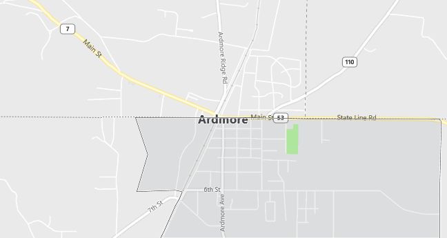
Ardmore is located in northern Alabama, within Limestone County, on the Alabama-Tennessee state line. The town is part of the Huntsville-Decatur Combined Statistical Area, making it a convenient residential location for those working in Huntsville, which is about 25 miles south. Ardmore experiences a humid subtropical climate, with hot summers and mild winters. The town is accessible via Interstate 65, providing easy connections to Huntsville, Decatur, and Nashville. Ardmore’s economy is largely based on small businesses, retail, and agriculture, with many residents commuting to nearby cities for work. The town is known for its family-friendly environment and proximity to outdoor recreational opportunities, including hiking and camping in the nearby Tennessee Valley. Ardmore’s small-town feel and access to larger metropolitan areas make it an attractive place for families and commuters.
Demographics
Median resident age: 36.6 years
Median household income: $28,352
Median house value: $64,800
Population by Race
Races in Ardmore:
- White Non-Hispanic (95.6%)
- Hispanic (1.7%)
- Other race (1.2%)
- Black (0.9%)
- American Indian (0.9%)
Ancestries: United States (33.7%), Irish (9.5%), English (7.9%), German (7.2%), Italian (1.5%).
Elevation: 883 feet
Land area: 2.0 square miles

Population by Education
For population 25 years and over in Ardmore
- High school or higher: 59.6%
- Bachelor’s degree or higher: 6.8%
- Graduate or professional degree: 1.9%
- Unemployed: 5.5%
- Mean travel time to work: 29.5 minutes
For population 15 years and over in Ardmore town
- Never married: 19.5%
- Now married: 49.9%
- Separated: 1.1%
- Widowed: 13.0%
- Divorced: 16.5%
1.6% Foreign born
Population change in the 1990s: -60 (-5.5%).
Hospitals
Hospitals/medical centers near Ardmore:
- ATHENS-LIMESTONE HOSPITAL (about 19 miles; ATHENS, AL)
- HILLSIDE HOSPITAL (about 20 miles; PULASKI, TN)
- LINCOLN REGIONAL HOSPITAL (about 22 miles; FAYETTEVILLE, TN)
Airports
Airports certified for carrier operations nearest to Ardmore:
- HUNTSVILLE INTL-CARL T JONES FIELD (about 25 miles; HUNTSVILLE, AL; Abbreviation: HSV)
- NORTHWEST ALABAMA RGNL (about 56 miles; MUSCLE SHOALS, AL; Abbreviation: MSL)
- SMYRNA (about 74 miles; SMYRNA, TN; Abbreviation: MQY)
Other public-use airports nearest to Ardmore:
- ARDMORE (about 4 miles; ARDMORE, AL; Abbreviation: 1M3)
- HAZEL GREEN (about 16 miles; HAZEL GREEN, AL; Abbreviation: M38)
- ABERNATHY FIELD (about 19 miles; PULASKI, TN; Abbreviation: GZS)
Colleges and Universities
Colleges/universities with over 2000 students nearest to Ardmore:
- UNIVERSITY OF ALABAMA IN HUNTSVILLE (about 23 miles; HUNTSVILLE, AL; Full-time enrollment: 4,795)
- ALABAMA A & M UNIVERSITY (about 29 miles; NORMAL, AL; Full-time enrollment: 4,886)
- JOHN C CALHOUN STATE COMMUNITY COLLEGE (about 29 miles; DECATUR, AL; Full-time enrollment: 4,547)
- COLUMBIA STATE COMMUNITY COLLEGE (about 46 miles; COLUMBIA, TN; Full-time enrollment: 2,784)
- MOTLOW STATE COMMUNITY COLLEGE (about 51 miles; Tullahoma, TN; Full-time enrollment: 2,256)
- NORTHWEST SHOALS COMMUNITY COLLEGE-MUSCLE SHOALS (about 57 miles; MUSCLE SHOALS, AL; Full-time enrollment: 2,669)
- UNIVERSITY OF NORTH ALABAMA (about 61 miles; FLORENCE, AL; Full-time enrollment: 4,770)
Public primary/middle schools in Ardmore:
- ARDMORE HIGH SCHOOL (Students: 846; Location: 30285 ARDMORE AVE; Grades: 06 – 12)
- CEDAR HILL ELEMENTARY SCHOOL (Students: 527; Location: 27905 CEDAR HILL RD.; Grades: KG – 05)
