Moving to Amado, Arizona
The current estimated population of Amado, Arizona is 295, with 50.8% male and 49.2% female. Amado has maintained a small, stable population, reflecting its status as a rural community in southern Arizona.
City Facts
- Year founded: 1919
- County: Santa Cruz
- Land area: 10.1 square miles
- Population density: Approximately 29 people per square mile
- Area code: 520
- Zip code: 85645
Geography and Location
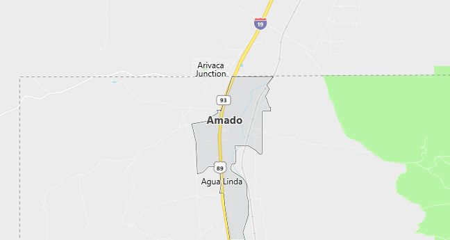
Amado, Arizona is located in Santa Cruz County, in the southern part of the state, about 30 miles south of Tucson. The town is situated near Interstate 19, providing easy access to both Tucson and the U.S.-Mexico border. Amado is surrounded by scenic desert landscapes, with the nearby Santa Rita Mountains offering opportunities for hiking, birdwatching, and outdoor recreation. The town is part of Arizona’s cattle ranching country and offers a peaceful, rural lifestyle with wide-open spaces and a close-knit community.
Demographics
Median resident age: 36.8 years
Median household income: $20,417
Median house value: $155,800
Population by Race
Races in Amado:
- White Non-Hispanic (54.2%)
- Hispanic (43.3%)
- Other race (26.2%)
- American Indian (1.1%)
- Japanese (0.7%)
- Two or more races (0.7%)
(Total can be greater than 100% because Hispanics could be counted in other races)
Ancestries: German (18.5%), Irish (8.7%), Italian (6.5%), French (5.8%), English (5.5%), United States (3.3%).
Elevation: 3091 feet
Land area: 11.2 square miles

Population by Education
For population 25 years and over in Amado
- High school or higher: 92.0%
- Bachelor’s degree or higher: 16.4%
- Graduate or professional degree: 3.8%
- Unemployed: 14.8%
- Mean travel time to work: 31.4 minutes
For population 15 years and over in Amado CDP
- Never married: 23.7%
- Now married: 41.5%
- Separated: 1.7%
- Widowed: 17.0%
- Divorced: 16.2%
4.0% Foreign born (4.0% Latin America).
Hospitals
Hospitals/medical centers near Amado:
- CARONDELET HOLY CROSS HOSPITAL INC (about 25 miles; NOGALES, AZ)
- KINO COMMUNITY HOSPITAL (about 35 miles; TUCSON, AZ)
- CARONDELET ST MARYS HOSPITAL (about 38 miles; TUCSON, AZ)
Airports
Airports certified for carrier operations nearest to Amado:
- TUCSON INTL (about 29 miles; TUCSON, AZ; Abbreviation: TUS)
- DAVIS-MONTHAN AFB (about 34 miles; TUCSON, AZ; Abbreviation: DMA)
- SIERRA VISTA MUNI-LIBBY AAF (about 52 miles; FORT HUACHUCA SIERRA VISTA, AZ; Abbreviation: FHU)
Other public-use airports nearest to Amado:
- NOGALES INTL (about 26 miles; NOGALES, AZ; Abbreviation: OLS)
- RYAN FIELD (about 31 miles; TUCSON, AZ; Abbreviation: RYN)
- MARANA NORTHWEST REGIONAL (about 49 miles; MARANA, AZ; Abbreviation: AVQ)
Colleges and Universities
Colleges/universities with over 2000 students nearest to Amado:
- PIMA COMMUNITY COLLEGE (about 36 miles; TUCSON, AZ; Full-time enrollment: 14,177)
- UNIVERSITY OF ARIZONA (about 38 miles; TUCSON, AZ; Full-time enrollment: 29,915)
- CENTRAL ARIZONA COLLEGE (about 93 miles; COOLIDGE, AZ; Full-time enrollment: 2,333)
- COCHISE COLLEGE (about 108 miles; DOUGLAS, AZ; Full-time enrollment: 2,585)
- EASTERN ARIZONA COLLEGE (about 118 miles; THATCHER, AZ; Full-time enrollment: 3,085)
- CHANDLER/GILBERT COMMUNITY COLLEGE (about 123 miles; CHANDLER, AZ; Full-time enrollment: 2,990)
- MESA COMMUNITY COLLEGE (about 129 miles; MESA, AZ; Full-time enrollment: 11,928)
Public primary/middle school in Amado:
- SOPORI ELEMENTARY SCHOOL (Students: 237; Location: 5000 W. ARIVACA ROAD; Grades: KG – 05)
