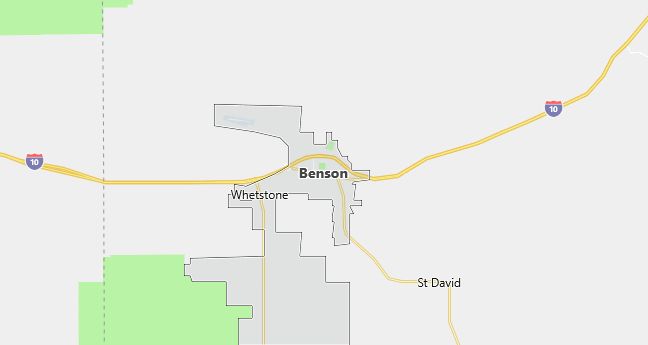
Moving to Benson, Arizona
Population: 4,711. Estimated population in July 2024: 4,934 (+4.7% change)
Males: 2,304 (48.9%), Females: 2,407 (51.1%)
Cochise County
Zip code: 85602
Demographics
Median resident age: 49.6 years
Median household income: $28,289
Median house value: $72,800
Population by Race
Races in Benson:
- White Non-Hispanic (77.2%)
- Hispanic (19.8%)
- Other race (5.7%)
- Two or more races (2.4%)
- American Indian (2.1%)
- Black (0.7%)
(Total can be greater than 100% because Hispanics could be counted in other races)
Ancestries: German (19.0%), English (17.7%), Irish (10.9%), United States (5.6%), French (3.5%), Scotch-Irish (2.9%).
Elevation: 3583 feet
Land area: 35.7 square miles

Population by Education
For population 25 years and over in Benson
- High school or higher: 77.1%
- Bachelor’s degree or higher: 14.3%
- Graduate or professional degree: 3.6%
- Unemployed: 12.1%
- Mean travel time to work: 23.7 minutes
For population 15 years and over in Benson city
- Never married: 14.7%
- Now married: 58.6%
- Separated: 1.4%
- Widowed: 11.7%
- Divorced: 13.6%
4.6% Foreign born (2.3% Latin America, 1.3% North America, 0.8% Europe).
Population change in the 1990s: +856 (+22.2%).
Hospitals
Hospital/medical center in Benson:
- BENSON HOSPITAL (450 SOUTH OCOTILLO STREET)
Other hospitals/medical centers near Benson:
- SIERRA VISTA REGIONAL HEALTH CENTER (about 28 miles; SIERRA VISTA, AZ)
- SUMMIT HOSPITAL OF SOUTHEAST AZ (about 41 miles; TUCSON, AZ)
- NORTHERN COCHISE COMMUNITY HOSPITAL (about 41 miles; WILLCOX, AZ)
Airports
Airports certified for carrier operations nearest to Benson:
- SIERRA VISTA MUNI-LIBBY AAF (about 26 miles; FORT HUACHUCA SIERRA VISTA, AZ; Abbreviation: FHU)
- DAVIS-MONTHAN AFB (about 42 miles; TUCSON, AZ; Abbreviation: DMA)
- TUCSON INTL (about 45 miles; TUCSON, AZ; Abbreviation: TUS)
Other public-use airports nearest to Benson:
- BENSON MUNICIPAL (about 4 miles; BENSON, AZ; Abbreviation: E95)
- TOMBSTONE MUNI (about 29 miles; TOMBSTONE, AZ; Abbreviation: P29)
- COCHISE COUNTY (about 36 miles; WILLCOX, AZ; Abbreviation: P33)
Amtrak station:
BENSON (4TH & SAN PEDRO STS.). Services: partially wheelchair accessible, public payphones, intercity bus service.
Colleges and Universities
Colleges/universities with over 2000 students nearest to Benson:
- PIMA COMMUNITY COLLEGE (about 45 miles; TUCSON, AZ; Full-time enrollment: 14,177)
- UNIVERSITY OF ARIZONA (about 49 miles; TUCSON, AZ; Full-time enrollment: 29,915)
- COCHISE COLLEGE (about 66 miles; DOUGLAS, AZ; Full-time enrollment: 2,585)
- EASTERN ARIZONA COLLEGE (about 71 miles; THATCHER, AZ; Full-time enrollment: 3,085)
- CENTRAL ARIZONA COLLEGE (about 110 miles; COOLIDGE, AZ; Full-time enrollment: 2,333)
- CHANDLER/GILBERT COMMUNITY COLLEGE (about 142 miles; CHANDLER, AZ; Full-time enrollment: 2,990)
- MESA COMMUNITY COLLEGE (about 147 miles; MESA, AZ; Full-time enrollment: 11,928)
Schools
Public high school in Benson:
- BENSON HIGH SCHOOL (Students: 398; Location: 360 S. PATAGONIA; Grades: 09 – 12)
Public primary/middle schools in Benson:
- BENSON PRIMARY SCHOOL (Students: 320; Location: 360 S PATAGONIA STREET; Grades: PK – 04)
- BENSON MIDDLE SCHOOL (Students: 298; Location: 360 S PATAGONIA STREET; Grades: 05 – 08)
- VISIONS UNLIMITED ACADEMY (Students: 67; Location: 1275 EAST BARNEY LANE; Grades: KG – 08)
- NEW WEST SCHOOLS (Students: 67; Location: 98 N. OAK DR.; Grades: KG – 12)
- NEW WEST SCHOOL (Students: 40; Location: 3225 W. NAVAJO TRAIL; Grades: 06 – 12)
Private primary/middle schools in Benson:
- FULL GOSPEL ASSEMBLY SCHOOL (Students: 26; Location: 151 WEST WALKER PO BOX 2137; Grades: KG – 11)
- GRACE CHAPEL SCHOOL (Students: 13; Location: 11050 S POST ROAD BOX 1880; Grades: PK – 5)
