Moving to Aberdeen, Idaho
The current estimated population of Aberdeen is 2,100, with a gender distribution of 48% male and 52% female. The population has remained stable over recent years, bolstered by the local agricultural economy.
City Facts:
- Founded: 1911
- County: Bingham County
- Land Area: 1.2 square miles
- Population Density: 1,750 people per square mile
- Area Code: 208
- Zip Code: 83210
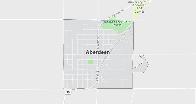
Geography and Location Overview: Aberdeen is a small agricultural town located in southeastern Idaho, near the Snake River and American Falls Reservoir. Situated in Bingham County, the town is surrounded by rich farmland primarily used for growing potatoes, grains, and sugar beets. Aberdeen’s proximity to the Snake River and nearby reservoirs provides opportunities for irrigation, which supports the town’s farming industry. The town is about 40 miles southwest of Pocatello, making it a central location for agricultural business in the region. Its rural atmosphere, with open skies and vast farmlands, is a hallmark of southeastern Idaho, where small communities thrive alongside expansive agricultural landscapes.
Demographics
Median resident age: 28.9 years
Median household income: $28,625
Median house value: $62,700
Population by Race
Races in Aberdeen:
- White Non-Hispanic (58.8%)
- Hispanic (39.3%)
- Other race (28.9%)
- Two or more races (3.6%)
- American Indian (1.0%)
(Total can be greater than 100% because Hispanics could be counted in other races)
Ancestries: English (12.3%), German (11.3%), United States (9.2%), Irish (3.7%), Danish (3.6%), Swedish (2.4%).
Elevation: 4400 feet
Land area: 1.0 square miles

Population by Education
For population 25 years and over in Aberdeen
- High school or higher: 59.6%
- Bachelor’s degree or higher: 8.7%
- Graduate or professional degree: 2.0%
- Unemployed: 6.3%
- Mean travel time to work: 14.3 minutes
For population 15 years and over in Aberdeen city
- Never married: 16.9%
- Now married: 63.6%
- Separated: 2.3%
- Widowed: 8.0%
- Divorced: 9.3%
22.4% Foreign born (21.9% Latin America).
Population change in the 1990s: +436 (+31.1%).
Hospitals
Hospitals/medical centers near Aberdeen:
- HARMS MEMORIAL HOSPITAL (about 15 miles; AMERICAN FALLS, ID)
- POCATELLO REGIONAL MEDICAL CENTER (about 28 miles; POCATELLO, ID)
- PORTNEUF REGIONAL MEDICAL CENTER (about 28 miles; POCATELLO, ID)
Airports
Airports certified for carrier operations nearest to Aberdeen:
- POCATELLO REGIONAL (about 18 miles; POCATELLO, ID; Abbreviation: PIH)
- IDAHO FALLS RGNL (about 66 miles; IDAHO FALLS, ID; Abbreviation: IDA)
- FRIEDMAN MEMORIAL (about 107 miles; HAILEY, ID; Abbreviation: SUN)
Other public-use airports nearest to Aberdeen:
- ABERDEEN MUNI (about 3 miles; ABERDEEN, ID; Abbreviation: U36)
- AMERICAN FALLS (about 12 miles; AMERICAN FALLS, ID; Abbreviation: U01)
- ROCKFORD MUNI (about 28 miles; ROCKFORD, ID; Abbreviation: 2U4)
Colleges and Universities
Colleges/universities with over 2000 students nearest to Aberdeen:
- IDAHO STATE UNIVERSITY (about 42 miles; POCATELLO, ID; Full-time enrollment: 10,057)
- RICKS COLLEGE (about 98 miles; REXBURG, ID; Full-time enrollment: 8,670)
- UTAH STATE UNIVERSITY (about 111 miles; LOGAN, UT; Full-time enrollment: 16,384)
- COLLEGE OF SOUTHERN IDAHO (about 117 miles; TWIN FALLS, ID; Full-time enrollment: 3,433)
- WEBER STATE UNIVERSITY (about 135 miles; OGDEN, UT; Full-time enrollment: 12,112)
- UNIVERSITY OF UTAH (about 165 miles; SALT LAKE CITY, UT; Full-time enrollment: 19,866)
- SALT LAKE COMMUNITY COLLEGE (about 170 miles; SALT LAKE CITY, UT; Full-time enrollment: 11,896)
Schools
Public high school in Aberdeen:
- ABERDEEN HIGH SCHOOL (Students: 265; Location: 268 WEST FOURTH WEST; Grades: 09 – 12)
Public primary/middle school in Aberdeen:
- ABERDEEN ELEM-MIDDLE SCHOOL (Students: 594; Location: 382 WEST WASHINGTON; Grades: PK – 08)
Libraries
Library in Aberdeen:
- ABERDEEN DISTRICT (Operating income: $116,255; Location: 76 E CENTRAL AVE; 16,162 books; 350 audio materials; 355 video materials; 33 serial subscriptions)
