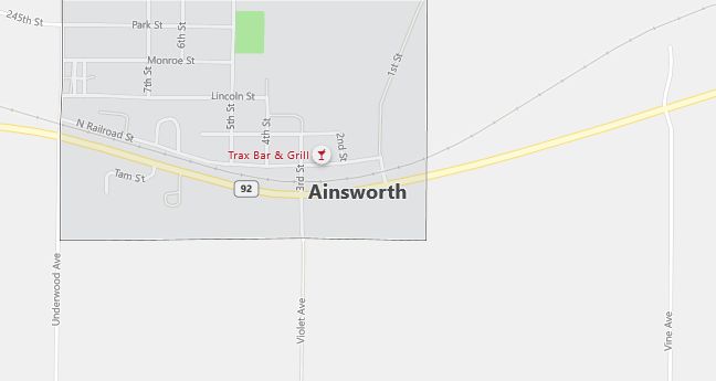
Moving to Ainsworth, Iowa
The current estimated population of Ainsworth is 580, with 49% male and 51% female. The population has remained steady over recent years, typical of small towns in rural Iowa.
City Facts
- Year founded: 1858
- County: Washington County
- Land area: 0.63 square miles
- Population density: 920 people per square mile
- Area code: 319
- Zip code: 52201
Geography and Location
Ainsworth is located in southeastern Iowa, in Washington County. The town is situated near U.S. Highway 218, about 30 miles south of Iowa City. The surrounding area is primarily agricultural, with vast corn and soybean fields typical of Iowa’s rural landscape. Ainsworth has a close-knit community and provides a peaceful, rural setting for its residents. The town experiences a humid continental climate, with cold winters and warm summers.
Demographics
Median resident age: 33.5 years
Median household income: $41,071
Median house value: $70,000
Population by Race
Races in Ainsworth:
- White Non-Hispanic (84.2%)
- Hispanic (15.6%)
- Other race (8.0%)
- American Indian (0.6%)
(Total can be greater than 100% because Hispanics could be counted in other races)
Ancestries: German (35.3%), Irish (16.2%), English (7.8%), United States (7.6%), Italian (5.2%), Dutch (4.8%).
Elevation: 730 feet
Land area: 0.4 square miles

Population by Education
For population 25 years and over in Ainsworth
- High school or higher: 81.8%
- Bachelor’s degree or higher: 10.9%
- Graduate or professional degree: 2.1%
- Unemployed: 3.4%
- Mean travel time to work: 24.6 minutes
For population 15 years and over in Ainsworth city
- Never married: 13.7%
- Now married: 68.7%
- Separated: 2.9%
- Widowed: 5.8%
- Divorced: 8.9%
9.4% Foreign born (8.4% Latin America, 1.0% Europe).
Population change in the 1990s: +18 (+3.6%).
Hospitals
Hospitals/medical centers near Ainsworth:
- WASHINGTON COUNTY HOSPITAL (about 10 miles; WASHINGTON, IA)
- HENRY COUNTY HEALTH CENTER (about 22 miles; MOUNT PLEASANT, IA)
- MENTAL HEALTH INSTITUTE (about 22 miles; MOUNT PLEASANT, IA)
Airports
Airports certified for carrier operations nearest to Ainsworth:
- THE EASTERN IOWA (about 42 miles; CEDAR RAPIDS, IA; Abbreviation: CID)
- SOUTHEAST IOWA REGIONAL (about 48 miles; BURLINGTON, IA; Abbreviation: BRL)
- OTTUMWA INDUSTRIAL (about 63 miles; OTTUMWA, IA; Abbreviation: OTM)
Other public-use airports nearest to Ainsworth:
- WASHINGTON MUNI (about 8 miles; WASHINGTON, IA; Abbreviation: AWG)
- IOWA CITY MUNI (about 24 miles; IOWA CITY, IA; Abbreviation: IOW)
- MOUNT PLEASANT MUNI (about 25 miles; MOUNT PLEASANT, IA; Abbreviation: MPZ)
Colleges and Universities
Colleges/universities with over 2000 students nearest to Ainsworth:
- UNIVERSITY OF IOWA (about 26 miles; IOWA CITY, IA; Full-time enrollment: 24,766)
- INDIAN HILLS COMMUNITY COLLEGE (about 63 miles; OTTUMWA, IA; Full-time enrollment: 2,744)
- AUGUSTANA COLLEGE (about 70 miles; ROCK ISLAND, IL; Full-time enrollment: 2,220)
- EASTERN IOWA COMMUNITY COLLEGE DISTRICT (about 70 miles; DAVENPORT, IA; Full-time enrollment: 4,180)
- KIRKWOOD COMMUNITY COLLEGE (about 71 miles; CEDAR RAPIDS, IA; Full-time enrollment: 7,991)
- SAINT AMBROSE UNIVERSITY (about 71 miles; DAVENPORT, IA; Full-time enrollment: 2,310)
- BLACK HAWK COLLEGE (about 75 miles; MOLINE, IL; Full-time enrollment: 3,891)
Public primary/middle school in Ainsworth:
- AINSWORTH ELEMENTARY SCHOOL (Students: 99; Location: 835 PARK STREET; Grades: PK – 05)
