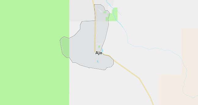
Moving to Ajo, Arizona
The current estimated population of Ajo is 3,200, with 49% male and 51% female. The town has experienced slow population decline due to economic challenges but remains a significant cultural and historical site.
City Facts
- Year founded: 1854
- County: Pima County
- Land area: 28.1 square miles
- Population density: 114 people per square mile
- Area code: 520
- Zip code: 85321
Geography and Location
Ajo is located in southwestern Arizona, in Pima County, near the U.S.-Mexico border. The town is situated in the Sonoran Desert, surrounded by rugged desert landscapes, mountains, and saguaro cacti. Ajo’s history is deeply tied to copper mining, with the New Cornelia mine being a major employer until its closure in the 1980s. The town lies along State Route 85, which connects it to Tucson and the Organ Pipe Cactus National Monument. Ajo experiences a desert climate, with extremely hot summers and mild winters, making it a popular winter destination for snowbirds.
Demographics
Median resident age: 51.6 years
Median household income: $25,618
Median house value: $63,100
Population by Race
Races in Ajo:
- White Non-Hispanic (54.4%)
- Hispanic (37.6%)
- American Indian (9.7%)
- Other race (9.1%)
- Two or more races (4.6%)
(Total can be greater than 100% because Hispanics could be counted in other races)
Ancestries: English (11.6%), German (9.7%), Irish (6.8%), United States (5.2%), Scottish (2.4%), Scotch-Irish (2.3%).
Elevation: 1757 feet
Land area: 28.1 square miles

Population by Education
For population 25 years and over in Ajo
- High school or higher: 72.1%
- Bachelor’s degree or higher: 12.7%
- Graduate or professional degree: 4.2%
- Unemployed: 9.3%
- Mean travel time to work: 13.9 minutes
For population 15 years and over in Ajo CDP
- Never married: 16.8%
- Now married: 60.8%
- Separated: 2.4%
- Widowed: 11.7%
- Divorced: 8.3%
11.4% Foreign born (8.6% Latin America, 1.6% Europe).
Hospitals
Hospitals/medical centers near Ajo:
- PHS INDIAN HOSPITAL (about 70 miles; SELLS, AZ)
- TUCSON MEDICAL CENTER (about 74 miles; TUCSON, AZ)
- ARROWHEAD COMMUNITY HOSP/MED CENTER (about 78 miles; GLENDALE, AZ)
Airports
Airports certified for carrier operations nearest to Ajo:
- LUKE AFB (about 87 miles; GLENDALE, AZ; Abbreviation: LUF)
- PHOENIX SKY HARBOR INTL (about 95 miles; PHOENIX, AZ; Abbreviation: PHX)
- WILLIAMS GATEWAY (about 106 miles; PHOENIX, AZ; Abbreviation: IWA)
Other public-use airports nearest to Ajo:
- AJO MUNI (about 5 miles; AJO, AZ; Abbreviation: P01)
- GILA BEND MUNI (about 42 miles; GILA BEND, AZ; Abbreviation: E63)
- ESTRELLA SAILPORT (about 70 miles; MARICOPA, AZ; Abbreviation: E68)
Colleges and Universities
Colleges/universities with over 2000 students nearest to Ajo:
- UNIVERSITY OF PHOENIX-PHOENIX CAMPUS (about 91 miles; PHOENIX, AZ; Full-time enrollment: 9,152)
- UNIVERSITY OF PHOENIX-ONLINE CAMPUS (about 94 miles; PHOENIX, AZ; Full-time enrollment: 14,783)
- GATEWAY COMMUNITY COLLEGE (about 94 miles; Phoenix, AZ; Full-time enrollment: 2,969)
- GRAND CANYON UNIVERSITY (about 94 miles; PHOENIX, AZ; Full-time enrollment: 2,207)
- UNIVERSAL TECHNICAL INSTITUTE INC (about 94 miles; PHOENIX, AZ; Full-time enrollment: 2,091)
- PHOENIX COLLEGE (about 95 miles; PHOENIX, AZ; Full-time enrollment: 5,911)
- GLENDALE COMMUNITY COLLEGE (about 95 miles; GLENDALE, AZ; Full-time enrollment: 9,981)
Public primary/middle schools in Ajo:
- AJO SCHOOL (Students: 299; Location: 111 WELL RD; Grades: PK – 12)
- AJO SCHOOL (Students: 269; Location: 111 WELL ROAD; Grades: UG – UG)
