Moving to Akron, Indiana
The current estimated population of Akron is 1,150, with 49% male and 51% female. The population has remained stable, supported by its agricultural surroundings and small-town charm.
City Facts
- Year founded: 1855
- County: Fulton County
- Land area: 0.53 square miles
- Population density: 2,170 people per square mile
- Area code: 574
- Zip code: 46910
Geography and Location
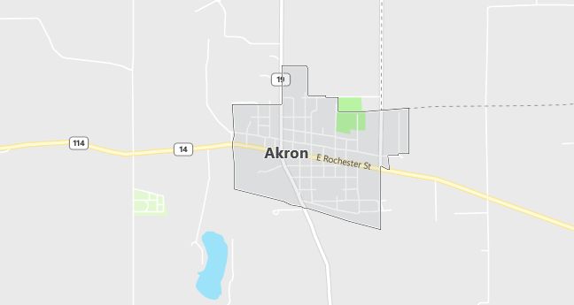
Akron is located in north-central Indiana, in Fulton County. The town is situated near several small lakes and creeks, typical of the region’s landscape. Akron lies along State Road 14, providing access to nearby cities such as Rochester and Warsaw. The surrounding area is largely agricultural, with corn and soybean fields dominating the landscape. Akron experiences a humid continental climate, with cold winters and warm summers, similar to much of the Midwest.
Demographics
Median resident age: 32.6 years
Median household income: $31,406
Median house value: $70,600
Population by Race
Races in Akron:
- White Non-Hispanic (84.3%)
- Hispanic (14.7%)
- Other race (7.2%)
- American Indian (0.8%)
- Two or more races (0.8%)
(Total can be greater than 100% because Hispanics could be counted in other races)
Ancestries: German (19.6%), United States (14.2%), English (9.9%), Irish (7.5%), Scottish (2.5%), French (2.1%).
Elevation: 859 feet
Land area: 0.5 square miles

Population by Education
For population 25 years and over in Akron
- High school or higher: 78.6%
- Bachelor’s degree or higher: 9.8%
- Graduate or professional degree: 3.8%
- Unemployed: 2.7%
- Mean travel time to work: 19.4 minutes
For population 15 years and over in Akron town
- Never married: 22.4%
- Now married: 57.4%
- Separated: 1.4%
- Widowed: 10.0%
- Divorced: 8.7%
8.7% Foreign born (8.1% Latin America).
Population change in the 1990s: +37 (+3.6%).
Hospitals
Hospitals/medical centers near Akron:
- WOODLAWN HOSPITAL (about 15 miles; ROCHESTER, IN)
- KOSCIUSKO COMMUNITY HOSPITAL (about 18 miles; WARSAW, IN)
- OTIS R BOWEN CTR FOR HUMAN SVS INC (about 18 miles; WARSAW, IN)
Airports
Airports certified for carrier operations nearest to Akron:
- GRISSOM ARB (about 30 miles; PERU, IN; Abbreviation: GUS)
- ELKHART MUNI (about 47 miles; ELKHART, IN; Abbreviation: EKM)
- SOUTH BEND REGIONAL (about 50 miles; SOUTH BEND, IN; Abbreviation: SBN)
Other public-use airports nearest to Akron:
- MENTONE (about 8 miles; MENTONE, IN; Abbreviation: C92)
- FULTON COUNTY (about 10 miles; ROCHESTER, IN; Abbreviation: RCR)
- PERU MUNI (about 20 miles; PERU, IN; Abbreviation: I76)
Colleges and Universities
Colleges/universities with over 2000 students nearest to Akron:
- INDIANA UNIVERSITY-SOUTH BEND (about 43 miles; SOUTH BEND, IN; Full-time enrollment: 4,725)
- INDIANA WESLEYAN UNIVERSITY (about 44 miles; MARION, IN; Full-time enrollment: 6,684)
- UNIVERSITY OF NOTRE DAME (about 49 miles; NOTRE DAME, IN; Full-time enrollment: 10,633)
- INDIANA UNIVERSITY-PURDUE UNIVERSITY-FORT WAYNE (about 63 miles; FT WAYNE, IN; Full-time enrollment: 7,385)
- ANDERSON UNIVERSITY (about 68 miles; ANDERSON, IN; Full-time enrollment: 2,116)
- PURDUE UNIVERSITY-NORTH CENTRAL CAMPUS (about 71 miles; WESTVILLE, IN; Full-time enrollment: 2,500)
- BALL STATE UNIVERSITY (about 72 miles; MUNCIE, IN; Full-time enrollment: 17,039)
Schools
Public high school in Akron:
- TIPPECANOE VALLEY HIGH SCHOOL (Students: 647; Location: 8345 S SR 19; Grades: 09 – 12)
Public primary/middle school in Akron:
- AKRON ELEMENTARY SCHOOL (Students: 421; Location: 202 E RURAL ST; Grades: KG – 05)
Libraries
Library in Akron:
- AKRON CARNEGIE PL (Operating income: $117,215; Location: 205 E ROCHESTER; 26,955 books; 162 audio materials; 1,258 video materials; 158 serial subscriptions)
