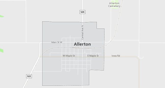
Moving to Allerton, Iowa
The current estimated population of Allerton is 500, with 48% male and 52% female. The population has remained steady, with the town’s rural charm and agricultural economy supporting its small population.
City Facts
- Year founded: 1870
- County: Wayne County
- Land area: 1.1 square miles
- Population density: 455 people per square mile
- Area code: 641
- Zip code: 50008
Geography and Location
Allerton is located in southern Iowa, in Wayne County, near the Missouri border. The town is situated along U.S. Route 65, providing access to nearby cities such as Corydon and Centerville. Allerton is surrounded by farmland, with corn and soybean fields dominating the landscape. The town is part of Iowa’s rolling plains region and experiences a humid continental climate, with cold winters and warm summers.
Demographics
Median resident age: 38.1 years
Median household income: $28,929
Median house value: $28,000
Population by Race
Races in Allerton:
- White Non-Hispanic (98.4%)
- Hispanic (0.9%)
- Two or more races (0.5%)
Ancestries: United States (17.5%), English (13.2%), German (12.2%), Dutch (5.9%), Irish (5.9%), French (3.0%).
Elevation: 1100 feet
Land area: 1.1 square miles

Population by Education
For population 25 years and over in Allerton
- High school or higher: 81.3%
- Bachelor’s degree or higher: 7.0%
- Graduate or professional degree: 2.1%
- Unemployed: 3.5%
- Mean travel time to work: 20.6 minutes
For population 15 years and over in Allerton city
- Never married: 22.3%
- Now married: 54.2%
- Separated: 3.2%
- Widowed: 12.7%
- Divorced: 7.6%
0.4% Foreign born
Population change in the 1990s: -50 (-8.2%).
Hospitals
Hospitals/medical centers near Allerton:
- WAYNE COUNTY HOSPITAL (about 5 miles; CORYDON, IA)
- LUCAS COUNTY HOSPITAL (about 23 miles; CHARITON, IA)
- DECATUR COUNTY HOSPITAL (about 27 miles; LEON, IA)
Airports
Airports certified for carrier operations nearest to Allerton:
- DES MOINES INTL (about 61 miles; DES MOINES, IA; Abbreviation: DSM)
- OTTUMWA INDUSTRIAL (about 71 miles; OTTUMWA, IA; Abbreviation: OTM)
- KIRKSVILLE REGIONAL (about 72 miles; KIRKSVILLE, MO; Abbreviation: IRK)
Other public-use airports nearest to Allerton:
- CORYDON (about 10 miles; CORYDON, IA; Abbreviation: 0E9)
- CHARITON MUNI (about 22 miles; CHARITON, IA; Abbreviation: CNC)
- PRINCETON-KAUFFMAN MEMORIAL (about 25 miles; PRINCETON, MO; Abbreviation: 7MO)
Colleges and Universities
Colleges/universities with over 2000 students nearest to Allerton:
- GRACELAND UNIVERSITY-LAMONI (about 41 miles; LAMONI, IA; Full-time enrollment: 2,026)
- TRUMAN STATE UNIVERSITY (about 66 miles; KIRKSVILLE, MO; Full-time enrollment: 5,922)
- DRAKE UNIVERSITY (about 66 miles; DES MOINES, IA; Full-time enrollment: 4,227)
- INDIAN HILLS COMMUNITY COLLEGE (about 70 miles; OTTUMWA, IA; Full-time enrollment: 2,744)
- DES MOINES COMMUNITY COLLEGE (about 72 miles; ANKENY, IA; Full-time enrollment: 6,959)
- IOWA STATE UNIVERSITY (about 92 miles; AMES, IA; Full-time enrollment: 24,473)
- NORTHWEST MISSOURI STATE UNIVERSITY (about 108 miles; MARYVILLE, MO; Full-time enrollment: 5,620)
Libraries
Library in Allerton:
- ALLERTON PUBLIC LIBRARY (Operating income: $6,418; Location: S CENTRAL. BOX 216; 6,931 books; 42 video materials; 12 serial subscriptions)
