Moving to Allison, Iowa
The current estimated population of Allison is 1,000, with 50% male and 50% female. The population has remained stable, supported by its role as the county seat and small-town charm.
City Facts
- Year founded: 1881
- County: Butler County
- Land area: 1.4 square miles
- Population density: 714 people per square mile
- Area code: 319
- Zip code: 50602
Geography and Location
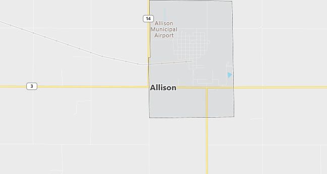
Allison is located in northern Iowa, in Butler County, where it serves as the county seat. The town is situated along State Highway 3 and is surrounded by farmland, with corn and soybeans being the dominant crops. Allison has a close-knit community and provides essential services to the surrounding rural area. The town has a humid continental climate, with cold winters and warm summers, typical of the Midwest.
Demographics
Median resident age: 45.7 years
Median household income: $34,338
Median house value: $53,900
Population by Race
Races in Allison:
- White Non-Hispanic (99.3%)
Ancestries: German (59.7%), Irish (7.3%), Norwegian (6.5%), English (6.4%), Dutch (5.4%), United States (5.3%).
Elevation: 1050 feet
Land area: 2.9 square miles

Population by Education
For population 25 years and over in Allison
- High school or higher: 81.1%
- Bachelor’s degree or higher: 11.2%
- Graduate or professional degree: 2.8%
- Unemployed: 2.8%
- Mean travel time to work: 23.2 minutes
For population 15 years and over in Allison city
- Never married: 13.4%
- Now married: 61.5%
- Separated: 1.2%
- Widowed: 15.4%
- Divorced: 8.4%
0.8% Foreign born
Population change in the 1990s: +59 (+6.2%).
Hospitals
Hospitals/medical centers near Allison:
- WAVERLY MUNICIPAL HOSPITAL (about 24 miles; WAVERLY, IA)
- FLOYD COUNTY MEMORIAL HOSPITAL (about 24 miles; CHARLES CITY, IA)
- GRUNDY COUNTY MEMORIAL HOSPITAL (about 27 miles; GRUNDY CENTER, IA)
Airports
Airports certified for carrier operations nearest to Allison:
- WATERLOO MUNI (about 31 miles; WATERLOO, IA; Abbreviation: ALO)
- MASON CITY MUNI (about 46 miles; MASON CITY, IA; Abbreviation: MCW)
- ROCHESTER INTERNATIONAL (about 82 miles; ROCHESTER, MN; Abbreviation: RST)
Other public-use airports nearest to Allison:
- ALLISON MUNI (about 1 miles; ALLISON, IA; Abbreviation: K98)
- WAVERLY MUNI (about 21 miles; WAVERLY, IA; Abbreviation: C25)
- ACKLEY MUNI (about 23 miles; ACKLEY, IA; Abbreviation: 4C7)
Colleges and Universities
Colleges/universities with over 2000 students nearest to Allison:
- HAWKEYE COMMUNITY COLLEGE (about 36 miles; WATERLOO, IA; Full-time enrollment: 3,292)
- UNIVERSITY OF NORTHERN IOWA (about 39 miles; CEDAR FALLS, IA; Full-time enrollment: 12,524)
- NORTH IOWA AREA COMMUNITY COLLEGE (about 40 miles; MASON CITY, IA; Full-time enrollment: 2,161)
- IOWA STATE UNIVERSITY (about 68 miles; AMES, IA; Full-time enrollment: 24,473)
- NORTHEAST IOWA COMMUNITY COLLEGE-CALMAR (about 70 miles; CALMAR, IA; Full-time enrollment: 2,393)
- UPPER IOWA UNIVERSITY (about 70 miles; FAYETTE, IA; Full-time enrollment: 3,173)
- KIRKWOOD COMMUNITY COLLEGE (about 78 miles; CEDAR RAPIDS, IA; Full-time enrollment: 7,991)
Public primary/middle schools in Allison:
- ALLISON-BRISTOW HIGH/MIDDLE SCHOOL (Students: 192; Location: 513 BIRCH; Grades: 06 – 12)
- ALLISON ELEMENTARY WING HIGH SCHOOL BUILDING (Students: 137; Location: 513 BIRCH; Grades: KG – 05)
Libraries
Library in Allison:
- ALLISON PUBLIC LIBRARY (Operating income: $36,092; Location: 410 N MAIN, PO BOX 605; 13,758 books; 201 audio materials; 418 video materials; 88 serial subscriptions)
