Moving to Alto, Georgia
The current estimated population of Alto is 1,150, with 50% male and 50% female. The population has grown moderately due to suburban expansion and its proximity to nearby cities.
City Facts
- Year founded: 1890
- County: Banks and Habersham Counties
- Land area: 3.0 square miles
- Population density: 383 people per square mile
- Area code: 706
- Zip code: 30510
Geography and Location
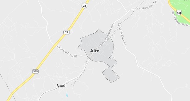
Alto is located in northeastern Georgia, spanning Banks and Habersham Counties. The town is situated in the foothills of the Appalachian Mountains, providing beautiful views and outdoor recreation opportunities. Alto is located near U.S. Route 23 and is close to larger cities like Gainesville and Cornelia. The area has a humid subtropical climate, with hot summers and mild winters.
Demographics
Median resident age: 29.9 years
Median household income: $30,750
Median house value: $76,900
Population by Race
Races in Alto:
- White Non-Hispanic (68.5%)
- Hispanic (20.1%)
- Other race (9.0%)
- Other Asian (4.8%)
- Black (3.1%)
- Two or more races (2.4%)
- Vietnamese (1.1%)
(Total can be greater than 100% because Hispanics could be counted in other races)
Ancestries: United States (14.6%), Irish (7.1%), English (6.6%), German (3.2%), Scottish (1.4%).
Elevation: 1394 feet
Land area: 0.8 square miles

Population by Education
For population 25 years and over in Alto
- High school or higher: 52.2%
- Bachelor’s degree or higher: 7.2%
- Graduate or professional degree: 2.0%
- Unemployed: 3.6%
- Mean travel time to work: 24.2 minutes
For population 15 years and over in Alto town
- Never married: 23.2%
- Now married: 55.6%
- Separated: 4.8%
- Widowed: 3.0%
- Divorced: 13.4%
25.8% Foreign born (19.3% Latin America, 6.3% Asia).
Population change in the 1990s: +222 (+33.9%).
Hospitals
Hospitals/medical centers near Alto:
- HABERSHAM COUNTY MEDICAL CENTER (about 8 miles; DEMOREST, GA)
- STEPHENS COUNTY HOSPITAL (about 19 miles; TOCCOA, GA)
- BANKS-JACKSON-COMMERCE HOSPITAL (about 20 miles; COMMERCE, GA)
Airports
Airports certified for carrier operations nearest to Alto:
- ATHENS/BEN EPPS (about 41 miles; ATHENS, GA; Abbreviation: AHN)
- ANDERSON RGNL (about 61 miles; ANDERSON, SC; Abbreviation: AND)
- DOBBINS AIR RESERVE BASE (about 75 miles; MARIETTA, GA; Abbreviation: MGE)
Other public-use airports nearest to Alto:
- HABERSHAM COUNTY (about 3 miles; CORNELIA, GA; Abbreviation: AJR)
- JACKSON COUNTY (about 21 miles; JEFFERSON, GA; Abbreviation: 19A)
- TOCCOA RG LETOURNEAU FIELD (about 22 miles; TOCCOA, GA; Abbreviation: TOC)
Amtrak station near Alto:
- 19 miles: TOCCOA (47 N. ALEXANDER ST.). Services: enclosed waiting area, public restrooms, public payphones, free short-term parking, free long-term parking, call for taxi service.
Colleges and Universities
Colleges/universities with over 2000 students nearest to Alto:
- GAINESVILLE COLLEGE (about 28 miles; OAKWOOD, GA; Full-time enrollment: 2,181)
- NORTH GEORGIA COLLEGE AND STATE UNIVERSITY (about 29 miles; DAHLONEGA, GA; Full-time enrollment: 3,119)
- UNIVERSITY OF GEORGIA (about 39 miles; ATHENS, GA; Full-time enrollment: 28,464)
- GWINNETT TECHNICAL COLLEGE (about 45 miles; LAWRENCEVILLE, GA; Full-time enrollment: 3,215)
- TRI-COUNTY TECHNICAL COLLEGE (about 58 miles; PENDLETON, SC; Full-time enrollment: 2,343)
- WESTERN CAROLINA UNIVERSITY (about 62 miles; CULLOWHEE, NC; Full-time enrollment: 5,843)
- CLEMSON UNIVERSITY (about 66 miles; CLEMSON, SC; Full-time enrollment: 15,962)
