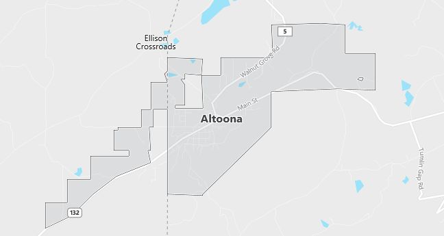
Moving to Altoona, Alabama
The current estimated population of Altoona is 900, with 48% male and 52% female. The population has remained stable, supported by small businesses and its rural setting.
City Facts
- Year founded: 1908
- County: Etowah County
- Land area: 5.5 square miles
- Population density: 164 people per square mile
- Area code: 205
- Zip code: 35952
Geography and Location
Altoona is located in northern Alabama, in Etowah County, near the Appalachian Mountains. The town is situated along U.S. Route 278, providing access to nearby cities like Gadsden and Oneonta. The surrounding landscape is characterized by rolling hills and forests, making it a quiet and peaceful community. Altoona has a humid subtropical climate, with hot summers and mild winters.
Demographics
Median resident age: 38.5 years
Median household income: $20,469
Median house value: $52,900
Population by Race
Races in Altoona:
- White Non-Hispanic (93.9%)
- Black (2.5%)
- Hispanic (2.5%)
- American Indian (1.0%)
- Two or more races (1.0%)
- Other race (0.9%)
Ancestries: United States (36.7%), Irish (8.6%), German (6.2%), English (4.5%), Scottish (1.2%), Dutch (1.1%).
Elevation: 953 feet
Land area: 3.8 square miles

Population by Education
For population 25 years and over in Altoona
- High school or higher: 54.7%
- Bachelor’s degree or higher: 4.7%
- Graduate or professional degree: 1.8%
- Unemployed: 6.3%
- Mean travel time to work: 35.0 minutes
For population 15 years and over in Altoona town
- Never married: 21.7%
- Now married: 51.3%
- Separated: 1.4%
- Widowed: 15.4%
- Divorced: 10.3%
3.4% Foreign born (2.9% Latin America).
Population change in the 1990s: +99 (+11.2%).
Hospitals
Hospitals/medical centers near Altoona:
- MEDICAL CENTER BLOUNT (about 12 miles; ONEONTA, AL)
- MARSHALL MEDICAL CENTER SOUTH (about 16 miles; BOAZ, AL)
- MARSHALL MEDICAL (about 23 miles; GUNTERSVILLE, AL)
Airports
Airports certified for carrier operations nearest to Altoona:
- TALLADEGA MUNI (about 37 miles; TALLADEGA, AL; Abbreviation: ASN)
- BIRMINGHAM INTL (about 45 miles; BIRMINGHAM, AL; Abbreviation: BHM)
- ANNISTON METROPOLITAN (about 45 miles; ANNISTON, AL; Abbreviation: ANB)
Other public-use airports nearest to Altoona:
- ROBBINS FIELD (about 6 miles; ONEONTA, AL; Abbreviation: 20A)
- THE ALBERTVILLE MUNI-THOMAS J BRUMLIK FLD (about 14 miles; ALBERTVILLE, AL; Abbreviation: 8A0)
- GADSDEN MUNI (about 17 miles; GADSDEN, AL; Abbreviation: GAD)
Colleges and Universities
Colleges/universities with over 2000 students nearest to Altoona:
- GEORGE C WALLACE STATE COMMUNITY COLL-HANCEVILLE (about 34 miles; HANCEVILLE, AL; Full-time enrollment: 3,272)
- GADSDEN STATE COMMUNITY COLLEGE (about 36 miles; GADSDEN, AL; Full-time enrollment: 3,360)
- JEFFERSON STATE COMMUNITY COLLEGE (about 38 miles; BIRMINGHAM, AL; Full-time enrollment: 3,279)
- JACKSONVILLE STATE UNIVERSITY (about 41 miles; JACKSONVILLE, AL; Full-time enrollment: 6,418)
- ALABAMA A & M UNIVERSITY (about 51 miles; NORMAL, AL; Full-time enrollment: 4,886)
- SAMFORD UNIVERSITY (about 51 miles; BIRMINGHAM, AL; Full-time enrollment: 4,106)
- UNIVERSITY OF ALABAMA IN HUNTSVILLE (about 54 miles; HUNTSVILLE, AL; Full-time enrollment: 4,795)
Public primary/middle school in Altoona:
- WEST END ELEMENTARY SCHOOL (Students: 440; Location: 6795 HIGHWAY 132; Grades: KG – 06)
