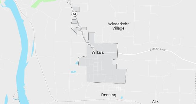
Moving to Altus, Arkansas
The current estimated population of Altus, Arkansas is 758, with 49.4% male and 50.6% female. The town has seen stable population trends, known for its wineries and location in Arkansas’s wine country.
City Facts
- Year founded: 1876
- County: Franklin
- Land area: 2.4 square miles
- Population density: Approximately 316 people per square mile
- Area code: 479
- Zip code: 72821
Geography and Location
Altus, Arkansas is located in Franklin County, in the northwestern part of the state, near the Arkansas River. The town is situated along U.S. Highway 64 and is known for its vineyards and wineries, as it is part of the Arkansas Wine Country region. The area is characterized by rolling hills and scenic views of the Ozark Mountains. Altus is home to several historic wineries, including Wiederkehr and Post Wineries, making it a popular destination for tourists. The town offers a peaceful, rural lifestyle with a strong connection to its agricultural roots.
Demographics
Median resident age: 37.0 years
Median household income: $21,842
Median house value: $49,500
Population by Race
Races in Altus:
- White Non-Hispanic (96.2%)
- Hispanic (2.1%)
- American Indian (0.9%)
- Two or more races (0.6%)
Ancestries: United States (21.8%), Irish (13.1%), German (8.7%), English (6.0%), French (4.7%), Polish (2.1%).
Elevation: 544 feet
Land area: 1.8 square miles

Population by Education
For population 25 years and over in Altus
- High school or higher: 72.0%
- Bachelor’s degree or higher: 13.3%
- Graduate or professional degree: 3.6%
- Unemployed: 5.7%
- Mean travel time to work: 22.8 minutes
For population 15 years and over in Altus city
- Never married: 21.5%
- Now married: 54.3%
- Separated: 3.5%
- Widowed: 10.4%
- Divorced: 10.3%
3.2% Foreign born (2.9% Latin America).
Population change in the 1990s: +383 (+88.2%).
Hospitals
Hospitals/medical centers near Altus:
- MERCY HOSPITAL TURNER MEMORIAL (about 8 miles; OZARK, AR)
- NORTH LOGAN MERCY HOSPITAL (about 12 miles; PARIS, AR)
- JOHNSON REGIONAL MEDICAL CENTER (about 20 miles; CLARKSVILLE, AR)
Airports
Airports certified for carrier operations nearest to Altus:
- FORT SMITH REGIONAL (about 42 miles; FORT SMITH, AR; Abbreviation: FSM)
- DRAKE FIELD (about 47 miles; FAYETTEVILLE, AR; Abbreviation: FYV)
- NORTHWEST ARKANSAS RGNL (about 67 miles; FAYETTEVILLE/SPRINGDALE/, AR; Abbreviation: XNA)
Other public-use airports nearest to Altus:
- OZARK-FRANKLIN COUNTY (about 6 miles; OZARK, AR; Abbreviation: 7M5)
- PARIS MUNI (about 13 miles; PARIS /SUBIACO/, AR; Abbreviation: 7M6)
- BOONEVILLE MUNI (about 23 miles; BOONEVILLE, AR; Abbreviation: 4M2)
Colleges and Universities
Colleges/universities with over 2000 students nearest to Altus:
- WESTARK COLLEGE (about 37 miles; FT SMITH, AR; Full-time enrollment: 3,472)
- ARKANSAS TECH UNIVERSITY (about 46 miles; RUSSELLVILLE, AR; Full-time enrollment: 4,450)
- UNIVERSITY OF ARKANSAS MAIN CAMPUS (about 48 miles; FAYETTEVILLE, AR; Full-time enrollment: 13,324)
- NORTHWEST ARKANSAS COMMUNITY COLLEGE (about 71 miles; BENTONVILLE, AR; Full-time enrollment: 2,197)
- NORTHEASTERN STATE UNIVERSITY (about 90 miles; TAHLEQUAH, OK; Full-time enrollment: 6,610)
- UNIVERSITY OF CENTRAL ARKANSAS (about 101 miles; CONWAY, AR; Full-time enrollment: 7,693)
- HENDERSON STATE UNIVERSITY (about 105 miles; ARKADELPHIA, AR; Full-time enrollment: 3,109)
Schools
Public high school in Altus:
- ALTUS-DENNING HIGH SCHOOL (Students: 106; Location: 18 WEST COLLEGE ST.; Grades: 07 – 12)
Public primary/middle school in Altus:
- ALTUS-DENNING ELEM. SCHOOL (Students: 145; Location: 525 HENDRIX ST.; Grades: KG – 06)
