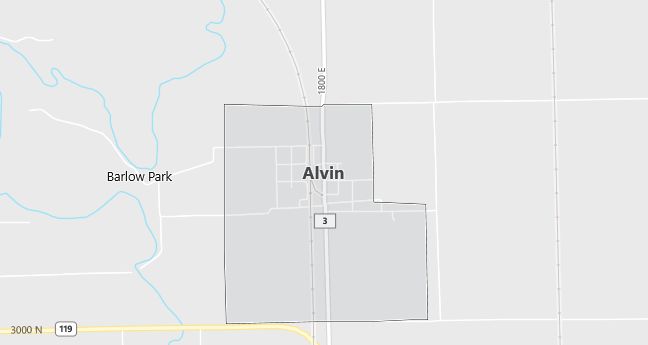
Moving to Alvin, Illinois
The current estimated population of Alvin, Illinois is 317, with 49.5% male and 50.5% female. Alvin has maintained a small, stable population, typical of rural farming communities in central Illinois.
City Facts
- Year founded: 1875
- County: Vermilion
- Land area: 0.5 square miles
- Population density: Approximately 634 people per square mile
- Area code: 217
- Zip code: 61811
Geography and Location
Alvin, Illinois is located in Vermilion County, in the east-central part of the state, about 10 miles north of Danville. The town is surrounded by farmland, with corn and soybean production being important parts of the local economy. Alvin is a quiet, rural community with a strong sense of local history and close-knit residents. Its location near larger towns and cities allows residents to enjoy a peaceful lifestyle while still having access to urban amenities.
Demographics
Median resident age: 30.3 years
Median household income: $36,000
Median house value: $40,800
Population by Race
Races in Alvin:
- White Non-Hispanic (97.2%)
- American Indian (1.9%)
- Hispanic (0.6%)
Ancestries: English (16.1%), German (12.0%), Irish (9.5%), United States (7.3%), French (2.8%), Scotch-Irish (2.8%).
Elevation: 660 feet
Land area: 0.8 square miles

Population by Education
For population 25 years and over in Alvin
- High school or higher: 77.1%
- Bachelor’s degree or higher: 4.7%
- Graduate or professional degree: 0.0%
- Unemployed: 13.2%
- Mean travel time to work: 26.1 minutes
For population 15 years and over in Alvin village
- Never married: 21.2%
- Now married: 60.8%
- Separated: 2.3%
- Widowed: 5.5%
- Divorced: 10.1%
0.0% Foreign born
Population change in the 1990s: -23 (-6.8%).
Hospitals
Hospitals/medical centers near Alvin:
- HOOPESTON COMMUNITY MEMORIAL HOSPITAL (about 12 miles; HOOPESTON, IL)
- UNITED SAMARITANS MED CENTER-LOGAN (about 13 miles; DANVILLE, IL)
- ST VINCENT WILLIAMSPORT HOSPITAL, INC (about 16 miles; WILLIAMSPORT, IN)
Airports
Airports certified for carrier operations nearest to Alvin:
- PURDUE UNIVERSITY (about 47 miles; LAFAYETTE, IN; Abbreviation: LAF)
- UNIVERSITY OF ILLINOIS-WILLARD (about 50 miles; CHAMPAIGN/URBANA, IL; Abbreviation: CMI)
- TERRE HAUTE INTERNATIONAL-HULMAN FIELD (about 63 miles; TERRE HAUTE, IN; Abbreviation: HUF)
Other public-use airports nearest to Alvin:
- VERMILION COUNTY (about 9 miles; DANVILLE, IL; Abbreviation: DNV)
- KENTLAND MUNI (about 34 miles; KENTLAND, IN; Abbreviation: 50I)
- PAXTON (about 37 miles; PAXTON, IL; Abbreviation: 1C1)
Amtrak station near Alvin:
- 14 miles: DANVILLE (MC DONALD’S, GILBERT ST.) – Bus Station. Services: enclosed waiting area, public restrooms, public payphones.
Colleges and Universities
Colleges/universities with over 2000 students nearest to Alvin:
- UNIVERSITY OF ILLINOIS AT URBANA-CHAMPAIGN (about 46 miles; Champaign, IL; Full-time enrollment: 36,284)
- PARKLAND COLLEGE (about 49 miles; CHAMPAIGN, IL; Full-time enrollment: 5,186)
- PURDUE UNIVERSITY-MAIN CAMPUS (about 49 miles; WEST LAFAYETTE, IN; Full-time enrollment: 36,407)
- INDIANA STATE UNIVERSITY (about 60 miles; TERRE HAUTE, IN; Full-time enrollment: 9,597)
- OLIVET NAZARENE UNIVERSITY (about 62 miles; BOURBONNAIS, IL; Full-time enrollment: 2,207)
- IVY TECH STATE COLLEGE-WABASH VALLEY (about 65 miles; TERRE HAUTE, IN; Full-time enrollment: 2,099)
- DEPAUW UNIVERSITY (about 68 miles; GREENCASTLE, IN; Full-time enrollment: 2,197)
