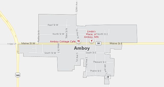
Moving to Amboy, Minnesota
The current estimated population of Amboy, Minnesota is 525, with 50.2% male and 49.8% female. The town has seen little population change over the years, serving as a small, rural community in southern Minnesota.
City Facts
- Year founded: 1879
- County: Blue Earth
- Land area: 0.6 square miles
- Population density: Approximately 875 people per square mile
- Area code: 507
- Zip code: 56010
Geography and Location
Amboy, Minnesota is located in Blue Earth County, in southern Minnesota, about 25 miles southwest of Mankato. The town is surrounded by farmland, with corn and soybean production being central to the local economy. Amboy offers a small-town atmosphere, with a quiet, rural lifestyle and a strong sense of community. Its location near State Highway 169 makes it accessible to larger cities in the region, while the town itself retains its peaceful, agricultural character. The surrounding natural beauty includes parks, lakes, and rivers, offering opportunities for outdoor recreation.
Demographics
Median resident age: 40.1 years
Median household income: $35,595
Median house value: $60,100
Population by Race
Races in Amboy:
- White Non-Hispanic (97.0%)
- Hispanic (1.4%)
- Two or more races (1.4%)
Ancestries: German (59.8%), Norwegian (12.3%), English (9.6%), Dutch (6.1%), French (5.7%), Irish (4.9%).
Elevation: 1044 feet
Land area: 0.3 square miles

Population by Education
For population 25 years and over in Amboy
- High school or higher: 84.4%
- Bachelor’s degree or higher: 11.3%
- Graduate or professional degree: 1.3%
- Unemployed: 3.5%
- Mean travel time to work: 20.1 minutes
For population 15 years and over in Amboy city
- Never married: 22.3%
- Now married: 62.6%
- Separated: 0.0%
- Widowed: 8.4%
- Divorced: 6.7%
0.0% Foreign born
Population change in the 1990s: +1 (+0.2%).
Hospitals
Hospitals/medical centers near Amboy:
- IMMANUEL-ST JOSEPHS-MAYO HEALTH SYSTEN (about 14 miles; MANKATO, MN)
- UNITED HOSPITAL DISTRICT (about 19 miles; BLUE EARTH, MN)
- MADELIA COMMUNITY HOSPITAL (about 22 miles; MADELIA, MN)
Airports
Airports certified for carrier operations nearest to Amboy:
- MASON CITY MUNI (about 78 miles; MASON CITY, IA; Abbreviation: MCW)
- FORT DODGE REGIONAL (about 92 miles; FORT DODGE, IA; Abbreviation: FOD)
- MINNEAPOLIS-ST PAUL INTL/WOLD-CHAMBERLAIN/ (about 94 miles; MINNEAPOLIS, MN; Abbreviation: MSP)
Other public-use airports nearest to Amboy:
- BLUE EARTH MUNI (about 22 miles; BLUE EARTH, MN; Abbreviation: SBU)
- FAIRMONT MUNI (about 25 miles; FAIRMONT, MN; Abbreviation: FRM)
- ST JAMES MUNI (about 28 miles; ST JAMES, MN; Abbreviation: JYG)
Colleges and Universities
Colleges/universities with over 2000 students nearest to Amboy:
- MINNESOTA STATE UNVERSITY-MANKATO (about 22 miles; MANKATO, MN; Full-time enrollment: 11,210)
- SOUTH CENTRAL TECHNICAL COLLEGE-MANKATO (about 22 miles; NORTH MANKATO, MN; Full-time enrollment: 2,186)
- GUSTAVUS ADOLPHUS COLLEGE (about 33 miles; ST PETER, MN; Full-time enrollment: 2,355)
- SAINT OLAF COLLEGE (about 80 miles; NORTHFIELD, MN; Full-time enrollment: 2,968)
- NORTH IOWA AREA COMMUNITY COLLEGE (about 84 miles; MASON CITY, IA; Full-time enrollment: 2,161)
- NORMANDALE COMMUNITY COLLEGE (about 88 miles; BLOOMINGTON, MN; Full-time enrollment: 4,636)
- IOWA CENTRAL COMMUNITY COLLEGE (about 96 miles; FT DODGE, IA; Full-time enrollment: 2,807)
Public primary/middle school in Amboy:
- MAPLE RIVER WEST MID. (Students: 157; Location: 211 WEST MAIN ST.; Grades: 06 – 08)
