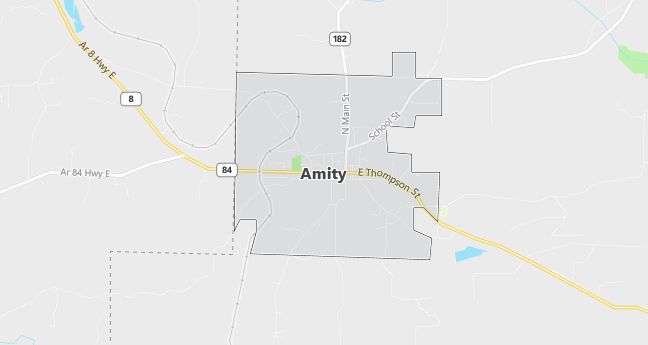
Moving to Amity, Arkansas
The current estimated population of Amity is 720, with 50% male and 50% female. The population has remained stable, supported by agriculture, forestry, and small businesses.
City Facts
- Year founded: 1869
- County: Clark County
- Land area: 1.3 square miles
- Population density: 553 people per square mile
- Area code: 870
- Zip code: 71921
Geography and Location
Amity is located in southwestern Arkansas, in Clark County, near the Ouachita Mountains. The town is surrounded by forests and farmland, and the timber industry plays a significant role in the local economy. Amity is situated near U.S. Highway 70, providing access to nearby cities like Arkadelphia and Hot Springs. The town experiences a humid subtropical climate, with hot summers and mild winters.
Demographics
Median resident age: 33.3 years
Median household income: $25,625
Median house value: $51,100
Population by Race
Races in Amity:
- White Non-Hispanic (95.8%)
- Hispanic (2.5%)
- American Indian (1.0%)
- Black (0.9%)
- Other race (0.9%)
- Two or more races (0.5%)
Ancestries: United States (27.6%), Irish (12.9%), English (7.7%), German (5.8%), Dutch (2.6%), Scotch-Irish (2.6%).
Elevation: 512 feet
Land area: 3.3 square miles

Population by Education
For population 25 years and over in Amity
- High school or higher: 65.9%
- Bachelor’s degree or higher: 8.2%
- Graduate or professional degree: 3.2%
- Unemployed: 4.6%
- Mean travel time to work: 19.6 minutes
For population 15 years and over in Amity city
- Never married: 17.2%
- Now married: 62.1%
- Separated: 1.3%
- Widowed: 10.1%
- Divorced: 9.3%
1.7% Foreign born
Population change in the 1990s: +235 (+44.6%).
Hospitals
Hospitals/medical centers near Amity:
- PIKE COUNTY MEMORIAL HOSPITAL (about 19 miles; MURFREESBORO, AR)
- ADVANCE CARE HOSPITAL (about 30 miles; HOT SPRINGS, AR)
- HOT SPRINGS SURGICAL HOSPITAL (about 30 miles; HOT SPRINGS, AR)
Airports
Airports certified for carrier operations nearest to Amity:
- MEMORIAL FIELD (about 30 miles; HOT SPRINGS, AR; Abbreviation: HOT)
- TEXARKANA REGIONAL-WEBB FIELD (about 67 miles; TEXARKANA, AR; Abbreviation: TXK)
- ADAMS FIELD (about 92 miles; LITTLE ROCK, AR; Abbreviation: LIT)
Other public-use airports nearest to Amity:
- BEARCE (about 18 miles; MOUNT IDA, AR; Abbreviation: 7M3)
- DEXTER B FLORENCE MEMORIAL FIELD (about 32 miles; ARKADELPHIA, AR; Abbreviation: M89)
- GURDON LOWE FIELD (about 32 miles; GURDON, AR; Abbreviation: 5M8)
Colleges and Universities
Colleges/universities with over 2000 students nearest to Amity:
- HENDERSON STATE UNIVERSITY (about 24 miles; ARKADELPHIA, AR; Full-time enrollment: 3,109)
- SOUTHERN ARKANSAS UNIVERSITY MAIN CAMPUS (about 73 miles; MAGNOLIA, AR; Full-time enrollment: 2,646)
- ARKANSAS TECH UNIVERSITY (about 74 miles; RUSSELLVILLE, AR; Full-time enrollment: 4,450)
- WESTARK COLLEGE (about 84 miles; FT SMITH, AR; Full-time enrollment: 3,472)
- UNIVERSITY OF ARKANSAS AT LITTLE ROCK (about 84 miles; LITTLE ROCK, AR; Full-time enrollment: 8,024)
- UNIVERSITY OF CENTRAL ARKANSAS (about 96 miles; CONWAY, AR; Full-time enrollment: 7,693)
- UNIVERSITY OF ARKANSAS AT PINE BLUFF (about 105 miles; PINE BLUFF, AR; Full-time enrollment: 2,801)
Schools
Public high school in Amity:
- CENTERPOINT HIGH SCHOOL (Students: 406; Location: 755 HWY 8 EAST; Grades: 07 – 12)
Public primary/middle school in Amity:
- AMITY ELEMENTARY SCHOOL (Students: 171; Location: 111 SCHOOL STREET; Grades: KG – 06)
