Moving to Andover, Illinois
The current estimated population of Andover, Illinois, is 595, with approximately 48% male and 52% female. The population has remained steady, with minor fluctuations, due to its status as a small, rural community.
City Facts
- Year Founded: 1835
- County Affiliated: Henry County
- Land Area: 1.47 square miles
- Population Density: 405 people per square mile
- Area Code: 309
- Zip Codes: 61233
Geography and Location
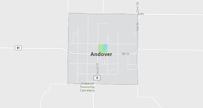
Andover, Illinois, is located in Henry County in the northwestern part of the state. It is part of the Quad Cities region, which includes the cities of Moline and Rock Island in Illinois, and Davenport and Bettendorf in Iowa. The town is surrounded by farmland, with vast fields of corn and soybeans dominating the landscape. Andover is a rural farming community that enjoys a peaceful setting, with gently rolling plains typical of the Midwest. The town experiences a humid continental climate, with cold, snowy winters and hot, humid summers. Andover is well-connected via major highways like Interstate 74 and US Route 150, providing access to larger cities such as Peoria and the Quad Cities. Despite its small size, Andover has a rich history and offers a serene lifestyle, with parks, historic buildings, and open green spaces. The rural nature of the town is balanced by its close proximity to the larger urban centers in the Quad Cities area, making it a quiet but accessible place to live.
Demographics
Median resident age: 39.6 years
Median household income: $46,944
Median house value: $77,500
Population by Race
Races in Andover:
- White Non-Hispanic (97.6%)
- Hispanic (0.8%)
- Filipino (0.5%)
- American Indian (0.5%)
- Two or more races (0.5%)
Ancestries: German (26.8%), Swedish (20.5%), Irish (15.8%), English (10.4%), French (5.2%), United States (3.9%).
Elevation: 776 feet
Land area: 1.0 square miles

Population by Education
For population 25 years and over in Andover
- High school or higher: 86.8%
- Bachelor’s degree or higher: 12.7%
- Graduate or professional degree: 0.8%
- Unemployed: 3.5%
- Mean travel time to work: 33.2 minutes
For population 15 years and over in Andover village
- Never married: 18.1%
- Now married: 69.2%
- Separated: 0.7%
- Widowed: 4.0%
- Divorced: 8.0%
0.8% Foreign born
Population change in the 1990s: +16 (+2.8%).
Hospitals
Hospitals/medical centers near Andover:
- HAMMOND HENRY HOSPITAL (about 15 miles; GENESEO, IL)
- ILLINI HOSPITAL (about 17 miles; SILVIS, IL)
- TRINITY MEDICAL CENTER WEST (about 24 miles; ROCK ISLAND, IL)
Airports
Airports certified for carrier operations nearest to Andover:
- QUAD CITY INTL (about 18 miles; MOLINE, IL; Abbreviation: MLI)
- CLINTON MUNI (about 36 miles; CLINTON, IA; Abbreviation: CWI)
- WHITESIDE CO ARPT-JOS H BITTORF FLD (about 53 miles; STERLING/ROCKFALLS, IL; Abbreviation: SQI)
Other public-use airports nearest to Andover:
- GEN-AIRPARK (about 17 miles; GENESEO, IL; Abbreviation: 3G8)
- QUAD-CITY (about 18 miles; MOLINE, IL; Abbreviation: I04)
- KEWANEE MUNI (about 25 miles; KEWANEE, IL; Abbreviation: EZI)
Amtrak station near Andover:
- 19 miles: MOLINE (QUAD CITY AIRPORT, 2200 69TH ST.) – Bus Station. Services: enclosed waiting area, public restrooms, public payphones, call for taxi service.
Colleges and Universities
Colleges/universities with over 2000 students nearest to Andover:
- BLACK HAWK COLLEGE (about 20 miles; MOLINE, IL; Full-time enrollment: 3,891)
- AUGUSTANA COLLEGE (about 24 miles; ROCK ISLAND, IL; Full-time enrollment: 2,220)
- EASTERN IOWA COMMUNITY COLLEGE DISTRICT (about 26 miles; DAVENPORT, IA; Full-time enrollment: 4,180)
- SAINT AMBROSE UNIVERSITY (about 26 miles; DAVENPORT, IA; Full-time enrollment: 2,310)
- ILLINOIS CENTRAL COLLEGE (about 55 miles; EAST PEORIA, IL; Full-time enrollment: 6,404)
- BRADLEY UNIVERSITY (about 63 miles; PEORIA, IL; Full-time enrollment: 5,262)
- WESTERN ILLINOIS UNIVERSITY (about 64 miles; MACOMB, IL; Full-time enrollment: 11,096)
