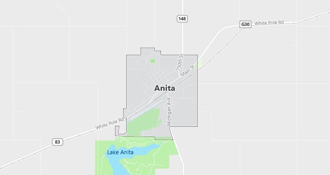
Moving to Anita, Iowa
The current estimated population of Anita is 900, with a gender distribution of 48% male and 52% female. The population has experienced a gradual decline, reflecting the broader trends of rural depopulation in the Midwest.
City Facts
- Year founded: 1872
- County: Cass County
- Land area: 1.1 square miles
- Population density: 818 people per square mile
- Area code: 712
- Zip code: 50020
Geography and Location
Anita is a small town located in southwestern Iowa, within Cass County. The town is situated along the East Nishnabotna River, and it benefits from its proximity to Lake Anita State Park, which provides recreational opportunities like fishing, camping, and hiking. Anita is located approximately 70 miles west of Des Moines and 20 miles east of Atlantic, making it accessible to larger cities while maintaining a quiet, rural character. The region surrounding Anita is characterized by rolling farmland, typical of Iowa’s agricultural landscape, with corn and soybean fields dominating the area. The town experiences a humid continental climate, with hot summers and cold, snowy winters. U.S. Highway 6 runs through Anita, providing a link to neighboring communities. Although small, Anita is known for its friendly, close-knit community and the annual community events that highlight its rural heritage.
Demographics
Median resident age: 43.8 years
Median household income: $28,984
Median house value: $44,800
Population by Race
Races in Anita:
- White Non-Hispanic (98.8%)
- American Indian (0.7%)
Ancestries: German (36.7%), Danish (13.5%), English (11.3%), Irish (9.3%), United States (5.8%), Norwegian (4.8%).
Elevation: 1260 feet
Land area: 1.7 square miles

Population by Education
For population 25 years and over in Anita
- High school or higher: 84.0%
- Bachelor’s degree or higher: 9.3%
- Graduate or professional degree: 2.3%
- Unemployed: 4.3%
- Mean travel time to work: 19.0 minutes
For population 15 years and over in Anita city
- Never married: 20.4%
- Now married: 55.7%
- Separated: 1.7%
- Widowed: 13.9%
- Divorced: 8.3%
0.8% Foreign born
Population change in the 1990s: -38 (-3.5%).
Hospitals
Hospitals/medical centers near Anita:
- CASS COUNTY MEMORIAL HOSPITAL (about 17 miles; ATLANTIC, IA)
- AUDUBON COUNTY MEMORIAL HOSPITAL (about 24 miles; AUDUBON, IA)
- GUTHRIE COUNTY HOSPITAL (about 24 miles; GUTHRIE CENTER, IA)
Airports
Airports certified for carrier operations nearest to Anita:
- DES MOINES INTL (about 78 miles; DES MOINES, IA; Abbreviation: DSM)
- EPPLEY AIRFIELD (about 78 miles; OMAHA, NE; Abbreviation: OMA)
- FORT DODGE REGIONAL (about 86 miles; FORT DODGE, IA; Abbreviation: FOD)
Other public-use airports nearest to Anita:
- ANITA MUNI-KEVIN BURKE MEMORIAL FIELD (about 1 miles; ANITA, IA; Abbreviation: Y43)
- ATLANTIC MUNI (about 19 miles; ATLANTIC, IA; Abbreviation: AIO)
- AUDUBON COUNTY (about 21 miles; AUDUBON, IA; Abbreviation: ADU)
Colleges and Universities
Colleges/universities with over 2000 students nearest to Anita:
- IOWA WESTERN COMMUNITY COLLEGE (about 73 miles; COUNCIL BLUFFS, IA; Full-time enrollment: 2,840)
- DRAKE UNIVERSITY (about 76 miles; DES MOINES, IA; Full-time enrollment: 4,227)
- NORTHWEST MISSOURI STATE UNIVERSITY (about 77 miles; MARYVILLE, MO; Full-time enrollment: 5,620)
- GRACELAND UNIVERSITY-LAMONI (about 80 miles; LAMONI, IA; Full-time enrollment: 2,026)
- BELLEVUE UNIVERSITY (about 82 miles; BELLEVUE, NE; Full-time enrollment: 2,723)
- DES MOINES COMMUNITY COLLEGE (about 83 miles; ANKENY, IA; Full-time enrollment: 6,959)
- IOWA CENTRAL COMMUNITY COLLEGE (about 83 miles; FT DODGE, IA; Full-time enrollment: 2,807)
Schools
Public high school in Anita:
- CAM HIGH SCHOOL (Students: 165; Location: 1000 VICTORY PARK RD; Grades: 09 – 12)
Public primary/middle school in Anita:
- ANITA ELEMENTARY SCHOOL (Students: 117; Location: 709 MCINTYRE DR; Grades: KG – 05)
Libraries
Library in Anita:
- ANITA PUBLIC LIBRARY (Operating income: $46,705; Location: 812 THIRD ST.; 10,711 books; 311 audio materials; 286 video materials; 59 serial subscriptions)
