Moving to Anthon, Iowa
The current estimated population of Anthon, Iowa, is 525, with approximately 49% male and 51% female. The population has remained stable, reflecting the town’s small size and agricultural roots.
City Facts
- Year Founded: 1888
- County Affiliated: Woodbury County
- Land Area: 0.6 square miles
- Population Density: 875 people per square mile
- Area Code: 712
- Zip Codes: 51004
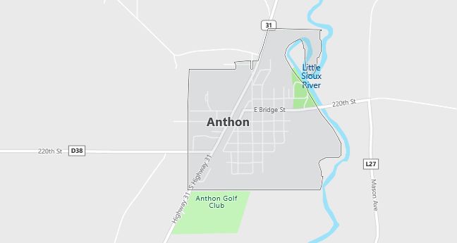
Geography and Location
Anthon, Iowa, is a small rural town located in northwestern Iowa, within Woodbury County. It is situated about 30 miles southeast of Sioux City, making it part of the Sioux City metropolitan area. The town experiences a humid continental climate, with cold winters and warm summers, typical of the Midwest. The surrounding geography is dominated by flat to gently rolling farmland, which is used primarily for growing corn and soybeans, as well as raising livestock. Anthon’s location along U.S. Route 141 makes it a convenient stop for travelers passing through the region, while also providing access to nearby towns and services. The town’s agricultural economy and close-knit community make it a peaceful place to live, with local schools, parks, and churches serving as community hubs. Anthon’s rural charm and strong connection to farming define its character, while the nearby Loess Hills provide scenic beauty and outdoor recreational opportunities.
Demographics
Median resident age: 42.5 years
Median household income: $26,364
Median house value: $49,000
Population by Race
Races in Anthon:
- White Non-Hispanic (98.2%)
- Hispanic (1.7%)
Ancestries: German (40.4%), Irish (20.6%), United States (6.9%), English (6.5%), Norwegian (4.6%), Swedish (4.2%).
Land area: 0.7 square miles
Population by Education
For population 25 years and over in Anthon
- High school or higher: 78.3%
- Bachelor’s degree or higher: 13.8%
- Graduate or professional degree: 5.6%
- Unemployed: 3.1%
- Mean travel time to work: 28.4 minutes
For population 15 years and over in Anthon city
- Never married: 23.1%
- Now married: 52.9%
- Separated: 1.4%
- Widowed: 12.2%
- Divorced: 10.4%
0.8% Foreign born
Population change in the 1990s: +23 (+3.7%).
Hospitals
Hospitals/medical centers near Anthon:
- HORN MEMORIAL HOSPITAL (about 28 miles; IDA GROVE, IA)
- BURGESS HEALTH CENTER (about 31 miles; ONAWA, IA)
- MENTAL HEALTH INSTITUTE (about 34 miles; CHEROKEE, IA)
Airports
Airports certified for carrier operations nearest to Anthon:
- SIOUX GATEWAY/COL. BUD DAY FIELD (about 36 miles; SIOUX CITY, IA; Abbreviation: SUX)
- EPPLEY AIRFIELD (about 75 miles; OMAHA, NE; Abbreviation: OMA)
- JOE FOSS FIELD (about 101 miles; SIOUX FALLS, SD; Abbreviation: FSD)
Other public-use airports nearest to Anthon:
- JAMES G. WHITING MEML FIELD (about 17 miles; MAPLETON, IA; Abbreviation: MEY)
- IDA GROVE MUNI (about 31 miles; IDA GROVE, IA; Abbreviation: IDG)
- ONAWA MUNI (about 32 miles; ONAWA, IA; Abbreviation: K36)
Colleges and Universities
Colleges/universities with over 2000 students nearest to Anthon:
- WESTERN IOWA TECH COMMUNITY COLLEGE (about 32 miles; SIOUX CITY, IA; Full-time enrollment: 2,639)
- BUENA VISTA UNIVERSITY (about 51 miles; STORM LAKE, IA; Full-time enrollment: 2,524)
- METROPOLITAN COMMUNITY COLLEGE AREA (about 76 miles; OMAHA, NE; Full-time enrollment: 6,175)
- IOWA WESTERN COMMUNITY COLLEGE (about 77 miles; COUNCIL BLUFFS, IA; Full-time enrollment: 2,840)
- UNIVERSITY OF NEBRASKA AT OMAHA (about 79 miles; OMAHA, NE; Full-time enrollment: 10,150)
- CREIGHTON UNIVERSITY (about 79 miles; OMAHA, NE; Full-time enrollment: 5,806)
- UNIVERSITY OF NEBRASKA MEDICAL CENTER (about 79 miles; OMAHA, NE; Full-time enrollment: 2,448)
Public primary/middle schools in Anthon:
- ANTHON-OTO-MAPLE VALLEY MIDDLE SCHOOL (Students: 229; Location: 110 W DIVISION; Grades: 06 – 08)
- ANTHON-OTO ELEMENTARY SCHOOL (Students: 112; Location: 110 W DIVISION; Grades: KG – 05)
Libraries
Library in Anthon:
- ANTHON PUBLIC LIBRARY (Operating income: $18,998; Location: 303 E MAIN; 6,408 books; 57 audio materials; 163 video materials; 29 serial subscriptions)