Moving to Antonito, Colorado
The current estimated population of Antonito, Colorado, is 733, with approximately 50% male and 50% female. The population has remained steady, reflecting the town’s small size and connection to its historical and cultural roots.
City Facts
- Year Founded: 1880
- County Affiliated: Conejos County
- Land Area: 0.5 square miles
- Population Density: 1,466 people per square mile
- Area Code: 719
- Zip Codes: 81120
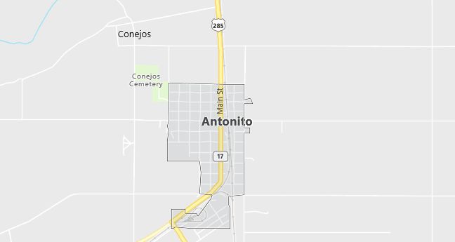
Geography and Location
Antonito, Colorado, is a small town located in the southern part of the state, within Conejos County, near the New Mexico border. It is situated along U.S. Highway 285, about 28 miles south of Alamosa. Antonito experiences a semi-arid climate, with cold winters and warm summers, typical of the high desert regions of the southwestern United States. The town lies at an elevation of about 7,800 feet, offering stunning views of the surrounding San Luis Valley and nearby mountains. Antonito is known for its connection to the historic Cumbres & Toltec Scenic Railroad, a narrow-gauge railway that runs between Colorado and New Mexico, drawing tourists interested in the region’s railroad heritage. The landscape around Antonito is a mix of open plains, sagebrush, and high desert terrain, with the San Juan Mountains to the west and the Sangre de Cristo Mountains to the east. Antonito’s location makes it a gateway for outdoor activities such as hiking, camping, and exploring the nearby Rio Grande National Forest.
Demographics
Median resident age: 36.5 years
Median household income: $19,205
Median house value: $50,500
Population by Race
Races in Antonito:
- Hispanic (90.3%)
- Other race (32.0%)
- White Non-Hispanic (7.3%)
- American Indian (4.1%)
- Two or more races (2.7%)
(Total can be greater than 100% because Hispanics could be counted in other races)
Ancestries: United States (4.4%), German (2.3%), French (2.1%), Irish (1.1%).
Elevation: 7882 feet
Land area: 0.4 square miles
Population by Education
For population 25 years and over in Antonito
- High school or higher: 65.2%
- Bachelor’s degree or higher: 10.4%
- Graduate or professional degree: 3.0%
- Unemployed: 8.4%
- Mean travel time to work: 24.2 minutes
For population 15 years and over in Antonito town
- Never married: 29.8%
- Now married: 41.9%
- Separated: 0.6%
- Widowed: 11.5%
- Divorced: 16.2%
3.4% Foreign born (3.4% Latin America).
Population change in the 1990s: -25 (-2.8%).
Hospitals
Hospitals/medical centers near Antonito:
- CONEJOS COUNTY HOSPITAL – CAH (about 14 miles; LA JARA, CO)
- SAN LUIS VALLEY REGIONAL MED CTR (about 30 miles; ALAMOSA, CO)
- RIO GRANDE HOSPITAL – CAH (about 53 miles; DEL NORTE, CO)
Airports
Airports certified for carrier operations nearest to Antonito:
- SAN LUIS VALLEY REGIONAL/BERGMAN FIELD (about 27 miles; ALAMOSA, CO; Abbreviation: ALS)
- GUNNISON-CRESTED BUTTE REGIONAL (about 119 miles; GUNNISON, CO; Abbreviation: GUC)
- DURANGO-LA PLATA COUNTY (about 121 miles; DURANGO, CO; Abbreviation: DRO)
Other public-use airports nearest to Antonito:
- MONTE VISTA MUNI (about 31 miles; MONTE VISTA, CO; Abbreviation: MVI)
- QUESTA MUNI NR 2 (about 36 miles; QUESTA, NM; Abbreviation: N24)
- BLANCA (about 39 miles; BLANCA, CO; Abbreviation: 05V)
Colleges and Universities
Colleges/universities with over 2000 students nearest to Antonito:
- ADAMS STATE COLLEGE (about 29 miles; ALAMOSA, CO; Full-time enrollment: 4,147)
- NEW MEXICO HIGHLANDS UNIVERSITY (about 121 miles; LAS VEGAS, NM; Full-time enrollment: 2,278)
- PUEBLO COMMUNITY COLLEGE (about 123 miles; PUEBLO, CO; Full-time enrollment: 2,587)
- FORT LEWIS COLLEGE (about 129 miles; DURANGO, CO; Full-time enrollment: 4,051)
- WESTERN STATE COLLEGE COLORADO (about 129 miles; GUNNISON, CO; Full-time enrollment: 2,199)
- UNIVERSITY OF SOUTHERN COLORADO (about 130 miles; PUEBLO, CO; Full-time enrollment: 4,275)
- UNIVERSITY OF PHOENIX-ALBUQUERQUE NM CAMPUS (about 138 miles; ALBUQUERQUE, NM; Full-time enrollment: 3,261)
Schools
Public high school in Antonito:
- ANTONITO HIGH SCHOOL (Students: 115; Location: 620 PINE STREET; Grades: 09 – 12)
Public primary/middle schools in Antonito:
- GUADALUPE ELEMENTARY SCHOOL (Students: 158; Location: 900 WEST 8TH STREET; Grades: PK – 06)
- ANTONITO JUNIOR HIGH SCHOOL (Students: 48; Location: 620 PINE STREET; Grades: 07 – 08)