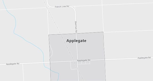
Moving to Applegate, Michigan
The current estimated population of Applegate is 250, with a gender distribution of 48% male and 52% female. The population has remained stable, reflecting the town’s rural character and its role as a small farming community in Michigan.
City Facts
- Year founded: 1856
- County: Sanilac County
- Land area: 0.7 square miles
- Population density: 357 people per square mile
- Area code: 810
- Zip code: 48401
Geography and Location
Applegate is a small village located in Sanilac County, in Michigan’s Thumb region. The village is situated about 10 miles inland from the shores of Lake Huron and is surrounded by farmland. The area is primarily rural, with agriculture playing a central role in the local economy, particularly dairy farming, grain crops, and livestock. Applegate experiences a humid continental climate, with cold winters and warm summers, similar to the rest of Michigan’s Great Lakes region. The village is accessible via M-25, a state highway that runs along Lake Huron’s shoreline, connecting Applegate to nearby towns such as Lexington and Sandusky. Despite its small size, Applegate serves as a local hub for the surrounding farming community, with local businesses and services supporting agricultural activities. The village’s rural charm and proximity to Lake Huron make it an appealing place for those seeking a quiet, small-town lifestyle in a scenic natural environment.
Demographics
Median resident age: 30.9 years
Median household income: $32,188
Median house value: $65,000
Population by Race
Races in Applegate:
- White Non-Hispanic (92.0%)
- Hispanic (7.0%)
- Other race (2.1%)
- Two or more races (1.4%)
- American Indian (1.0%)
(Total can be greater than 100% because Hispanics could be counted in other races)
Ancestries: German (17.4%), Irish (14.3%), English (9.1%), Dutch (7.3%), United States (5.9%), Polish (5.6%).
Elevation: 740 feet
Land area: 1.0 square miles

Population by Education
For population 25 years and over in Applegate
- High school or higher: 66.1%
- Bachelor’s degree or higher: 3.5%
- Graduate or professional degree: 1.2%
- Unemployed: 1.8%
- Mean travel time to work: 36.8 minutes
For population 15 years and over in Applegate village
- Never married: 22.0%
- Now married: 56.9%
- Separated: 0.5%
- Widowed: 8.1%
- Divorced: 12.4%
3.5% Foreign born (2.8% North America, 0.7% Latin America).
Population change in the 1990s: -14 (-4.7%).
Hospitals
Hospitals/medical centers near Applegate:
- DECKERVILLE COMMUNITY HOSPITAL (about 13 miles; DECKERVILLE, MI)
- MCKENZIE MEMORIAL HOSPITAL (about 15 miles; SANDUSKY, MI)
- MARLETTE COMMUNITY HOSPITAL (about 28 miles; MARLETTE, MI)
Airports
Airports certified for carrier operations nearest to Applegate:
- DETROIT CITY (about 71 miles; DETROIT, MI; Abbreviation: DET)
- OAKLAND COUNTY INTERNATIONAL (about 73 miles; PONTIAC, MI; Abbreviation: PTK)
- BISHOP INTERNATIONAL (about 81 miles; FLINT, MI; Abbreviation: FNT)
Other public-use airports nearest to Applegate:
- ARNOLD FIELD (about 6 miles; CROSWELL, MI; Abbreviation: 55G)
- COWLEY FIELD (about 12 miles; SANDUSKY, MI; Abbreviation: 96G)
- PARA FIELD (about 14 miles; YALE, MI; Abbreviation: 4Y8)
Colleges and Universities
Colleges/universities with over 2000 students nearest to Applegate:
- ST CLAIR COUNTY COMMUNITY COLLEGE (about 37 miles; PORT HURON, MI; Full-time enrollment: 2,287)
- OAKLAND UNIVERSITY (about 61 miles; ROCHESTER HILLS, MI; Full-time enrollment: 11,424)
- MACOMB COMMUNITY COLLEGE (about 63 miles; WARREN, MI; Full-time enrollment: 11,057)
- UNIVERSITY OF PHOENIX-DETROIT CAMPUS (about 63 miles; TROY, MI; Full-time enrollment: 2,090)
- OAKLAND COMMUNITY COLLEGE-BLOOMFIELD HILLS CAMPUS (about 67 miles; BLOOMFIELD HILLS, MI; Full-time enrollment: 11,634)
- MARYGROVE COLLEGE (about 73 miles; DETROIT, MI; Full-time enrollment: 5,301)
- UNIVERSITY OF DETROIT MERCY (about 73 miles; DETROIT, MI; Full-time enrollment: 4,119)
