Moving to Arapahoe, Wyoming
The current estimated population of Arapahoe, Wyoming, is 1,656, with approximately 48% male and 52% female. The population has remained relatively stable over the years, with some fluctuations due to the town’s location on the Wind River Indian Reservation.
City Facts
- Year Founded: Late 1800s
- County Affiliated: Fremont County
- Land Area: 22.1 square miles
- Population Density: 75 people per square mile
- Area Code: 307
- Zip Codes: 82510
Geography and Location
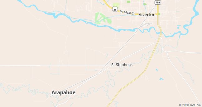
Arapahoe, Wyoming, is located in central Wyoming, within Fremont County, and is part of the Wind River Indian Reservation. The town is situated near the Wind River and is surrounded by the rugged beauty of Wyoming’s high plains and mountain ranges. Arapahoe experiences a semi-arid climate, with cold winters and warm summers, typical of the interior West. The surrounding geography includes open plains, sagebrush, and nearby mountains, such as the Wind River Range, which offers outdoor recreational opportunities like hiking, fishing, and camping. The town is home to members of the Eastern Shoshone and Northern Arapaho tribes, and the local culture is deeply influenced by Native American traditions. Arapahoe is located about 8 miles south of Riverton, which serves as the nearest major city for shopping, healthcare, and other services. The town’s connection to the Wind River Reservation and its natural beauty make it a culturally rich and scenic place to live.
Demographics
Median resident age: 22.9 years
Median household income: $22,679
Median house value: $46,100
Population by Race
Races in Arapahoe:
- American Indian (81.0%)
- White Non-Hispanic (17.8%)
- Hispanic (5.2%)
- Two or more races (0.7%)
- Other race (0.5%)
(Total can be greater than 100% because Hispanics could be counted in other races)
Ancestries: German (4.8%), Irish (2.4%), English (1.8%).
Land area: 31.4 square miles

Population by Education
For population 25 years and over in Arapahoe
- High school or higher: 76.0%
- Bachelor’s degree or higher: 4.5%
- Graduate or professional degree: 2.7%
- Unemployed: 30.0%
- Mean travel time to work: 20.9 minutes
For population 15 years and over in Arapahoe CDP
- Never married: 41.2%
- Now married: 36.3%
- Separated: 1.9%
- Widowed: 6.1%
- Divorced: 14.4%
0.3% Foreign born
Hospitals
Hospitals/medical centers near Arapahoe:
- RIVERTON MEMORIAL HOSPITAL (about 8 miles; RIVERTON, WY)
- LANDER VALLEY MEDICAL CENTER (about 22 miles; LANDER, WY)
- HOT SPRINGS COUNTY MEMORIAL HOSPITAL (about 50 miles; THERMOPOLIS, WY)
Airports
Airports certified for carrier operations nearest to Arapahoe:
- RIVERTON REGIONAL (about 5 miles; RIVERTON, WY; Abbreviation: RIW)
- WORLAND MUNI (about 75 miles; WORLAND, WY; Abbreviation: WRL)
- ROCK SPRINGS-SWEETWATER COUNTY (about 105 miles; ROCK SPRINGS, WY; Abbreviation: RKS)
Other public-use airports nearest to Arapahoe:
- HUNT FIELD (about 23 miles; LANDER, WY; Abbreviation: LND)
- SHOSHONI MUNI (about 30 miles; SHOSHONI, WY; Abbreviation: 49U)
- HOT SPRINGS CO-THERMOPOLIS MUNI (about 50 miles; THERMOPOLIS, WY; Abbreviation: THP)
Colleges and Universities
Colleges/universities with over 2000 students nearest to Arapahoe:
- CASPER COLLEGE (about 149 miles; CASPER, WY; Full-time enrollment: 2,564)
- MONTANA STATE UNIVERSITY-BILLINGS (about 190 miles; BILLINGS, MT; Full-time enrollment: 3,105)
- UNIVERSITY OF WYOMING (about 203 miles; LARAMIE, WY; Full-time enrollment: 9,665)
- RICKS COLLEGE (about 232 miles; REXBURG, ID; Full-time enrollment: 8,670)
- MONTANA STATE UNIVERSITY-BOZEMAN (about 249 miles; BOZEMAN, MT; Full-time enrollment: 10,380)
- COLORADO MOUNTAIN COLLEGE (about 251 miles; GLENWOOD SPRINGS, CO; Full-time enrollment: 3,400)
- UTAH STATE UNIVERSITY (about 256 miles; LOGAN, UT; Full-time enrollment: 16,384)
Public primary/middle school in Arapahoe:
- ARAPAHOE ELEMENTARY (Students: 297; Location: 445 WIND RIVER BOTTOM ROAD; Grades: PK – 08)
