Moving to Arbuckle, California
The current estimated population of Arbuckle, California, is 3,060, with approximately 51% male and 49% female. The population has seen moderate growth due to the area’s agricultural industry.
City Facts
- Year Founded: 1866
- County Affiliated: Colusa County
- Land Area: 1.9 square miles
- Population Density: 1,610 people per square mile
- Area Code: 530
- Zip Codes: 95912
Geography and Location
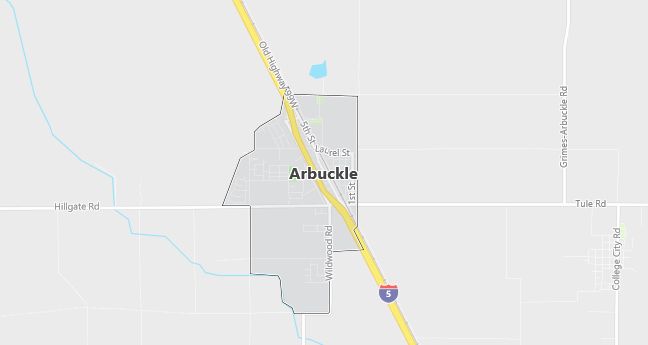
Arbuckle, California, is a small agricultural town located in the northern part of the state, within Colusa County. It is situated in the heart of California’s Sacramento Valley, an area known for its fertile farmland and agricultural production. Arbuckle enjoys a Mediterranean climate, with hot, dry summers and mild, wet winters. The town’s economy is primarily based on farming, with almonds, walnuts, and rice being some of the primary crops grown in the surrounding area. Arbuckle is located along Interstate 5, providing easy access to nearby cities like Sacramento (about 50 miles to the south) and Chico. The flat landscape of the Sacramento Valley is ideal for large-scale farming operations, and the town’s rural charm and proximity to major highways make it a vital agricultural hub in the region. Arbuckle offers a peaceful, small-town atmosphere for residents while maintaining a strong connection to the agricultural industry.
Demographics
Median resident age: 26.5 years
Median household income: $35,463
Median house value: $101,800
Population by Race
Races in Arbuckle:
- Hispanic (70.8%)
- Other race (40.4%)
- White Non-Hispanic (27.0%)
- Two or more races (6.5%)
- American Indian (2.9%)
(Total can be greater than 100% because Hispanics could be counted in other races)
Ancestries: United States (8.7%), German (7.5%), Irish (4.1%), English (1.9%), Scottish (1.5%).
Elevation: 140 feet
Land area: 1.4 square miles

Population by Education
For population 25 years and over in Arbuckle
- High school or higher: 50.2%
- Bachelor’s degree or higher: 8.1%
- Graduate or professional degree: 0.6%
- Unemployed: 16.6%
- Mean travel time to work: 22.7 minutes
For population 15 years and over in Arbuckle CDP
- Never married: 29.9%
- Now married: 56.9%
- Separated: 2.4%
- Widowed: 4.5%
- Divorced: 6.2%
39.9% Foreign born (39.3% Latin America).
Hospitals
Hospitals/medical centers near Arbuckle:
- COLUSA COMMUNITY HOSPITAL (about 17 miles; COLUSA, CA)
- WOODLAND MEMORIAL HOSPITAL (about 29 miles; WOODLAND, CA)
- FREMONT MEDICAL CENTER (about 32 miles; YUBA CITY, CA)
Airports
Airports certified for carrier operations nearest to Arbuckle:
- SACRAMENTO INTERNATIONAL (about 41 miles; SACRAMENTO, CA; Abbreviation: SMF)
- BEALE AFB (about 45 miles; MARYSVILLE, CA; Abbreviation: BAB)
- TRAVIS AFB (about 54 miles; FAIRFIELD, CA; Abbreviation: SUU)
Other public-use airports nearest to Arbuckle:
- COLUSA COUNTY (about 12 miles; COLUSA, CA; Abbreviation: O08)
- WATTS-WOODLAND (about 28 miles; WOODLAND, CA; Abbreviation: O41)
- SUTTER COUNTY (about 33 miles; YUBA CITY, CA; Abbreviation: O52)
Colleges and Universities
Colleges/universities with over 2000 students nearest to Arbuckle:
- YUBA COLLEGE (about 38 miles; MARYSVILLE, CA; Full-time enrollment: 5,593)
- UNIVERSITY OF CALIFORNIA-DAVIS (about 40 miles; DAVIS, CA; Full-time enrollment: 24,405)
- BUTTE COLLEGE (about 50 miles; Oroville, CA; Full-time enrollment: 7,061)
- NAPA VALLEY COLLEGE (about 50 miles; NAPA, CA; Full-time enrollment: 3,558)
- CALIFORNIA STATE UNIVERSITY-CHICO (about 53 miles; CHICO, CA; Full-time enrollment: 14,658)
- SACRAMENTO CITY COLLEGE (about 53 miles; SACRAMENTO, CA; Full-time enrollment: 10,762)
- CALIFORNIA STATE UNIVERSITY-SACRAMENTO (about 53 miles; SACRAMENTO, CA; Full-time enrollment: 20,830)
Schools
Public high schools in Arbuckle:
- PIERCE HIGH (Students: 355; Location: 960 WILDWOOD ROAD; Grades: 09 – 12)
- ARBUCKLE ALTERNATIVE HIGH (CONT.) (Students: 20; Location: 966 WILDWOOD ROAD; Grades: 09 – 12)
Public primary/middle schools in Arbuckle:
- ARBUCKLE ELEMENTARY (Students: 500; Location: 701 HALL ST.; Grades: KG – 05)
- JOHNSON (LLOYD G.) JR. HIGH (Students: 281; Location: 938 WILDWOOD ROAD; Grades: 06 – 08)
