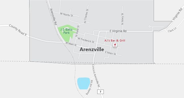
Moving to Arenzville, Illinois
The current estimated population of Arenzville is 400, with a gender distribution of 50% male and 50% female. The population has remained stable, supported by agriculture and its small-town appeal in rural Illinois.
City Facts
- Year founded: 1839
- County: Cass County
- Land area: 0.4 square miles
- Population density: 1,000 people per square mile
- Area code: 217
- Zip code: 62611
Geography and Location
Arenzville is a small village located in Cass County, in west-central Illinois, about 50 miles west of Springfield. The town is surrounded by fertile farmland, typical of the central Illinois landscape, with agriculture playing a central role in the local economy. Arenzville’s rural setting offers a peaceful, close-knit community atmosphere, where farming, particularly corn and soybean production, forms the backbone of daily life. The town experiences a humid continental climate, with hot summers and cold winters. Arenzville is accessible via Illinois Route 125, which connects it to nearby communities. The village hosts several community events, including an annual burgoo festival, highlighting its agricultural roots and sense of tradition. Arenzville’s small size and quiet rural lifestyle make it an ideal place for those seeking a slower pace of life.
Demographics
Median resident age: 40.3 years
Median household income: $37,500
Median house value: $57,400
Population by Race
Races in Arenzville:
- White Non-Hispanic (99.8%)
Ancestries: German (45.6%), United States (10.5%), English (8.8%), Irish (6.2%), French (4.5%), Scottish (4.1%).
Elevation: 513 feet
Land area: 0.8 square miles

Population by Education
For population 25 years and over in Arenzville
- High school or higher: 86.2%
- Bachelor’s degree or higher: 19.9%
- Graduate or professional degree: 6.1%
- Unemployed: 0.0%
- Mean travel time to work: 19.6 minutes
For population 15 years and over in Arenzville village
- Never married: 15.2%
- Now married: 67.5%
- Separated: 0.6%
- Widowed: 10.7%
- Divorced: 6.0%
0.0% Foreign born
Population change in the 1990s: +29 (+7.4%).
Hospitals
Hospitals/medical centers near Arenzville:
- PASSAVANT AREA HOSPITAL (about 15 miles; JACKSONVILLE, IL)
- SARAH D CULBERTSON MEMORIAL HOSPITAL (about 22 miles; RUSHVILLE, IL)
- ILLINI COMMUNITY HOSPITAL (about 35 miles; PITTSFIELD, IL)
Airports
Airports certified for carrier operations nearest to Arenzville:
- CAPITAL (about 49 miles; SPRINGFIELD, IL; Abbreviation: SPI)
- QUINCY REGIONAL-BALDWIN FIELD (about 57 miles; QUINCY, IL; Abbreviation: UIN)
- GREATER PEORIA REGIONAL (about 72 miles; PEORIA, IL; Abbreviation: PIA)
Other public-use airports nearest to Arenzville:
- GREATER BEARDSTOWN (about 7 miles; BEARDSTOWN, IL; Abbreviation: K06)
- JACKSONVILLE MUNI (about 13 miles; JACKSONVILLE, IL; Abbreviation: IJX)
- SCHUY-RUSH (about 23 miles; RUSHVILLE, IL; Abbreviation: 5K4)
Colleges and Universities
Colleges/universities with over 2000 students nearest to Arenzville:
- WESTERN ILLINOIS UNIVERSITY (about 45 miles; MACOMB, IL; Full-time enrollment: 11,096)
- LINCOLN LAND COMMUNITY COLLEGE (about 54 miles; SPRINGFIELD, IL; Full-time enrollment: 3,756)
- UNIVERSITY OF ILLINOIS AT SPRINGFIELD (about 54 miles; Springfield, IL; Full-time enrollment: 2,357)
- LEWIS AND CLARK COMMUNITY COLLEGE (about 65 miles; GODFREY, IL; Full-time enrollment: 3,451)
- LINDENWOOD UNIVERSITY (about 75 miles; ST CHARLES, MO; Full-time enrollment: 5,116)
- ILLINOIS CENTRAL COLLEGE (about 75 miles; EAST PEORIA, IL; Full-time enrollment: 6,404)
- BRADLEY UNIVERSITY (about 77 miles; PEORIA, IL; Full-time enrollment: 5,262)
Private primary/middle school in Arenzville:
- TRINITY LUTHERAN SCHOOL (Students: 55; Location: BOX 118 FREDERICK STREET; Grades: PK – 6)
