Moving to Arlington, Georgia
The current estimated population of Arlington, Georgia, is 1,400, with approximately 48% male and 52% female. The population has remained stable, reflecting the town’s small size and agricultural economy.
City Facts
- Year Founded: 1873
- County Affiliated: Calhoun County
- Land Area: 4.5 square miles
- Population Density: 311 people per square mile
- Area Code: 229
- Zip Codes: 39813
Geography and Location
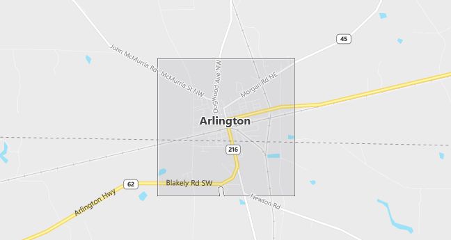
Arlington, Georgia, is a small rural town located in southwestern Georgia, within Calhoun County. The town is situated about 50 miles west of Albany, Georgia, and is surrounded by agricultural land. Arlington experiences a humid subtropical climate, with hot, humid summers and mild winters, typical of the southern U.S. The surrounding geography is characterized by flat farmland, with cotton, peanuts, and corn being the primary crops grown in the area. Arlington’s economy is closely tied to agriculture, with local businesses and schools serving the community. The town is located along U.S. Route 27, providing easy access to nearby cities and towns. Arlington’s small size, rural charm, and strong connection to agriculture make it a quiet, close-knit community in the heart of Georgia’s farming region.
Demographics
Median resident age: 31.4 years
Median household income: $22,311
Median house value: $48,900
Population by Race
Races in Arlington:
- Black (69.9%)
- White Non-Hispanic (28.2%)
- Hispanic (1.4%)
Ancestries: United States (7.6%), English (1.9%), Subsaharan African (1.8%), Irish (1.5%), Scotch-Irish (1.4%).
Elevation: 293 feet
Land area: 4.0 square miles

Population by Education
For population 25 years and over in Arlington
- High school or higher: 63.7%
- Bachelor’s degree or higher: 8.3%
- Graduate or professional degree: 3.4%
- Unemployed: 9.6%
- Mean travel time to work: 28.9 minutes
For population 15 years and over in Arlington city
- Never married: 35.7%
- Now married: 38.6%
- Separated: 7.8%
- Widowed: 9.5%
- Divorced: 8.3%
0.1% Foreign born
Population change in the 1990s: +86 (+5.7%).
Hospitals
Hospital/medical center in Arlington:
- CALHOUN MEMORIAL HOSPITAL (209 ACADEMY AVENUE SE)
Other hospitals/medical centers near Arlington:
- EARLY MEMORIAL HOSPITAL (about 18 miles; BLAKELY, GA)
- MILLER COUNTY HOSPITAL (about 20 miles; COLQUITT, GA)
- SOUTHWEST GEORGIA REGIONAL MEDICAL CTR (about 24 miles; CUTHBERT, GA)
Airports
Airports certified for carrier operations nearest to Arlington:
- SOUTHWEST GEORGIA REGIONAL (about 39 miles; ALBANY, GA; Abbreviation: ABY)
- DOTHAN RGNL (about 50 miles; DOTHAN, AL; Abbreviation: DHN)
- LAWSON AAF (FORT BENNING) (about 64 miles; FORT BENNING(COLUMBUS), GA; Abbreviation: LSF)
Other public-use airports nearest to Arlington:
- EARLY COUNTY (about 12 miles; BLAKELY, GA; Abbreviation: 11J)
- CUTHBERT-RANDOLPH (about 19 miles; CUTHBERT, GA; Abbreviation: 25J)
- DAWSON MUNI (about 30 miles; DAWSON, GA; Abbreviation: 16J)
Colleges and Universities
Colleges/universities with over 2000 students nearest to Arlington:
- ALBANY STATE UNIVERSITY (about 45 miles; ALBANY, GA; Full-time enrollment: 2,996)
- GEORGE C WALLACE STATE COMMUNITY COLLEGE-DOTHAN (about 49 miles; DOTHAN, AL; Full-time enrollment: 2,703)
- COLUMBUS STATE UNIVERSITY (about 73 miles; COLUMBUS, GA; Full-time enrollment: 3,886)
- TALLAHASSEE COMMUNITY COLLEGE (about 74 miles; TALLAHASSEE, FL; Full-time enrollment: 7,016)
- FLORIDA STATE UNIVERSITY (about 75 miles; TALLAHASSEE, FL; Full-time enrollment: 29,949)
- FLORIDA AGRICULTURAL AND MECHANICAL UNIVERSITY (about 76 miles; TALLAHASSEE, FL; Full-time enrollment: 10,991)
- TROY STATE UNIVERSITY-MAIN CAMPUS (about 90 miles; TROY, AL; Full-time enrollment: 9,143)
Public primary/middle schools in Arlington:
- CALHOUN COUNTY ELEMENTARY SCHOOL (Students: 345; Location: 699 MORGAN ROAD, NE; Grades: KG – 05)
- OAK TREE PSYCHOEDUCATIONAL PROGRAM (Location: 699 MORGAN RD. NE; Grades: 00 – 00)
