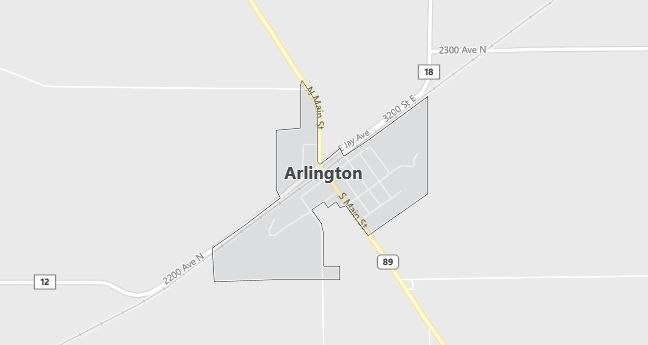
Moving to Arlington, Illinois
The current estimated population of Arlington, Illinois, is 189, with approximately 49% male and 51% female. The population has remained stable, reflecting the town’s small size and rural character.
City Facts
- Year Founded: 1853
- County Affiliated: Bureau County
- Land Area: 0.2 square miles
- Population Density: 945 people per square mile
- Area Code: 815, 779
- Zip Codes: 61312
Geography and Location
Arlington, Illinois, is a small rural village located in north-central Illinois, within Bureau County. The town is situated approximately 80 miles southwest of Chicago, providing access to urban areas while maintaining a peaceful rural atmosphere. Arlington experiences a humid continental climate, with cold winters and warm summers, typical of the Midwest. The surrounding geography consists of flat, fertile farmland, with corn and soybeans being the primary crops grown in the region. The town is located near U.S. Route 34, providing easy access to nearby towns and larger cities such as Princeton and LaSalle. Arlington’s small population, rural charm, and agricultural setting make it a close-knit community ideal for those seeking a quiet lifestyle away from urban centers.
Demographics
Median resident age: 34.5 years
Median household income: $27,292
Median house value: $49,500
Population by Race
Races in Arlington:
- White Non-Hispanic (91.9%)
- Hispanic (6.2%)
- Other race (5.7%)
- Other Asian (0.9%)
- American Indian (0.9%)
(Total can be greater than 100% because Hispanics could be counted in other races)
Ancestries: German (32.2%), Irish (12.3%), Norwegian (10.4%), English (8.5%), Swedish (5.7%), United States (5.2%).
Elevation: 750 feet
Land area: 0.4 square miles

Population by Education
For population 25 years and over in Arlington
- High school or higher: 78.8%
- Bachelor’s degree or higher: 5.1%
- Graduate or professional degree: 0.8%
- Unemployed: 13.1%
- Mean travel time to work: 29.7 minutes
For population 15 years and over in Arlington village
- Never married: 32.9%
- Now married: 53.3%
- Separated: 0.0%
- Widowed: 6.6%
- Divorced: 7.2%
1.9% Foreign born
Population change in the 1990s: +11 (+5.5%).
Hospitals
Hospitals/medical centers near Arlington:
- ST MARGARETS HOSPITAL (about 10 miles; SPRING VALLEY, IL)
- MENDOTA COMMUNITY HOSPITAL (about 11 miles; MENDOTA, IL)
- ILLINOIS VALLEY COMMUNITY HOSPITAL (about 13 miles; PERU, IL)
Airports
Airports certified for carrier operations nearest to Arlington:
- WHITESIDE CO ARPT-JOS H BITTORF FLD (about 35 miles; STERLING/ROCKFALLS, IL; Abbreviation: SQI)
- GREATER ROCKFORD (about 51 miles; ROCKFORD, IL; Abbreviation: RFD)
- GREATER PEORIA REGIONAL (about 65 miles; PEORIA, IL; Abbreviation: PIA)
Other public-use airports nearest to Arlington:
- GRANDPAS’ FARM MENDOTA (about 10 miles; MENDOTA, IL; Abbreviation: 0C7)
- ILLINOIS VALLEY RGNL-WALTER A DUNCAN FIELD (about 11 miles; PERU, IL; Abbreviation: VYS)
- BRESSON (about 22 miles; COMPTON, IL; Abbreviation: C82)
Amtrak stations near Arlington:
- 11 miles: MENDOTA (8TH ST.). Services: enclosed waiting area, public restrooms, public payphones, free short-term parking, free long-term parking.
- 16 miles: PRINCETON (107 BICENTENNIAL DR.). Services: partially wheelchair accessible, enclosed waiting area, public restrooms, public payphones, free short-term parking, free long-term parking, call for car rental service.
Colleges and Universities
Colleges/universities with over 2000 students nearest to Arlington:
- ILLINOIS VALLEY COMMUNITY COLLEGE (about 18 miles; OGLESBY, IL; Full-time enrollment: 2,272)
- KISHWAUKEE COLLEGE (about 41 miles; MALTA, IL; Full-time enrollment: 2,289)
- NORTHERN ILLINOIS UNIVERSITY (about 47 miles; DeKalb, IL; Full-time enrollment: 19,477)
- WAUBONSEE COMMUNITY COLLEGE (about 59 miles; SUGAR GROVE, IL; Full-time enrollment: 3,834)
- BRADLEY UNIVERSITY (about 60 miles; PEORIA, IL; Full-time enrollment: 5,262)
- ROCK VALLEY COLLEGE (about 60 miles; ROCKFORD, IL; Full-time enrollment: 4,200)
- ILLINOIS CENTRAL COLLEGE (about 60 miles; EAST PEORIA, IL; Full-time enrollment: 6,404)
