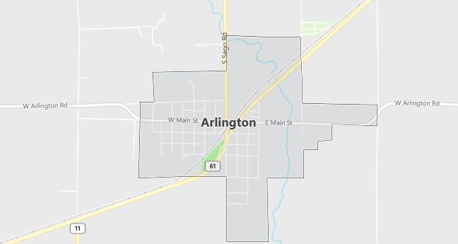
Moving to Arlington, Kansas
The current estimated population of Arlington, Kansas, is 471, with approximately 50% male and 50% female. The population has remained stable, reflecting the town’s small size and rural economy.
City Facts
- Year Founded: 1877
- County Affiliated: Reno County
- Land Area: 0.4 square miles
- Population Density: 1,177 people per square mile
- Area Code: 620
- Zip Codes: 67514
Geography and Location
Arlington, Kansas, is a small town located in south-central Kansas, within Reno County. It is situated about 25 miles west of Hutchinson, the largest nearby city. Arlington experiences a humid continental climate, with hot summers and cold winters. The surrounding geography consists of flat farmland, typical of Kansas’ agricultural landscape, with crops such as wheat, corn, and soybeans being common in the region. The town’s economy is closely tied to agriculture, with local businesses and farms supporting the community. Arlington is located along U.S. Route 61, making it accessible to nearby towns and services. The town’s small size, rural setting, and strong agricultural roots provide residents with a peaceful lifestyle and a tight-knit community atmosphere.
Demographics
Median resident age: 41.3 years
Median household income: $29,453
Median house value: $37,400
Population by Race
Races in Arlington:
- White Non-Hispanic (97.4%)
- Two or more races (1.5%)
- Hispanic (1.3%)
- American Indian (1.3%)
Ancestries: German (29.8%), English (14.8%), Irish (8.3%), United States (6.5%), Dutch (4.4%), French (2.2%).
Elevation: 1610 feet
Land area: 1.2 square miles

Population by Education
For population 25 years and over in Arlington
- High school or higher: 80.6%
- Bachelor’s degree or higher: 7.9%
- Graduate or professional degree: 3.2%
- Unemployed: 1.1%
- Mean travel time to work: 25.3 minutes
For population 15 years and over in Arlington city
- Never married: 12.5%
- Now married: 65.8%
- Separated: 0.6%
- Widowed: 8.4%
- Divorced: 12.8%
0.4% Foreign born
Population change in the 1990s: -4 (-0.9%).
Hospitals
Hospitals/medical centers near Arlington:
- KINGMAN COMMUNITY HOSPITAL (about 20 miles; KINGMAN, KS)
- HUTCHINSON HOSPITAL CORPORATION (about 23 miles; HUTCHINSON, KS)
- STAFFORD DISTRICT HOSPITAL #4 (about 30 miles; STAFFORD, KS)
Airports
Airports certified for carrier operations nearest to Arlington:
- HUTCHINSON MUNI (about 26 miles; HUTCHINSON, KS; Abbreviation: HUT)
- GREAT BEND MUNI (about 56 miles; GREAT BEND, KS; Abbreviation: GBD)
- WICHITA MID-CONTINENT (about 56 miles; WICHITA, KS; Abbreviation: ICT)
Other public-use airports nearest to Arlington:
- KINGMAN AIRPORT – CLYDE CESSNA FIELD (about 17 miles; KINGMAN, KS; Abbreviation: 9K8)
- LYONS-RICE COUNTY MUNI (about 31 miles; LYONS, KS; Abbreviation: LYO)
- STAFFORD MUNI (about 33 miles; STAFFORD, KS; Abbreviation: 3TA)
Colleges and Universities
Colleges/universities with over 2000 students nearest to Arlington:
- HUTCHINSON COMMUNITY COLLEGE (about 21 miles; HUTCHINSON, KS; Full-time enrollment: 2,268)
- WICHITA STATE UNIVERSITY (about 51 miles; WICHITA, KS; Full-time enrollment: 10,403)
- BARTON COUNTY COMMUNITY COLLEGE (about 53 miles; GREAT BEND, KS; Full-time enrollment: 2,268)
- FRIENDS UNIVERSITY (about 59 miles; WICHITA, KS; Full-time enrollment: 2,983)
- BUTLER COUNTY COMMUNITY COLLEGE (about 93 miles; EL DORADO, KS; Full-time enrollment: 4,250)
- COWLEY COUNTY COMMUNITY COLLEGE (about 98 miles; ARKANSAS CITY, KS; Full-time enrollment: 2,392)
- FORT HAYS STATE UNIVERSITY (about 105 miles; HAYS, KS; Full-time enrollment: 4,572)
Public primary/middle school in Arlington:
- FAIRFIELD EAST ELEM (Students: 110; Location: 900 W MAIN; Grades: PK – 05)
Libraries
Library in Arlington:
- ARLINGTON CITY LIBRARY (Operating income: $8,606; Location: 111 W. MAIN BOX 396; 6,178 books; 15 audio materials; 23 video materials; 11 serial subscriptions)
