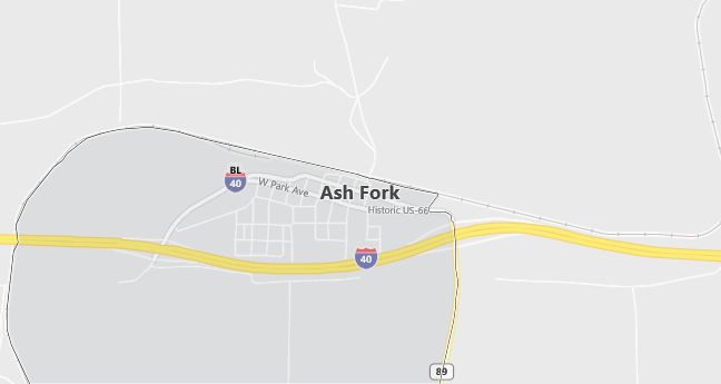
Moving to Ash Fork, Arizona
The current estimated population of Ash Fork is 450, with a gender distribution of 50% male and 50% female. The population has remained relatively stable, supported by tourism and its location along historic Route 66.
City Facts
- Year founded: 1882
- County: Coconino County
- Land area: 2.8 square miles
- Population density: 161 people per square mile
- Area code: 928
- Zip code: 86320
Geography and Location
Ash Fork is located in northern Arizona, within Coconino County, about 50 miles west of Flagstaff. The town is situated along Historic Route 66 and serves as a gateway to the Kaibab National Forest. Ash Fork experiences a semi-arid climate, with hot summers and cold winters. The town’s location along Route 66 has made it a popular stop for travelers, and its economy is primarily based on tourism, small businesses, and services catering to visitors exploring the historic highway. Ash Fork’s proximity to natural attractions such as the Grand Canyon and the Kaibab National Forest makes it a convenient base for outdoor activities and sightseeing in northern Arizona.
Demographics
Median resident age: 33.8 years
Median household income: $30,893
Median house value: $55,300
Population by Race
Races in Ash Fork:
- Hispanic (51.4%)
- White Non-Hispanic (46.8%)
- American Indian (2.2%)
- Other race (1.5%)
- Two or more races (0.9%)
(Total can be greater than 100% because Hispanics could be counted in other races)
Ancestries: German (17.7%), Irish (14.2%), English (10.7%), United States (6.3%), Scottish (3.1%), Norwegian (2.6%).
Elevation: 5137 feet
Land area: 2.3 square miles

Population by Education
For population 25 years and over in Ash Fork
- High school or higher: 58.5%
- Bachelor’s degree or higher: 15.0%
- Graduate or professional degree: 4.2%
- Unemployed: 15.7%
- Mean travel time to work: 24.7 minutes
For population 15 years and over in Ash Fork CDP
- Never married: 28.5%
- Now married: 59.0%
- Separated: 3.8%
- Widowed: 2.2%
- Divorced: 6.5%
37.0% Foreign born (34.4% Latin America).
Hospitals
Hospitals/medical centers near Ash Fork:
- YAVAPAI REGIONAL MEDICAL CENTER (about 44 miles; PRESCOTT, AZ)
- VERDE VALLEY MEDICAL CENTER (about 48 miles; COTTONWOOD, AZ)
- FLAGSTAFF MEDICAL CENTER (about 54 miles; FLAGSTAFF, AZ)
Airports
Airports certified for carrier operations nearest to Ash Fork:
- ERNEST A. LOVE FIELD (about 40 miles; PRESCOTT, AZ; Abbreviation: PRC)
- GRAND CANYON NATIONAL PARK (about 56 miles; GRAND CANYON, AZ; Abbreviation: GCN)
- FLAGSTAFF PULLIAM (about 58 miles; FLAGSTAFF, AZ; Abbreviation: FLG)
Other public-use airports nearest to Ash Fork:
- H.A. CLARK MEMORIAL FIELD (about 22 miles; WILLIAMS, AZ; Abbreviation: P32)
- SELIGMAN (about 29 miles; SELIGMAN, AZ; Abbreviation: P23)
- VALLE (about 39 miles; GRAND CANYON, AZ; Abbreviation: 40G)
Colleges and Universities
Colleges/universities with over 2000 students nearest to Ash Fork:
- NORTHERN ARIZONA UNIVERSITY (about 42 miles; FLAGSTAFF, AZ; Full-time enrollment: 15,758)
- YAVAPAI COLLEGE (about 44 miles; PRESCOTT, AZ; Full-time enrollment: 3,415)
- MOHAVE COMMUNITY COLLEGE (about 102 miles; KINGMAN, AZ; Full-time enrollment: 2,405)
- ARIZONA STATE UNIVERSITY-WEST (about 112 miles; Glendale, AZ; Full-time enrollment: 3,334)
- PARADISE VALLEY COMMUNITY COLLEGE (about 115 miles; PHOENIX, AZ; Full-time enrollment: 3,410)
- GLENDALE COMMUNITY COLLEGE (about 116 miles; GLENDALE, AZ; Full-time enrollment: 9,981)
- DEVRY INSTITUTE OF TECHNOLOGY (about 118 miles; PHOENIX, AZ; Full-time enrollment: 3,165)
Schools
Public high school in Ash Fork:
- ASH FORK HIGH SCHOOL (Students: 49; Location: 46999 N. FIFTH STREET; Grades: 09 – 12)
Public primary/middle schools in Ash Fork:
- ASH FORK ELEMENTARY SCHOOL (Students: 115; Location: 46999 N. FIFTH STREET; Grades: KG – 08)
- ASH FORK MIDDLE SCHOOL (Students: 54; Location: 46999 N. FIFTH STREET; Grades: 06 – 08)
- ACADEMY OF HOPE (Students: 30; Location: 47117 1ST STREET; Grades: 06 – 12)
