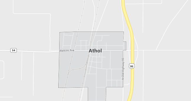
Moving to Athol, Idaho
The current estimated population of Athol is 800, with males making up 50% and females 50%. The town’s population has been growing steadily due to its rural appeal and increasing popularity as a place for outdoor recreation.
City Facts
- Year Founded: 1895
- County Affiliated: Kootenai County
- Land Area: 0.94 square miles
- Population Density: 851 people per square mile
- Area Code: 208
- Zip Codes: 83801
Geography and Location
Athol is located in northern Idaho, about 25 miles north of Coeur d’Alene and 45 miles south of Sandpoint. The town is nestled in a heavily forested area, with proximity to the Coeur d’Alene National Forest and several nearby lakes, including Lake Pend Oreille and Spirit Lake. This location makes Athol a popular destination for outdoor enthusiasts, offering activities such as hiking, fishing, boating, and camping. The town experiences a humid continental climate, with cold, snowy winters and warm, dry summers, making it ideal for year-round outdoor activities. Athol’s economy is primarily supported by tourism, outdoor recreation, and small businesses that serve both the local population and visitors. The town’s rural charm, combined with its access to natural beauty and outdoor adventure, has made it increasingly popular for those seeking a peaceful, nature-focused lifestyle while remaining relatively close to larger urban centers like Coeur d’Alene and Spokane, Washington.
Demographics
Median resident age: 34.3 years
Median household income: $30,595
Median house value: $87,900
Population by Race
Races in Athol:
- White Non-Hispanic (94.1%)
- American Indian (4.1%)
- Hispanic (2.1%)
- Two or more races (2.1%)
Ancestries: German (24.0%), Irish (16.7%), English (16.6%), Norwegian (6.1%), United States (4.6%), Dutch (3.7%).
Elevation: 2391 feet
Land area: 0.8 square miles

Population by Education
For population 25 years and over in Athol
- High school or higher: 79.9%
- Bachelor’s degree or higher: 6.5%
- Graduate or professional degree: 0.8%
- Unemployed: 5.7%
- Mean travel time to work: 29.5 minutes
For population 15 years and over in Athol city
- Never married: 20.3%
- Now married: 61.2%
- Separated: 1.7%
- Widowed: 2.3%
- Divorced: 14.5%
0.3% Foreign born
Population change in the 1990s: +334 (+97.7%).
Hospitals
Hospitals/medical centers near Athol:
- KOOTENAI MEDICAL CENTER (about 20 miles; COEUR D’ALENE, ID)
- BONNER GENERAL HOSPITAL (about 31 miles; SANDPOINT, ID)
- NEWPORT COMMUNITY HOSPITAL (about 36 miles; NEWPORT, WA)
Airports
Airports certified for carrier operations nearest to Athol:
- COEUR D’ALENE AIR TERM (about 15 miles; COEUR D’ALENE, ID; Abbreviation: COE)
- SPOKANE INTL (about 62 miles; SPOKANE, WA; Abbreviation: GEG)
- FAIRCHILD AFB (about 70 miles; SPOKANE, WA; Abbreviation: SKA)
Other public-use airports nearest to Athol:
- SILVERWOOD (about 4 miles; ATHOL, ID; Abbreviation: S62)
- BROOKS (about 20 miles; COEUR D’ALENE, ID; Abbreviation: S76)
- PRIEST RIVER MUNI (about 22 miles; PRIEST RIVER, ID; Abbreviation: 1S6)
Colleges and Universities
Colleges/universities with over 2000 students nearest to Athol:
- NORTH IDAHO COLLEGE (about 20 miles; COEUR D’ALENE, ID; Full-time enrollment: 2,988)
- SPOKANE COMMUNITY COLLEGE (about 47 miles; SPOKANE, WA; Full-time enrollment: 5,564)
- GONZAGA UNIVERSITY (about 54 miles; SPOKANE, WA; Full-time enrollment: 3,860)
- SPOKANE FALLS COMMUNITY COLLEGE (about 59 miles; SPOKANE, WA; Full-time enrollment: 6,284)
- EASTERN WASHINGTON UNIVERSITY (about 71 miles; CHENEY, WA; Full-time enrollment: 7,852)
- UNIVERSITY OF IDAHO (about 77 miles; MOSCOW, ID; Full-time enrollment: 9,823)
- WASHINGTON STATE UNIVERSITY (about 100 miles; PULLMAN, WA; Full-time enrollment: 18,110)
Public primary/middle school in Athol:
- ATHOL ELEMENTARY SCHOOL (Students: 368; Location: 6333 EAST MENSER AVENUE; Grades: PK – 06)
