Moving to Atkins, Iowa
The current estimated population of Atkins, Iowa, is 2,060, with a near-even gender distribution (49% male and 51% female). The population has grown modestly in recent years, driven by the town’s proximity to the Cedar Rapids metropolitan area, making it an attractive place for suburban living.
City Facts
- Year Founded: 1881
- County Affiliation: Benton County
- Land Area: 1.84 square miles
- Population Density: 1,119 people per square mile
- Area Code: 319
- Zip Codes: 52206
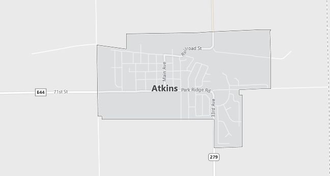
Geography and Location
Atkins, Iowa, is a small but growing city situated in Benton County, approximately 12 miles west of Cedar Rapids. This suburban community is surrounded by fertile farmland typical of the Midwest, and it sits on gently rolling plains that are part of the larger Cedar River watershed. Atkins is easily accessible via U.S. Highway 30, which connects it to nearby cities and transportation routes.
The city is located in a region known for its agricultural productivity, with corn and soybean fields dominating the landscape. Although predominantly rural, Atkins benefits from its proximity to Cedar Rapids, allowing residents to enjoy a peaceful small-town atmosphere while being close to the amenities and job opportunities of a larger urban center. The area’s geography supports a mix of agriculture and light industrial development, which has attracted new residents in recent years. Its climate is typical of the Midwest, with cold winters and warm summers, and the terrain is relatively flat, ideal for farming and suburban expansion.
Demographics
Median resident age: 33.4 years
Median household income: $50,833
Median house value: $100,700
Population by Race
Races in Atkins:
- White Non-Hispanic (99.0%)
- Hispanic (0.8%)
Ancestries: German (51.2%), Irish (18.3%), Czech (10.3%), English (8.1%), Norwegian (5.3%), United States (4.5%).
Elevation: 850 feet
Land area: 0.8 square miles
Population by Education
For population 25 years and over in Atkins
- High school or higher: 90.0%
- Bachelor’s degree or higher: 17.0%
- Graduate or professional degree: 2.5%
- Unemployed: 2.5%
- Mean travel time to work: 20.4 minutes
For population 15 years and over in Atkins city
- Never married: 18.6%
- Now married: 68.8%
- Separated: 0.1%
- Widowed: 5.2%
- Divorced: 7.3%
0.0% Foreign born
Population change in the 1990s: +244 (+33.3%).
Hospitals
Hospitals/medical centers near Atkins:
- ST LUKES HOSPITAL (about 15 miles; CEDAR RAPIDS, IA)
- VIRGINIA GAY HOSPITAL (about 17 miles; VINTON, IA)
- MERCY MEDICAL CENTER (about 18 miles; CEDAR RAPIDS, IA)
Airports
Airports certified for carrier operations nearest to Atkins:
- THE EASTERN IOWA (about 14 miles; CEDAR RAPIDS, IA; Abbreviation: CID)
- WATERLOO MUNI (about 54 miles; WATERLOO, IA; Abbreviation: ALO)
- OTTUMWA INDUSTRIAL (about 74 miles; OTTUMWA, IA; Abbreviation: OTM)
Other public-use airports nearest to Atkins:
- AMANA (about 15 miles; AMANA, IA; Abbreviation: C11)
- VINTON VETERANS MEML ARPK (about 19 miles; VINTON, IA; Abbreviation: VTI)
- MARION (about 24 miles; MARION, IA; Abbreviation: C17)
Colleges and Universities
Colleges/universities with over 2000 students nearest to Atkins:
- KIRKWOOD COMMUNITY COLLEGE (about 21 miles; CEDAR RAPIDS, IA; Full-time enrollment: 7,991)
- UNIVERSITY OF IOWA (about 32 miles; IOWA CITY, IA; Full-time enrollment: 24,766)
- UNIVERSITY OF NORTHERN IOWA (about 46 miles; CEDAR FALLS, IA; Full-time enrollment: 12,524)
- HAWKEYE COMMUNITY COLLEGE (about 48 miles; WATERLOO, IA; Full-time enrollment: 3,292)
- UPPER IOWA UNIVERSITY (about 58 miles; FAYETTE, IA; Full-time enrollment: 3,173)
- INDIAN HILLS COMMUNITY COLLEGE (about 77 miles; OTTUMWA, IA; Full-time enrollment: 2,744)
- NORTHEAST IOWA COMMUNITY COLLEGE-CALMAR (about 83 miles; CALMAR, IA; Full-time enrollment: 2,393)
Public primary/middle school in Atkins:
- ATKINS ELEMENTARY SCHOOL (Students: 176; Location: 217 4TH AVE; Grades: KG – 04)
Libraries
Library in Atkins:
- ATKINS PUBLIC LIBRARY (Operating income: $28,121; Location: 84 MAIN; 7,676 books; 245 audio materials; 641 video materials; 46 serial subscriptions)