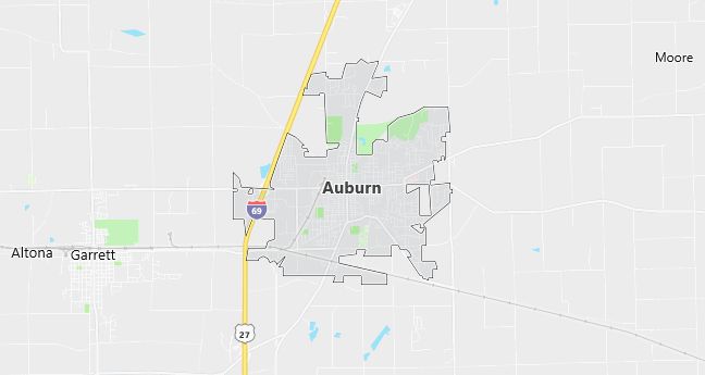
Moving to Auburn, Indiana
Population: 12,074. Estimated population in July 2024: 12,687 (+5.1% change)
Males: 5,803 (48.1%), Females: 6,271 (51.9%)
DeKalb County
Zip code: 46706
Demographics
Median resident age: 34.2 years
Median household income: $42,762
Median house value: $93,800
Population by Race
Races in Auburn:
- White Non-Hispanic (96.7%)
- Hispanic (1.7%)
- Two or more races (0.8%)
- Other race (0.6%)
- American Indian (0.5%)
Ancestries: German (35.2%), United States (14.6%), Irish (9.6%), English (9.3%), French (3.2%), Dutch (1.8%).
Elevation: 869 feet
Land area: 6.6 square miles

Population by Education
For population 25 years and over in Auburn
- High school or higher: 85.5%
- Bachelor’s degree or higher: 17.4%
- Graduate or professional degree: 5.7%
- Unemployed: 3.4%
- Mean travel time to work: 16.3 minutes
For population 15 years and over in Auburn city
- Never married: 20.8%
- Now married: 56.3%
- Separated: 1.4%
- Widowed: 8.1%
- Divorced: 13.4%
0.5% Foreign born
Population change in the 1990s: +2,277 (+23.2%).
Hospitals
Hospital/medical center in Auburn:
- DEKALB MEMORIAL HOSPITAL INC (1316 EAST SEVENTH STREET)
Other hospitals/medical centers near Auburn:
- DUPONT HOSPITAL LLC (about 16 miles; FORT WAYNE, IN)
- PARKVIEW NOBLE HOSPITAL (about 16 miles; KENDALLVILLE, IN)
- PARKVIEW HOSPITAL (about 19 miles; FORT WAYNE, IN)
Airports
Airports certified for carrier operations nearest to Auburn:
- FORT WAYNE INTERNATIONAL (about 29 miles; FORT WAYNE, IN; Abbreviation: FWA)
- W K KELLOGG (about 66 miles; BATTLE CREEK, MI; Abbreviation: BTL)
- KALAMAZOO/BATTLE CREEK INTERNATIONAL (about 69 miles; KALAMAZOO, MI; Abbreviation: AZO)
Other public-use airports nearest to Auburn:
- DE KALB COUNTY (about 5 miles; AUBURN, IN; Abbreviation: 07C)
- WALKER/ROWE WATERLOO (about 8 miles; WATERLOO, IN; Abbreviation: 4C2)
- HARROLD (about 13 miles; BUTLER, IN; Abbreviation: B25)
Amtrak station near Auburn:
- 6 miles: WATERLOO (LINCOLN & CENTER STS.). Services: public payphones, free short-term parking, free long-term parking.
Colleges and Universities
Colleges/universities with over 2000 students nearest to Auburn:
- INDIANA UNIVERSITY-PURDUE UNIVERSITY-FORT WAYNE (about 19 miles; FT WAYNE, IN; Full-time enrollment: 7,385)
- SPRING ARBOR UNIVERSITY (about 68 miles; SPRING ARBOR, MI; Full-time enrollment: 2,266)
- KELLOGG COMMUNITY COLLEGE (about 69 miles; BATTLE CREEK, MI; Full-time enrollment: 2,824)
- INDIANA WESLEYAN UNIVERSITY (about 71 miles; MARION, IN; Full-time enrollment: 6,684)
- WESTERN MICHIGAN UNIVERSITY (about 73 miles; KALAMAZOO, MI; Full-time enrollment: 23,132)
- KALAMAZOO VALLEY COMMUNITY COLLEGE (about 77 miles; KALAMAZOO, MI; Full-time enrollment: 5,017)
- JACKSON COMMUNITY COLLEGE (about 77 miles; JACKSON, MI; Full-time enrollment: 2,756)
Private high school in Auburn:
- LAKEWOOD PARK CHRISTIAN SCHOOL (Students: 445; Location: 5555 COUNTY ROAD 29 SOUTH; Grades: PK – 12)
Public primary/middle schools in Auburn:
- JAMES R WATSON ELEM SCHOOL (Students: 647; Location: 901 ECKHART ST; Grades: PK – 05)
- MCKENNEY-HARRISON ELEM SCHOOL (Students: 597; Location: 320 VAN AUKEN ST; Grades: KG – 05)
Libraries
Library in Auburn:
- ECKHART PL (Operating income: $786,919; Location: 603 S JACKSON ST; 66,024 books; 11,000 audio materials; 2,475 video materials; 197 serial subscriptions)
