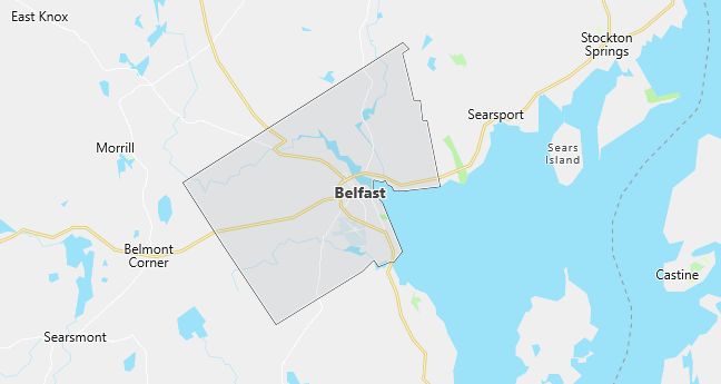
Moving to Belfast, Maine
Population: 6,381. Estimated population in July 2024: 6,872 (+7.7% change)
Males: 2,976 (46.6%), Females: 3,405 (53.4%)
Waldo County
Demographics
Median resident age: 43.3 years
Median household income: $32,400
Median house value: $108,200
Population by Race
Races in Belfast:
- White Non-Hispanic (97.2%)
- Two or more races (1.3%)
- American Indian (1.2%)
- Hispanic (0.7%)
Ancestries: English (25.7%), Irish (15.3%), United States (8.7%), German (7.1%), French (6.6%), Scottish (6.6%).
Elevation: 103 feet
Land area: 34.0 square miles

Population by Education
For population 25 years and over in Belfast
- High school or higher: 82.0%
- Bachelor’s degree or higher: 29.1%
- Graduate or professional degree: 10.7%
- Unemployed: 6.2%
- Mean travel time to work: 20.2 minutes
For population 15 years and over in Belfast city
- Never married: 21.4%
- Now married: 51.3%
- Separated: 1.2%
- Widowed: 11.5%
- Divorced: 14.7%
2.2% Foreign born (1.2% Europe, 0.8% North America, 0.2% Asia).
Population change in the 1990s: -104 (-1.6%).
Hospitals
Hospital/medical center in Belfast:
- WALDO COUNTY GENERAL HOSPITAL (118 NORTHPORT AVENUE)
Other hospitals/medical centers near Belfast:
- PENOBSCOT BAY MEDICAL CENTER (about 18 miles; ROCKPORT, ME)
- BLUE HILL MEMORIAL HOSPITAL (about 30 miles; BLUE HILL, ME)
- ACADIA HOSPITAL,THE (about 31 miles; BANGOR, ME)
Airports
Airports certified for carrier operations nearest to Belfast:
- BANGOR INTL (about 30 miles; BANGOR, ME; Abbreviation: BGR)
- BRUNSWICK NAS (about 74 miles; BRUNSWICK, ME; Abbreviation: NHZ)
- PORTLAND INTL JETPORT (about 105 miles; PORTLAND, ME; Abbreviation: PWM)
Other public-use airports nearest to Belfast:
- BELFAST MUNI (about 2 miles; BELFAST, ME; Abbreviation: BST)
- ISLESBORO (about 12 miles; ISLESBORO, ME; Abbreviation: 57B)
- RING HILL (about 25 miles; CARMEL, ME; Abbreviation: 38B)
Colleges and Universities
Colleges/universities with over 2000 students nearest to Belfast:
- UNIVERSITY OF MAINE (about 48 miles; ORONO, ME; Full-time enrollment: 8,590)
- UNIVERSITY OF MAINE AT AUGUSTA (about 53 miles; AUGUSTA, ME; Full-time enrollment: 3,172)
- UNIVERSITY OF MAINE AT FARMINGTON (about 79 miles; FARMINGTON, ME; Full-time enrollment: 2,229)
- UNIVERSITY OF SOUTHERN MAINE (about 103 miles; PORTLAND, ME; Full-time enrollment: 7,381)
- SAINT JOSEPHS COLLEGE (about 117 miles; STANDISH, ME; Full-time enrollment: 2,376)
- UNIVERSITY OF NEW ENGLAND-UNIVERSITY CAMPUS (about 120 miles; BIDDEFORD, ME; Full-time enrollment: 2,251)
- UNIVERSITY OF NEW HAMPSHIRE-MAIN CAMPUS (about 162 miles; DURHAM, NH; Full-time enrollment: 12,586)
Schools
Public high school in Belfast:
- BELFAST AREA HIGH SCHOOL (Students: 641; Location: 98 WALDO AVENUE; Grades: 09 – 12)
Public primary/middle schools in Belfast:
- TROY A HOWARD MIDDLE SCHOOL (Students: 473; Location: 173 LINCOLNVILLE AVENUE; Grades: 06 – 08)
- EAST BELFAST SCHOOL (Students: 133; Location: 14 SWAN LAKE AVENUE; Grades: PK – 05)
- GOVERNOR ANDERSON SCHOOL (Students: 122; Location: 256 HIGH STREET; Grades: KG – 03)
- GEORGE H ROBERTSON SCHOOL (Students: 116; Location: 9 SCHOOL STREET; Grades: 03 – 05)
- PEIRCE ELEMENTARY SCHOOL (Students: 50; Location: 24 CHURCH STREET; Grades: KG – 02)
Private primary/middle school in Belfast:
- TODDY POND SCHOOL (Students: 21; Location: RR 2 BOX 2145; Grades: KG – 8)
Libraries
Library in Belfast:
- BELFAST FREE LIBRARY (Operating income: $352,682; Location: 106 HIGH STREET; 32,034 books; 1,286 audio materials; 1,186 video materials; 90 serial subscriptions)
