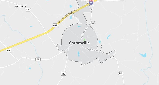
Moving to Carnesville, Georgia
Carnesville, the county seat of Franklin County, was incorporated as a village December 7, 1807. The city was named for Judge Thomas Peter Carnes, a lawyer and Congressman of the Revolutionary War era.
The Franklin County courthouse in Carnesville was constructed in 1906 and is listed on the National Register of Historic Places.
Cromer’s Mill Covered Bridge (also known as Nail’s Creek Bridge) is located in Carnesville, south of the city. The bridge was built in 1906 and is 136 feet long with a town lattice design.
The Franklin County Historical Society Museum in Carnesville has exhibits on local history.
Population: 541. Estimated population in July 2024: 617 (+14.0% change)
Males: 272 (50.3%), Females: 269 (49.7%)
Franklin County
Zip code: 30521
Demographics
Median resident age: 37.8 years
Median household income: $36,719
Median house value: $77,200
Population by Race
Races in Carnesville:
- White Non-Hispanic (72.8%)
- Black (25.0%)
- Two or more races (1.5%)
Ancestries: United States (37.3%), Irish (10.0%), English (3.5%), German (3.3%), French (1.1%).
Elevation: 712 feet
Land area: 2.4 square miles

Population by Education
For population 25 years and over in Carnesville
- High school or higher: 64.5%
- Bachelor’s degree or higher: 20.0%
- Graduate or professional degree: 5.9%
- Unemployed: 3.8%
- Mean travel time to work: 22.5 minutes
For population 15 years and over in Carnesville city
- Never married: 23.1%
- Now married: 56.4%
- Separated: 3.3%
- Widowed: 12.7%
- Divorced: 4.5%
0.6% Foreign born
Population change in the 1990s: +29 (+5.7%).
Hospitals
Hospitals/medical centers near Carnesville:
- COBB HEALTHCARE SYSTEMS, INC (about 11 miles; ROYSTON, GA)
- STEPHENS COUNTY HOSPITAL (about 15 miles; TOCCOA, GA)
- BANKS-JACKSON-COMMERCE HOSPITAL (about 20 miles; COMMERCE, GA)
Airports
Airports certified for carrier operations nearest to Carnesville:
- ATHENS/BEN EPPS (about 31 miles; ATHENS, GA; Abbreviation: AHN)
- ANDERSON RGNL (about 38 miles; ANDERSON, SC; Abbreviation: AND)
- DONALDSON CENTER (about 66 miles; GREENVILLE, SC; Abbreviation: GYH)
Other public-use airports nearest to Carnesville:
- FRANKLIN COUNTY (about 8 miles; CANON, GA; Abbreviation: 18A)
- TOCCOA RG LETOURNEAU FIELD (about 15 miles; TOCCOA, GA; Abbreviation: TOC)
- HABERSHAM COUNTY (about 24 miles; CORNELIA, GA; Abbreviation: AJR)
Amtrak station near Carnesville:
- 16 miles: TOCCOA (47 N. ALEXANDER ST.). Services: enclosed waiting area, public restrooms, public payphones, free short-term parking, free long-term parking, call for taxi service.
Colleges and Universities
Colleges/universities with over 2000 students nearest to Carnesville:
- UNIVERSITY OF GEORGIA (about 31 miles; ATHENS, GA; Full-time enrollment: 28,464)
- TRI-COUNTY TECHNICAL COLLEGE (about 38 miles; PENDLETON, SC; Full-time enrollment: 2,343)
- GAINESVILLE COLLEGE (about 47 miles; OAKWOOD, GA; Full-time enrollment: 2,181)
- CLEMSON UNIVERSITY (about 49 miles; CLEMSON, SC; Full-time enrollment: 15,962)
- NORTH GEORGIA COLLEGE AND STATE UNIVERSITY (about 53 miles; DAHLONEGA, GA; Full-time enrollment: 3,119)
- GWINNETT TECHNICAL COLLEGE (about 60 miles; LAWRENCEVILLE, GA; Full-time enrollment: 3,215)
- WESTERN CAROLINA UNIVERSITY (about 62 miles; CULLOWHEE, NC; Full-time enrollment: 5,843)
Schools
Public high school in Carnesville:
- FRANKLIN COUNTY HIGH SCHOOL (Students: 1,023; Location: P.O. BOX 543, 6570 GA HIGHWAY; Grades: 09 – 12)
Public primary/middle schools in Carnesville:
- FRANKLIN COUNTY MIDDLE SCHOOL (Students: 937; Location: P.O. BOX 544, 280 BUSHA ROAD; Grades: 06 – 08)
- CARNESVILLE ELEMENTARY SCHOOL (Students: 670; Location: P.O. BOX 39, 825 HULL AVENUE; Grades: KG – 05)
