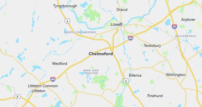
Moving to Chelmsford, Massachusetts
Population: 33,858. Estimated population in July 2024: 33,759 (-0.3% change)
Males: 16,364 (48.3%), Females: 17,494 (51.7%)
Middlesex County
Demographics
Median resident age: 38.9 years
Median household income: $70,207
Median house value: $213,900
Population by Race
Races in Chelmsford:
- White Non-Hispanic (92.4%)
- Chinese (2.0%)
- Asian Indian (1.4%)
- Hispanic (1.2%)
- Two or more races (0.9%)
- Black (0.8%)
- Other race (0.5%)
Ancestries: Irish (32.1%), English (16.9%), Italian (14.0%), French (8.3%), German (6.8%), French Canadian (6.7%).

Population by Education
For population 25 years and over in Chelmsford
- High school or higher: 93.0%
- Bachelor’s degree or higher: 44.0%
- Graduate or professional degree: 18.1%
- Unemployed: 2.7%
- Mean travel time to work: 27.6 minutes
For population 15 years and over in Chelmsford town
- Never married: 23.1%
- Now married: 61.9%
- Separated: 0.7%
- Widowed: 6.6%
- Divorced: 7.7%
7.1% Foreign born (3.5% Asia, 2.3% Europe).
Hospitals
Hospitals/medical centers near Chelmsford:
- DR HARRY SOLOMON MHC (about 5 miles; LOWELL, MA)
- LOWELL GENERAL HOSPITAL (about 5 miles; LOWELL, MA)
- SAINTS MEMORIAL MEDICAL CENTER INC (about 6 miles; LOWELL, MA)
Airports
Airports certified for carrier operations nearest to Chelmsford:
- LAURENCE G HANSCOM FLD (about 11 miles; BEDFORD, MA; Abbreviation: BED)
- MANCHESTER (about 24 miles; MANCHESTER, NH; Abbreviation: MHT)
- GENERAL EDWARD LAWRENCE LOGAN INTL (about 31 miles; BOSTON, MA; Abbreviation: BOS)
Other public-use airports nearest to Chelmsford:
- MERRIMACK VALLEY (about 14 miles; METHUEN, MA; Abbreviation: MA2)
- MINUTE MAN AIR FIELD (about 15 miles; STOW, MA; Abbreviation: 6B6)
- BOIRE FIELD (about 15 miles; NASHUA, NH; Abbreviation: ASH)
Amtrak station near Chelmsford:
- 17 miles: WOBURN (100 ATLANTIC AVE.). Services: ticket office.
Colleges and Universities
Colleges/universities with over 2000 students nearest to Chelmsford:
- UNIVERSITY OF MASSACHUSETTS-LOWELL (about 5 miles; LOWELL, MA; Full-time enrollment: 8,373)
- MIDDLESEX COMMUNITY COLLEGE (about 10 miles; BEDFORD, MA; Full-time enrollment: 4,501)
- BRANDEIS UNIVERSITY (about 13 miles; WALTHAM, MA; Full-time enrollment: 4,444)
- BENTLEY COLLEGE (about 18 miles; WALTHAM, MA; Full-time enrollment: 4,651)
- MERRIMACK COLLEGE (about 19 miles; NORTH ANDOVER, MA; Full-time enrollment: 2,384)
- FRAMINGHAM STATE COLLEGE (about 20 miles; FRAMINGHAM, MA; Full-time enrollment: 4,185)
- WELLESLEY COLLEGE (about 21 miles; WELLESLEY, MA; Full-time enrollment: 2,241)
Public primary/middle schools in Chelmsford:
- MCCARTHY MIDDLE SCHOOL (Students: 975; Location: 250 NORTH RD; Grades: 05 – 08)
- COL MOSES PARKER SCHL (Students: 795; Location: 75 GRANITEVILLE RD; Grades: 05 – 08)
- BYAM SCHOOL (Students: 530; Location: 25 MAPLE ROAD; Grades: KG – 04)
- SOUTH ROW (Students: 434; Location: 250 BOSTON RD; Grades: KG – 04)
- CENTER ELEMENTARY SCHOOL (Students: 425; Location: 84 BILLERICA ROAD; Grades: KG – 04)
- WESTLANDS ELEMENTARY (Students: 369; Location: 170 DALTON RD; Grades: KG – 04)
- MURDOCH MIDDLE PUBLIC CHARTER SCHOOL (Students: 263; Location: 40 BRICK KILN ROAD; Grades: 05 – 08)
Private primary/middle schools in Chelmsford:
- CHELMSFORD DISCOVERY CENTER (Students: 76; Location: 194 CHELMSFORD STREET; Grades: PK – KG)
- KINDERCARE LEARING CENTER#654 (Students: 15; Location: 72 BOSTON RD; Grades: KG – KG)
Libraries
Library in Chelmsford:
- CHELMSFORD PUBLIC LIBRARY (Operating income: $1,379,617; Location: 25 BOSTON RD.; 111,720 books; 7,434 audio materials; 6,995 video materials; 299 serial subscriptions)
