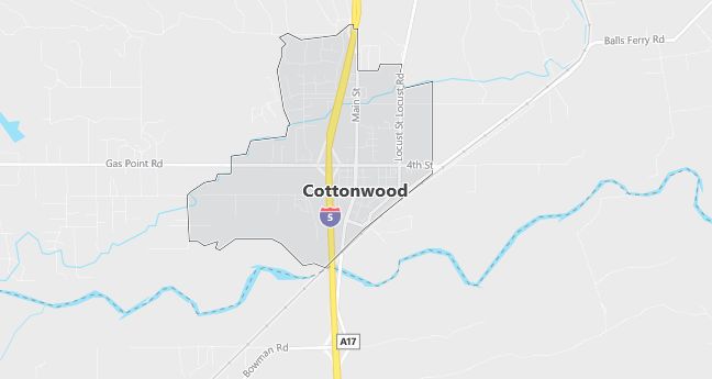
Moving to Cottonwood, California
Population: 2,960
Males: 1,401 (47.3%), Females: 1,559 (52.7%)
Zip code: 96022
Demographics
Median resident age: 32.6 years
Median household income: $30,191
Median house value: $95,700
Population by Race
Races in Cottonwood:
- White Non-Hispanic (81.5%)
- Hispanic (9.4%)
- American Indian (5.6%)
- Two or more races (3.8%)
- Other race (3.3%)
- Other Asian (2.8%)
(Total can be greater than 100% because Hispanics could be counted in other races)
Ancestries: Irish (15.4%), German (14.4%), United States (9.9%), English (7.8%), Italian (6.6%), French (3.0%).
Land area: 2.4 square miles

Population by Education
For population 25 years and over in Cottonwood
- High school or higher: 68.4%
- Bachelor’s degree or higher: 8.3%
- Graduate or professional degree: 2.6%
- Unemployed: 10.2%
- Mean travel time to work: 30.0 minutes
For population 15 years and over in Cottonwood CDP
- Never married: 19.3%
- Now married: 54.9%
- Separated: 1.2%
- Widowed: 7.7%
- Divorced: 16.9%
8.4% Foreign born (5.9% Latin America, 1.7% Europe).
Hospitals
Hospitals/medical centers near Cottonwood:
- ST ELIZABETH COMMUNITY HOSPITAL (about 15 miles; RED BLUFF, CA)
- MERCY MEDICAL CENTER REDDING (about 16 miles; REDDING, CA)
- NORTHERN CALIFORNIA REHAB HOSPITAL (about 16 miles; REDDING, CA)
Airports
Airports certified for carrier operations nearest to Cottonwood:
- REDDING MUNI (about 8 miles; REDDING, CA; Abbreviation: RDD)
- CHICO MUNI (about 52 miles; CHICO, CA; Abbreviation: CIC)
- BEALE AFB (about 105 miles; MARYSVILLE, CA; Abbreviation: BAB)
Other public-use airports nearest to Cottonwood:
- BENTON FIELD (about 15 miles; REDDING, CA; Abbreviation: O85)
- RED BLUFF MUNI (about 17 miles; RED BLUFF, CA; Abbreviation: RBL)
- BRIDGE BAY RESORT (about 25 miles; REDDING, CA; Abbreviation: Q83)
Amtrak stations near Cottonwood:
- 15 miles: RED BLUFF (460 ANTELOPE BLVD.) – Bus Station. Services: fully wheelchair accessible, public payphones, free short-term parking, call for taxi service.
- 16 miles: REDDING (1620 YUBA ST.). Services: fully wheelchair accessible, public payphones, free short-term parking, call for taxi service.
Colleges and Universities
Colleges/universities with over 2000 students nearest to Cottonwood:
- SHASTA COLLEGE (about 23 miles; REDDING, CA; Full-time enrollment: 5,251)
- CALIFORNIA STATE UNIVERSITY-CHICO (about 57 miles; CHICO, CA; Full-time enrollment: 14,658)
- BUTTE COLLEGE (about 75 miles; Oroville, CA; Full-time enrollment: 7,061)
- YUBA COLLEGE (about 99 miles; MARYSVILLE, CA; Full-time enrollment: 5,593)
- MENDOCINO COLLEGE (about 106 miles; UKIAH, CA; Full-time enrollment: 2,080)
- SOUTHERN OREGON UNIVERSITY (about 125 miles; ASHLAND, OR; Full-time enrollment: 4,424)
- HUMBOLDT STATE UNIVERSITY (about 129 miles; ARCATA, CA; Full-time enrollment: 6,800)
Schools
Public high school in Cottonwood:
- WEST VALLEY HIGH (Students: 1,120; Location: 3805 HAPPY VALLEY ROAD; Grades: 09 – 12)
Public primary/middle schools in Cottonwood:
- WEST COTTONWOOD JUNIOR HIGH (Students: 703; Location: 20512 W. 1ST ST.; Grades: 04 – 08)
- EAST COTTONWOOD ELEMENTARY (Students: 529; Location: 3425 BUSH ST.; Grades: KG – 08)
- EVERGREEN MIDDLE (Students: 457; Location: 19500 LEARNING WAY; Grades: KG – 08)
- EVERGREEN ELEMENTARY (Students: 457; Location: 19415 HOOKER CREEK ROAD; Grades: KG – 05)
- ACORN TO OAKS CHARTER (Students: 32; Location: 16280 BOWMAN RD.; Grades: KG – 08)
- EVERGREEN COMMUNITY DAY (Students: 4; Location: 19500 LEARNING WAY; Grades: KG – 08)
