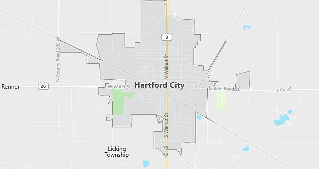
Moving to Hartford City, Indiana
Population: 6,928. Estimated population in July 2024: 6,684 (-3.5% change)
Males: 3,273 (47.2%), Females: 3,655 (52.8%)
Blackford County
Zip code: 47348
Demographics
Median resident age: 38.0 years
Median household income: $31,531
Median house value: $54,100
Population by Race
Races in Hartford City:
- White Non-Hispanic (98.0%)
- American Indian (0.8%)
- Two or more races (0.8%)
- Hispanic (0.6%)
Ancestries: German (15.1%), United States (14.0%), Irish (8.8%), English (7.6%), French (2.0%), Italian (1.6%).
Elevation: 922 feet
Land area: 3.7 square miles

Population by Education
For population 25 years and over in Hartford City
- High school or higher: 79.8%
- Bachelor’s degree or higher: 11.4%
- Graduate or professional degree: 4.6%
- Unemployed: 4.3%
- Mean travel time to work: 20.1 minutes
For population 15 years and over in Hartford City city
- Never married: 18.9%
- Now married: 58.8%
- Separated: 0.6%
- Widowed: 9.4%
- Divorced: 12.3%
0.2% Foreign born
Population change in the 1990s: -30 (-0.4%).
Hospitals
Hospital/medical center in Hartford City:
- BLACKFORD COMMUNITY HOSPITAL (503 E VANCLEVE ST)
Other hospitals/medical centers near Hartford City:
- BALL MEMORIAL HOSPITAL INC (about 16 miles; MUNCIE, IN)
- GRANT-BLACKFORD MENTAL HEALTH, INC (about 23 miles; MARION, IN)
- MARION GENERAL HOSPITAL (about 23 miles; MARION, IN)
Airports
Airports certified for carrier operations nearest to Hartford City:
- DELAWARE COUNTY – JOHNSON FIELD (about 16 miles; MUNCIE, IN; Abbreviation: MIE)
- ANDERSON MUNICIPAL-DARLINGTON FIELD (about 30 miles; ANDERSON, IN; Abbreviation: AID)
- FORT WAYNE INTERNATIONAL (about 38 miles; FORT WAYNE, IN; Abbreviation: FWA)
Other public-use airports nearest to Hartford City:
- MILLER (about 21 miles; BLUFFTON, IN; Abbreviation: C40)
- MARION MUNI (about 21 miles; MARION, IN; Abbreviation: MZZ)
- REESE (about 22 miles; MUNCIE, IN; Abbreviation: 7I2)
Colleges and Universities
Colleges/universities with over 2000 students nearest to Hartford City:
- BALL STATE UNIVERSITY (about 18 miles; MUNCIE, IN; Full-time enrollment: 17,039)
- IVY TECH STATE COLLEGE-EAST CENTRAL (about 20 miles; MUNCIE, IN; Full-time enrollment: 2,013)
- INDIANA WESLEYAN UNIVERSITY (about 21 miles; MARION, IN; Full-time enrollment: 6,684)
- ANDERSON UNIVERSITY (about 30 miles; ANDERSON, IN; Full-time enrollment: 2,116)
- INDIANA UNIVERSITY-PURDUE UNIVERSITY-FORT WAYNE (about 48 miles; FT WAYNE, IN; Full-time enrollment: 7,385)
- BUTLER UNIVERSITY (about 71 miles; INDIANAPOLIS, IN; Full-time enrollment: 3,721)
- INDIANA UNIVERSITY-PURDUE UNIVERSITY-INDIANAPOLIS (about 72 miles; INDIANAPOLIS, IN; Full-time enrollment: 19,818)
Schools
Public high school in Hartford City:
- BLACKFORD HIGH SCHOOL (Students: 686; Location: 2392 N SR 3 N; Grades: 09 – 12)
Public primary/middle schools in Hartford City:
- HARTFORD CITY MIDDLE SCHOOL (Students: 429; Location: 800 W VAN CLEVE ST; Grades: 06 – 08)
- NORTH SIDE ELEMENTARY SCHOOL (Students: 360; Location: 400 E MCDONALD; Grades: 03 – 05)
- SOUTHSIDE ELEMENTARY SCHOOL (Students: 323; Location: 1515 S MONROE ST; Grades: KG – 02)
Private primary/middle school in Hartford City:
- ST. JOHN’S RIEDMAN MEMORIAL SC (Students: 69; Location: 213 S. SPRING ST.; Grades: PK – 6)
Libraries
Library in Hartford City:
- HARTFORD CITY PL (Operating income: $370,430; Location: 314 N HIGH ST; 51,020 books; 3,100 audio materials; 3,500 video materials; 315 serial subscriptions)
