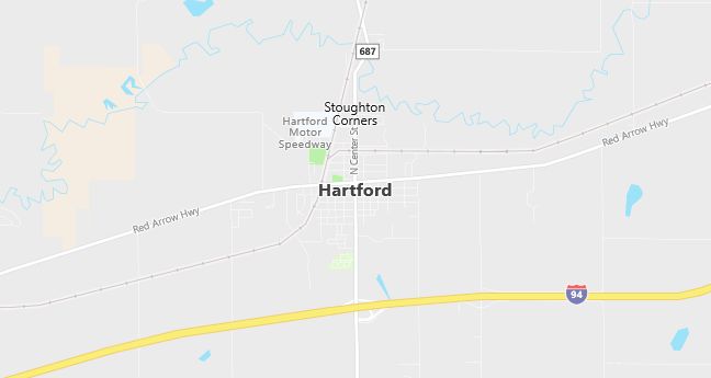
Moving to Hartford, Michigan
Population: 2,476. Estimated population in July 2024: 2,433 (-1.7% change)
Males: 1,196 (48.3%), Females: 1,280 (51.7%)
Van Buren County
Zip code: 49057
Demographics
Median resident age: 33.0 years
Median household income: $32,879
Median house value: $62,600
Population by Race
Races in Hartford:
- White Non-Hispanic (80.6%)
- Hispanic (12.7%)
- Other race (7.2%)
- American Indian (5.0%)
- Two or more races (2.9%)
- Black (0.9%)
(Total can be greater than 100% because Hispanics could be counted in other races)
Ancestries: German (16.2%), Irish (15.8%), English (7.9%), United States (6.3%), Dutch (3.8%), Italian (2.7%).
Land area: 1.4 square miles

Population by Education
For population 25 years and over in Hartford
- High school or higher: 68.9%
- Bachelor’s degree or higher: 6.4%
- Graduate or professional degree: 2.8%
- Unemployed: 7.5%
- Mean travel time to work: 20.7 minutes
For population 15 years and over in Hartford city
- Never married: 27.0%
- Now married: 47.9%
- Separated: 2.8%
- Widowed: 7.5%
- Divorced: 14.8%
3.9% Foreign born (3.4% Latin America).
Population change in the 1990s: -82 (-3.2%).
Hospitals
Hospitals/medical centers near Hartford:
- COMMUNITY HOSPITAL (about 7 miles; WATERVLIET, MI)
- LEE MEMORIAL HOSPITAL (about 15 miles; DOWAGIAC, MI)
- SOUTH HAVEN COMMUNITY HOSPITAL (about 15 miles; SOUTH HAVEN, MI)
Airports
Airports certified for carrier operations nearest to Hartford:
- ELKHART MUNI (about 36 miles; ELKHART, IN; Abbreviation: EKM)
- SOUTH BEND REGIONAL (about 37 miles; SOUTH BEND, IN; Abbreviation: SBN)
- KALAMAZOO/BATTLE CREEK INTERNATIONAL (about 43 miles; KALAMAZOO, MI; Abbreviation: AZO)
Other public-use airports nearest to Hartford:
- WATERVLIET MUNI (about 6 miles; WATERVLIET, MI; Abbreviation: 40C)
- SOUTH HAVEN AREA REGIONAL (about 12 miles; SOUTH HAVEN, MI; Abbreviation: 0D1)
- DOWAGIAC MUNICIPAL (about 16 miles; DOWAGIAC, MI; Abbreviation: C91)
Amtrak stations near Hartford:
- 9 miles: BANGOR (541 RAILROAD ST.). Services: enclosed waiting area, public payphones, free short-term parking, free long-term parking.
- 16 miles: DOWAGIAC (100 RAILROAD DR.). Services: enclosed waiting area, public restrooms, public payphones, free short-term parking, free long-term parking, call for car rental service.
Colleges and Universities
Colleges/universities with over 2000 students nearest to Hartford:
- KALAMAZOO VALLEY COMMUNITY COLLEGE (about 34 miles; KALAMAZOO, MI; Full-time enrollment: 5,017)
- UNIVERSITY OF NOTRE DAME (about 36 miles; NOTRE DAME, IN; Full-time enrollment: 10,633)
- HOPE COLLEGE (about 39 miles; HOLLAND, MI; Full-time enrollment: 2,918)
- WESTERN MICHIGAN UNIVERSITY (about 39 miles; KALAMAZOO, MI; Full-time enrollment: 23,132)
- ANDREWS UNIVERSITY (about 41 miles; BERRIEN SPRINGS, MI; Full-time enrollment: 2,342)
- INDIANA UNIVERSITY-SOUTH BEND (about 43 miles; SOUTH BEND, IN; Full-time enrollment: 4,725)
- GRAND VALLEY STATE UNIVERSITY (about 56 miles; ALLENDALE, MI; Full-time enrollment: 15,124)
Schools
Public high school in Hartford:
- HARTFORD HIGH SCHOOL (Students: 504; Location: 115-A SCHOOL STREET; Grades: 09 – 12)
Public primary/middle schools in Hartford:
- WOODSIDE ELEMENTARY SCHOOL (Students: 363; Location: 395 WOODSIDE DRIVE; Grades: PK – 05)
- RED ARROW ELEMENTARY SCHOOL (Students: 334; Location: 15 S. EAST STREET; Grades: KG – 05)
- HARTFORD MIDDLE SCHOOL (Students: 312; Location: 141 SCHOOL STREET; Grades: 06 – 08)
Libraries
Library in Hartford:
- HARTFORD PUBLIC LIBRARY (Operating income: $104,973; Location: 15 FRANKLIN STREET; 50,282 books; 389 audio materials; 215 video materials; 37 serial subscriptions)
