Moving to Jerome, Arizona
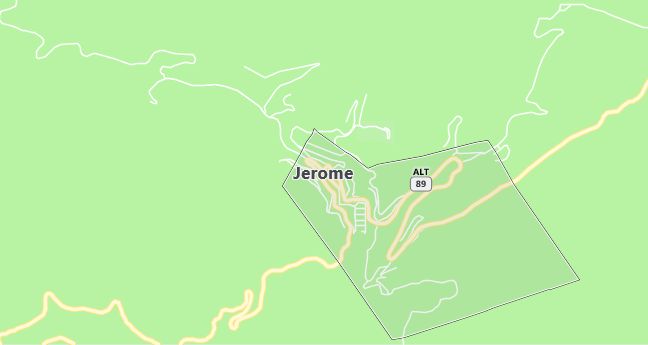
Jerome is located at 130 km north of Phoenix. Jerome is a wondrous place. Miners began to work the area in the 1870s, and the town boomed and busted several times, depending on the price of copper. When it boomed, it was known to be wild and wicked, but the mines shut down for good in the 1950s.The Jerome State Historical Park provides a good overview of the town’s mining history. The Mine Museum will give you further background on the amount of money that changed hands in the heyday of the gold, silver and copper enterprises.
The town began to slide down Cleopatra Hill during the 1930s, primarily as a result of inadequate construction, gravity, and an unstable mountainside. The Sliding Jail, a prison that moved 70 m during this slide, attracts many visitors. The Jerome State Historical Park is also located here.
Population: 329. Estimated population in July 2024: 343 (+4.3% change)
Males: 167 (50.8%), Females: 162 (49.2%)
Yavapai County
Zip code: 86331
Demographics
Median resident age: 46.4 years
Median household income: $27,857
Median house value: $127,500
Population by Race
Races in Jerome:
- White Non-Hispanic (87.2%)
- Hispanic (8.2%)
- American Indian (3.3%)
- Two or more races (3.0%)
- Other race (2.1%)
(Total can be greater than 100% because Hispanics could be counted in other races)
Ancestries: Irish (14.3%), German (13.4%), English (12.5%), Italian (8.8%), French (3.3%), Norwegian (3.3%).
Elevation: 5057 feet
Land area: 0.7 square miles

Population by Education
For population 25 years and over in Jerome
- High school or higher: 93.4%
- Bachelor’s degree or higher: 31.7%
- Graduate or professional degree: 7.8%
- Unemployed: 5.0%
- Mean travel time to work: 16.7 minutes
For population 15 years and over in Jerome town
- Never married: 30.9%
- Now married: 40.1%
- Separated: 2.8%
- Widowed: 4.6%
- Divorced: 21.6%
2.7% Foreign born (1.5% Latin America, 0.9% Europe, 0.3% North America).
Population change in the 1990s: -76 (-18.8%).
Hospitals
Hospitals/medical centers near Jerome:
- VERDE VALLEY MEDICAL CENTER (about 8 miles; COTTONWOOD, AZ)
- YAVAPAI REGIONAL MEDICAL CENTER (about 26 miles; PRESCOTT, AZ)
- FLAGSTAFF MEDICAL CENTER (about 46 miles; FLAGSTAFF, AZ)
Airports
Airports certified for carrier operations nearest to Jerome:
- ERNEST A. LOVE FIELD (about 23 miles; PRESCOTT, AZ; Abbreviation: PRC)
- FLAGSTAFF PULLIAM (about 41 miles; FLAGSTAFF, AZ; Abbreviation: FLG)
- GRAND CANYON NATIONAL PARK (about 83 miles; GRAND CANYON, AZ; Abbreviation: GCN)
Other public-use airports nearest to Jerome:
- COTTONWOOD (about 6 miles; COTTONWOOD, AZ; Abbreviation: P52)
- SEDONA (about 24 miles; SEDONA, AZ; Abbreviation: SEZ)
- H.A. CLARK MEMORIAL FIELD (about 39 miles; WILLIAMS, AZ; Abbreviation: P32)
Amtrak station near Jerome:
- 19 miles: CAMP VERDE (355 W MIDDLE VERDE RD.) – Bus Station. Services: snack bar, free short-term parking.
Colleges and Universities
Colleges/universities with over 2000 students nearest to Jerome:
- YAVAPAI COLLEGE (about 26 miles; PRESCOTT, AZ; Full-time enrollment: 3,415)
- NORTHERN ARIZONA UNIVERSITY (about 61 miles; FLAGSTAFF, AZ; Full-time enrollment: 15,758)
- ARIZONA STATE UNIVERSITY-WEST (about 78 miles; Glendale, AZ; Full-time enrollment: 3,334)
- PARADISE VALLEY COMMUNITY COLLEGE (about 78 miles; PHOENIX, AZ; Full-time enrollment: 3,410)
- GLENDALE COMMUNITY COLLEGE (about 82 miles; GLENDALE, AZ; Full-time enrollment: 9,981)
- DEVRY INSTITUTE OF TECHNOLOGY (about 82 miles; PHOENIX, AZ; Full-time enrollment: 3,165)
- GRAND CANYON UNIVERSITY (about 85 miles; PHOENIX, AZ; Full-time enrollment: 2,207)
Private primary/middle school in Jerome:
- ARCADIA MONTESSORI SCHOOL (Students: 80; Location: PO BOX 1095; Grades: PK – KG)
